Concept
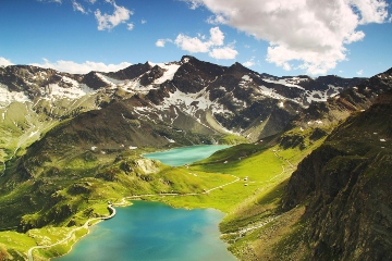
SPHY (Spatial Processes in Hydrology) is een conceptueel, ruimtelijk gedistribueerd (op raster gebaseerd) “leaky-bucket”-type waterbalansmodel. Het model integreert dominante hydrologische processen zoals (i) neerslag-afvoer; (ii) uitstroom van meren / reservoirs, (iii) cryosferische processen (sneeuw, ijs, gletsjers) (iv) verdamping en (v) hydrologische bodemprocessen. Het SPHY-model is in de loop van de tijd ontwikkeld en bijgewerkt door de beste componenten van bestaande en goed geteste simulatiemodellen te combineren: SRM, VIC, HydroS, SWAT, PCR-GLOBWB, SWAP en HimSim. SPHY omvat relevante terrestrische hydrologische processen op flexibele schalen (lokaal, regionaal en mondiaal), onder verschillende scenario’s van landgebruiksverandering, extreme weersomstandigheden en klimaatscenario’s. Een conceptueel overzicht van het SPHY-model is te zien in Figuur 1.
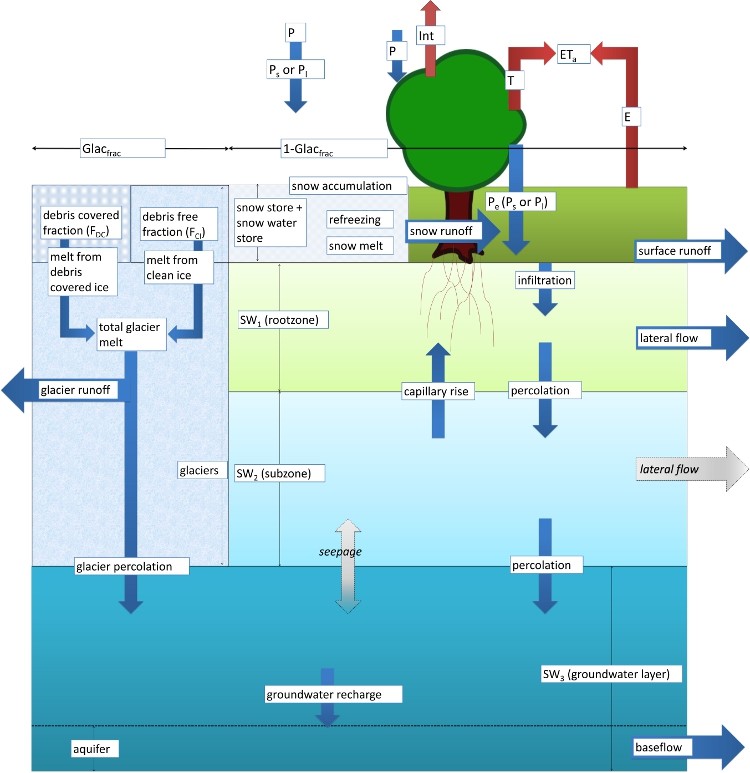
Massabehoud is het belangrijkste onderliggende concept dat wordt gebruikt in het SPHY-model. De dominante hydrologische processen worden gedefinieerd door de vergelijkingen en parameters. SPHY gebruikt een variabiliteitsbenadering op het subraster voor een juiste weergave van de processen die op fijnere ruimtelijke schalen werken. Een cel kan gletsjervrij, gedeeltelijk bedekt zijn met een gletsjer of volledig bedekt zijn met gletsjers. Het gedeelte van een cel dat niet door een gletsjer is bedekt kan een ander landgebruikstype zijn. De variabiliteit van het subraster wordt voornamelijk bepaald door de relatieve vegetatiebedekking, die van invloed is op processen zoals interceptie, (effectieve) neerslag en mogelijke verdamping.
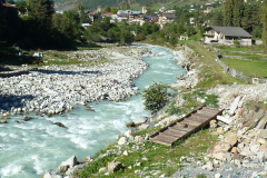
De bodem/het landoppervlak is in SPHY verdeeld in twee lagen (de bovenste bodemlaag en de onderste bodemlaag) met daaronder een derde laag: het grondwater. Voor het landoppervlak/bodem zijn de bijbehorende drainagecomponenten gedefinieerd: oppervlakkige afstroming, laterale stroming en de permanente afvoer. Het smelten van gletsjerijs draagt bij aan de rivierafvoer door middel van een langzame en snelle component, namelijk (i) percolatie naar het grondwaterreservoir dat uiteindelijk de permanente afvoer wordt, en (ii) directe afvoer.
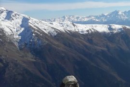
Het model simuleert het dynamische gedrag van de gletsjers door sleutelprocessen zoals accumulatie, ablatie en overdracht van ijsmassa van accumulatie naar ablatiezone op te nemen. Als de gletsjer massa verliest, wordt ijs uit de ablatiezone herverdeeld over de ablatiezone volgens de volume-herverdeling van het ijs.
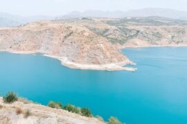
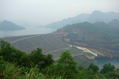
Verder bevat SPHY een meer-module die de waterstand en het volume van het meer bijhoudt bij elke stap van de modelsimulatie. De meer-module gebruikt een geavanceerde regeling om de stroom van meer-cellen naar de stroomafwaartse regio’s te bepalen. Daarnaast maakt SPHY gebruik van een erosiemodule die de bodemerosie berekent als gevolg van regendruppels, oppervlakkige afstroming en rivierafvoer.
In modellenland is er geen beste model beschikbaar dat geschikt is voor alle soorten toepassingen. De modelkeuze wordt gedreven door de algemene doelstelling van het project. SPHY onderscheidt zich echter in vergelijking met andere modellen vanwege het brede scala aan functionaliteiten zoals:
Ruimtelijke schaal
Het SPHY-model kan worden toegepast op flexibele ruimtelijke schalen, zoals kleinschalige landbouwbedrijven, (middel)grote deelstroomgebieden en grootschalige regionale en mondiale toepassingen. SPHY helpt de gebruiker om de ruimtelijke verschillen en variabiliteit van het belangrijkste hydrologische proces beter te begrijpen. Verder kan het model op verschillende ruimtelijke schalen worden gebruikt voor verschillende processen binnen dezelfde simulatie. Zo kan bijvoorbeeld een gletsjer op een resolutie van 50 meter worden gemodelleerd terwijl de modelresolutie 1000 meter is.
Tijdelijke schaal
Het SPHY-model kan worden toegepast van subdagelijkse tot dagelijkse, wekelijkse, maandelijkse en jaarlijkse tijdsstappen, afhankelijk van de dagelijkse variaties van de belangrijkste hydrologische processen en de beschikbaarheid van gegevens.
Aanpassingsvermogen
Het SPHY-model kan eenvoudig worden aangepast voor gebruik in verschillende klimatologische omstandigheden over de hele wereld. Dit is erg handig als de gebruiker hydrologische processen bestudeert in regio’s waar niet alle hydrologische processen relevant zijn. Een gebruiker kan bijvoorbeeld geïnteresseerd zijn in het bestuderen van de behoefte aan irrigatiewater in Centraal-Afrika. Voor deze regio zijn gletsjer- en sneeuwsmeltprocessen niet relevant en kunnen dus worden uitgeschakeld. Een andere gebruiker is wellicht alleen geïnteresseerd in het simuleren van vochtcondities in de eerste grondlaag, waardoor de mogelijkheid bestaat om de routing- en grondwatermodules uit te schakelen.
Benodigde gegevens
Een gebruiker kan alle waarnemingen op de grond gebruiken, zoals hydrologische gegevens: afvoer, cryosferische gegevens: sneeuwbedekking, gletsjermassabalans, gewasgegevens: statische gewascoëfficiënten, bladoppervlakindex, meer- en reservoirinformatie enz., Vaak is het zo dat meer gegevens er voor zorgen dat het model beter gekalibreerd kan worden waardoor de betrouwbaarheid en nauwkeurigheid van het model wordt vergroot. Maar zowel in een gebied met veel data als een gebied zonder veel data kan SPHY worden ingezet.
Gebruiksvriendelijkheid
Het SPHY-model is gebruiksvriendelijk en kan worden toegepast door iedereen met algemene kennis van de belangrijkste hydrologische processen. Een statische constante of stochastische tijdreeks of een complexere rasterkaart kan worden geleverd als invoer afhankelijk van de gebruiker. Verder biedt het SPHY-model een schat aan uitvoergegevens die kunnen worden geselecteerd op basis van de voorkeur van de gebruiker. Ruimtelijke output kan worden gepresenteerd als ruimtelijke kaarten van alle hydrologische processen. Deze kaarten kunnen dagelijks worden gegenereerd, maar ook op maand- of jaarbasis. Daarnaast kunnen voor elke willekeurige locatie in het modelgebied tijdreeksen worden gegenereerd van de wensen van de gebruiker.
FutureWater-toepassingen
FutureWater gebruikt het SPHY-model in verschillende contexten en toepassingen. Hoe het model wordt ingezet hangt per project af van de vereisten. Hieronder volgen een aantal voorbeeld van de SPHY-modeltoepassing.
Verleden en toekomstige hydrologische veranderingen
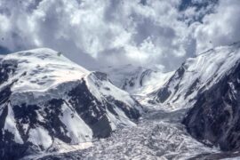
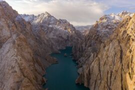
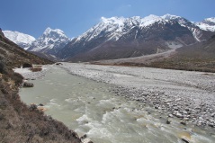
SPHY is toegepast op tal van projecten om de historische hydrologische regimes en de toekomstige veranderingen te beoordelen. Het model is gebruikt in de projecten HICAP en HI-AWARE om de belangrijkste aspecten van de historische en toekomstige veranderingen in hydrologische regimes van grote stroomgebieden in Zuidoost-Azië en Centraal-Azië te begrijpen. Verder onderzoekt het HI-AWARE-project de veranderingen in hydro-klimatologische extremen (overstromingen en droogtes) in de regio. Daarnaast wordt SPHY in Pan-TPE gebruikt om de impact van klimaatverandering voor een duurzame ontwikkeling van de Silk Road Economic Belt (SREB) in de derde poolregio te onderzoeken.
Stroomgebiedsbeheer
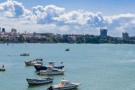
SPHY is in het ‘Strategic Basin Planning Ganga River Basin’ project gebruikt om de interacties tussen oppervlakte en grondwater in het stroomgebied van de Ganges te begrijpen om daarmee de riviermodellen te verfijnen. In het project is gebruik gemaakt van allerlei soorten informatie op verschillende schalen om zo de scenariomodellering te kunnen ondersteunen. In het project zijn ook een aantal scenario’s verkend met SPHY die alternatieve opties bieden voor het verbeteren van het waterbeheer, waaronder het verbeteren van de riviergezondheid.
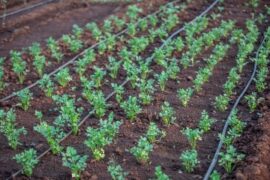
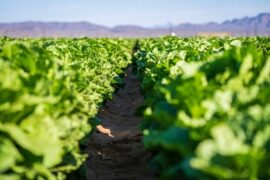
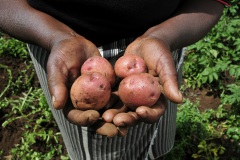
Irrigatiebeheer
SPHY is vaak toegepast met als doel om veldspecifiek irrigatieadvies te kunnen geven aan kleinschalige boerenbedrijven in landen als Roemenië en Angola. Het resultaat van het project in Roemenië is een systeem waarin online in-situ grondgegevens over bodemvochtgehalte en SPHY-berekeningen van de wortelzone en ondiepe ondergrond worden getoond.
Afvoer prognoses
SPHY wordt toegepast voor het operationele waterbeheer in een stroomgebied in Chili. In dit project is SPHY gebruikt in een geïntegreerd systeem, waarin metingen die zijn afgeleid van zowel aardobservatiesatellieten als in situ sensoren worden gecombineerd om de seizoensafhankelijke afvoer tijdens het sneeuwsmeltseizoen te voorspellen.
Landdegradatie en herstel
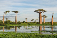
SPHY is in Madagaskar gebruikt ter ondersteuning van geïntegreerde besluitvorming over landschapsbeheer in Madagascar door verbeterde ruimtelijke gegevens over bodemdegradatie te leveren. Daarnaast is een prototype-model ontwikkeld waarmee het simuleren, evalueren en heroriënteren van landgebruik en veranderingsprocessen van landgebruik eenvoudig lokaal kan worden gedaan.
Energie
SPHY is in verschillende landen (Georgië, Indonesië, Kenia, Tanzania, Nepal) gebruikt om de toekomstige rivierafvoer te berekenen waarmee de toepasbaarheid van (kleine) waterkrachtcentrales kan worden beoordeeld. Deze projecten verkennen het effect van landgebruik en klimaatverandering op rivierafvoeren die vervolgens gebruikt moeten worden door de waterkrachtontwikkelaars om de technische en financiële haalbaarheid van de projecten onder veranderend klimaat te beoordelen.
Hydroclimatische uitersten en samengestelde gebeurtenissen
Het SPHY-model is gebruikt in verschillende wetenschappelijke onderzoeksprojecten zoals SYSTEM-RISK en IMPREX om een systeembenadering te onderzoeken voor grootschalige beoordeling en beheer van overstromingsrisico’s als gevolg van samengestelde extreme gebeurtenissen.
Kijk voor meer informatie over het model en andere toepassingen op http://www.sphy.nl/.
Gerelateerde projecten
-
SPHY GUI Plugins Update
SPHY (Spatial Processes in Hydrology) is a conceptual, spatially distributed (raster-based) “leaky-bucket” type water balance model. Developed by FutureWater, with the support of national and international partners, SPHY has emerged as a robust, user-friendly tool for undertaking operational and strategic water resource management decisions. It stands out for its physical...
-
Model Development and Hydrological Assessments to Inform Ecosystem-based Adaptation Solutions in Lao PDR
The GCF project “Building resilience of urban populations with ecosystem-based solutions in Lao PDR” aims to test an alternative approach to flood control in urban Laos, moving away from a traditional focus on grey infrastructure, such as dams and concrete drainage systems, and towards Ecosystem-based Adaptation (EbA). A consortium led...
-
Megadroughts in the water towers of Europe – from process understanding to strategies for management and adaptation
Megadroughts are rare and poorly understood hazards. They are defined as exceptionally severe, multi-year, prolonged (>5 years) periods of drought that impact severely large areas and different sectors of the economy and the environment (Cook et al., 2022). They are generally caused by the concurrence of extreme events of dryness...
-

Catchment Assessment for Water Stewardship Plan
Highly productive berry farms and water scarcity are causing conflicts with the environmental assets and values of the Doñana National Park, Spain. There is growing interest in the agricultural sector to reverse this situation by implementing a water stewardship program. A catchment assessment is needed to produce baseline information to...
-
Scientific Support for a Watershed Investment Program for Addis Ababa
Addis Ababa's water supply is under threat caused by the complex interaction of rapid population growth, increased water demand, intensive groundwater development, natural resource degradation, and climate change. A comprehensive Watershed Investment Program should return this situation and secure water supply for the future. An in-depth study is performed to...
-
Pre-Feasibility Work to Identify Nature-based Solutions for Multiple Catchments in Nigeria
This project will involve working across two fee-for-service engagements with the Coca Cola Corporation and Diageo in Nigeria. The identification and prioritisation of NbS for implementation will be achieved through the development of three key products: two prefeasibility analyses for Ogun and Oshun catchments, and a high-level country-wide strategic assessment...
-
Roadside Spring Protection to Improve Water Security in Nepal
The mid and high-altitude areas of the Himalayas face a critical water scarcity issue, making them one of the most vulnerable regions in the world. Springs are essential lifelines for millions of mountain communities, serving as the primary source of domestic water and local food security. Unfortunately, the flow regimes...
-
Integrated Water Resources Management in Tajikistan
Given the abundant freshwater resources in Tajikistan, water plays a crucial role in the country's socioeconomic development. However, the rising population, economic growth, and the growing impacts of climate change pose significant challenges to ensure water availability and accessibility. This project aims to address the aforementioned information gap by improving...
-
GLOW: Global Water Availability Forecasting Service to Support Water Security
The GLOW project aims to pilot an operational service that provides timely and easy access to current and forecasted water availability and demand across the entire Maputo River and the Black Umbeluzi River Basins.
-
WE-ACT: Water Efficient Allocation in a Central Asian Transboundary River Basin
The WE-ACT project’s overall goal is to demonstrate a Decision Support System (DSS) for water allocation in a Central Asian transboundary river to increase shared benefits and foster the adaptation of water resources management and planning to climate change.
-
MAGDA: Meteorological Assimilation from Galileo and Drones for Agriculture
The MAGDA project aims at providing an integrated – but modular – system to provide severe weather forecasts and irrigation advisories enhanced by means of various satellite-borne, drone-borne and ground-based weather-observing technologies. The main applications will be in providing both warnings about severe weather that could affect crops and irrigation...
-
Strategic Climate Adaptation Planning for the Amu Darya Basin in Uzbekistan
Uzbekistan's water resources depend to a large extent on those provided by the transboundary Amu Darya river which are fully allocated and highly sensitive to climate change and water demand and management changes. Especially the agricultural sector, but also the energy and urban water supply sector need to transform into...
-
Hydrological Assessment for the Lunyangwa Dam
The Lunyangwa Dam is prone to overtopping during the wet season. Raising the spillway crest and/or installing gates on the existing crest will allow an increase in the retention level. In order to determine the height of the redesigned spillway, a flood analysis was conducted for several return periods in...
-
Integrated Strategic Water Resources Planning and Management for Rwanda
SRwanda recently published its “Vision 2050” which sets out the national long-term development strategy, stating new objectives for urbanization, energy production, irrigation and water resources development. The Rwanda Green Fund (FONERWA) in collaboration with the Rwanda Water Resources Board (RWB) with financial support from the World Bank undertakes the consultancy...
-
Groundwater Recharge in the Campo de Cartagena Quaternary Aquifer
This project (1) provides a critical review of previous results generated, and a SWOT analysis of hydrological simulation tools used in the area. (2) improve and update the quantification of the main water balance components, including vertical and lateral fluxes, at the basin scale in recent times (2000-2020 period) through...
-

Hoge-resolutie bodemvochtdata ter ondersteuning van onderzoek naar dierziekten
De Gezondheidsdienst voor Dieren (GD) doet onderzoek naar het voorkomen van dierziekten en de relatie met omgevingsvariabelen, zoals klimaat en bodem. Dit project ondersteunt deze werkzaamheiden door het toepassen van een upgrade van de landsdekkende bodemvochtberekeningen die de afgelopen jaren zijn uitgevoerd door FutureWater m.b.v. het hydrologische model SPHY. Het...
-
Technical Coordination for the Norfolk Water Fund
FutureWater provide support and technical expertise to The Nature Conservancy and Water Resources East in the creation of a Water Fund for Norfolk, in the East Anglia region of the UK. This work identifies Nature-based Solutions (NbS) to be implemented accross the county, aiming to leverage blended finance to fund...
-
Climate Risk and Adaptation Assessment for Nepal’s Power Sector
Nepal’s power sector predominantly relies on hydropower generation. Hydropower is vulnerable to climate change and natural disasters caused by climate change. An understanding of the future impact of climate change on hydropower assets and their performance is important for the successful implementation of hydropower projects. Climate risk and adaptation (CRA)...
-
Tailor-made Training on Climate Smart Irrigation Strategies to Improve Salinity Control and Enhance Agricultural Production
This tailor-made training, funded by Nuffic and requested by the staff of the college of Agriculture of Basra University, aims to help mitigate soil and water salinization problems hampering agricultural production in Iraq. The training focuses on accessing and using innovative data and tools in the public domain, to gain...
-

Bio-Physical Assessment and Hydrological Analysis for Mukungwa and Akagera Lower catchments in Rwanda
FutureWater will conduct the bio-physical assessment and hydrological analysis for the Mukungwa and Akagera Lower Catchments in Rwanda. The project will be the basis for two catchment plans to be developed through the “EIWRM Project”, funded by the Government of the Netherlands and implemented by a consortium led by the...
-
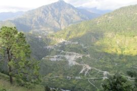
Development of a Glacio-Hydrological Model and IWRM Plan for the Uttarakhand subbasin in India
The Swiss Agency for Development and Cooperation’s (SDCs) Global Programme Climate Change and Environment (GP CCE) India is supporting the operationalization of climate change adaptation actions in the mountain states of Uttarakhand, Sikkim and Himachal Pradesh through the phase two of the “Strengthening State Strategies for Climate Action” (3SCA) project...
-
Design Study for the Mombasa Water Fund
A design study for the Mombasa Water Fund is performed by assessing biophysical, financial, economic and socio-economic benefits, and identifying potential governance and financing models. The Fund should improve the quantity and quality of source waters for Mombasa City by channelling investments into source protection and catchment conservation measures of...
-
Improved Watershed and Forestry Activities to Secure Hydropower
This study supports Gabon in preserving Hydrologic Ecosystem Services in a river basin which faces challenges due to planned hydropower and forestry operations. It will evaluate various watershed management scenarios which may improve hydrological flow conditions and hydropower options. FutureWater analyzes hydrological ecosystem services provision in the Komo basin through...
-
Baseline Assessment for the Identification of Landscape Restoration Options in Kyrgyzstan
FutureWater's role in this project is to provide remote sensing and GIS services with an aim of highlighting degraded areas of land in Kyrgyzstan and determining where restoration interventions are possible. The identification of highly degraded areas is achieved by analysing a number of remote sensing products, notably including NDVI...
-

HiHydroSoil v2.0: Global Maps of Soil Hydraulic Properties at 250m Resolution
In 2016, FutureWater released a new dataset: HiHydroSoil v1.2, containing global maps with a spatial resolution of 1 km of soil hydraulic properties to support hydrological modeling. Since then, the maps of the HiHydroSoil v1.2 database have been used a lot in hydrological modeling throughout the world in numerous (scientific) projects. A few examples of...
-
WAT4CAM: Mekong-Bassac Hydrological and Hydraulic Study
The WAT4CAM program aims to apply IWRM and ISWM principles towards achieving the strategies of the government of Cambodia. This project (WAT4CAM subcompoment 3.1) supports this objective by performing a detailed hydraulic and hydrological modelling study, of which the outcomes will be used in the implementation of Prek rehabilitation works....
-

Training in Hydrology and Water Allocation Modelling for Kenyan Water Resources Professionals
This course on hydrology and water allocation modelling is organized for the Kenya Water Resources Authority (WRA) and funded by the Blue Deal program of the Netherlands. The first four-week course block introduces the participants to the main concepts in hydrology, hydrological modelling and data collection, including remote sensing. Exercises...
-
Climate Risk Assessment for the Li River in China
The Li River basin in China is a basin that is prone to floods because of its mountainous character, narrow floodplains and extreme rainfall events. In 2020, large floods have occurred in this basin when enormous amounts of precipitation were observed in just a few days. A total of 272...
-
Hydrological Assessment for Hydropower in the Lukhra River
The objective was to develop a hydrological assessment for a planned run-of-river hydropower plant in the Lukhra river basin in Georgia. There is no observed river discharge data available. Hence, the assessment was developed based on hydrological simulations of the basin using the SPHY model (Terink et al., 2015) and...
-
Toetsing van watersysteem bij toekomstig klimaat ter voorkoming van wateroverlast
In 2009 is door het voormalig waterschap Velt en Vecht (tegewoordig onderdeel van waterschap Vechtstromen) en in samenspraak met de gemeenten Emmen, Coevorden, Hardenberg en Ommen een overeenkomst gesloten waarbij afspraken zijn gemaakt over de omvang en invulling van een wateropgave, genaamd het Lokaal Bestuursakkoord Water (LBW). Vanaf 2015 is...
-
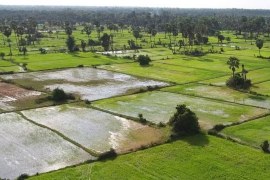
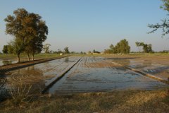
Mavo Diami: Services on Land-crop Suitability Mapping and Operational Irrigation Advice in Angola
The overall project goal is to improve sustainable food and income security for >100,000 smallholder farmers in Angola, by accelerating their agri-business performance through informed decisions supported by the Mavo Diami services built on weather, soil and crop signals and other relevant data and indicators. Ensuring the services are offered...
-
Glacio-hydrological Assessment for Hydropower in the Nakhra River
The objective was to develop a glacio-hydrological assessment for planned run-of-river hydropower plant locations in the Nakhraa river basin in Georgia. The availability of observed river flow data is limited. Hence the assessment was developed based on hydrological simulations of the basin using the SPHY model (Terink et al., 2015)....
-
Glacio-hydrological assessment for hydropower, Mestiachala river, Georgia
The objective of this project was to develop a hydrological assessment for two potential hydropower plant locations in the Mestiachala basin in Georgia. The availability of observed river discharge data is limited. Hence the assessment was developed based on hydrological simulations of the basin using the SPHY model (Terink et...
-

Thought Leader Convening on Water Towers
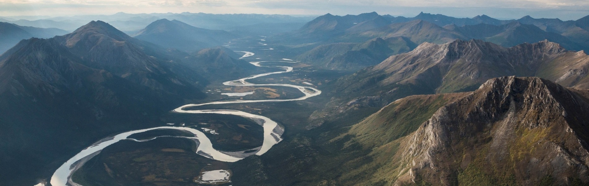
Scientists from around the world have assessed the planet’s 78 mountain glacier–based water systems and, for the first time, ranked them in order of their importance to adjacent lowland communities, as well as their vulnerability to future environmental and socioeconomic changes. These systems, known as mountain water towers, store and...
-
Improved catchment management for small hydropower
This study assessed the impacts of various investment portfolios for catchment management activities on the cost-benefits of small hydropower schemes, in two case study catchments in Kenya and Tanzania, and analyzes the return-on-investment for the hydropower developers. Catchment degradation trends, climate change impacts and socio-economic changes increasing competing water use...
-

Pan-TPE: Changes in the Pan-Third Pole Water Tower
The proposed research targets changes in climate, water supply and demand, and suitable adaptation measures for green development of the Silk Road Economic Belt (SREB) in the river basins crossed by the SREB transect. Given the strong role of large scale hydrology in the proposed research activities, the spatial domain...
-
Hydrological and water resources assessment for the Muhazi Dam
The current infrastructure at the outlet of the large Muhazi Lake in Rwanda is highly unstable and causes a risk to the surrounding and downsteam inhabitants. The authorities want to improve this situation by building a new dyke. A feasibility and detailed designs study was performed for this new structure....
-
Hydrological assessment for two potential sites for run-of-river hydropower, southwestern Georgia
A hydrological assessment was carried out for two sites where run-of-river hydropower plants are planned, in the southwestern part of Georgia. Only very limited streamflow data were available, so the assessment was based mainly on hydrological modelling of the basin upstream of the points of interest. Principally global datasets were...
-

NL-RIA: Satellite-based altimetry data for hydrological assessments
A Dutch consortium has joined in the project “Dutch network on small spaceborne radar instruments and applications (NL-RIA)”, led by TU Delft. The objective is to bundle the radar-related knowhow available in The Netherlands, and fill the knowledge gaps, in order to boost SmallSat radar-based Earth Observation technology. The task...
-
Hydrological pre-feasibility assessment for a potential hydropower plant, North Sumatra, Indonesia
Following the successful development of hydropower facilities in Indonesia, a new project was established to study the potentials for the development of a hydro-electric power plant in the Tripa Basin, North Sumatra, Indonesia. To make a go/no-go decision of a more detailed feasibility study, a pre-feasibility study is undertaken to...
-
Remote Sensing for Land Suitability Assessment in Angola
The government of Angola considers the agricultural sector as an economic sector that offers great prospects and therefore aims to further develop the agricultural sector in order to diversify its economy. The potential for expanding the area under production is great. To support the effective planning of interventions that increase...
-
Pre-feasibility study of run-of-river hydropower plant, Georgia
There is great potential for hydropower in Georgia. Critical is to conduct accurate feasibility assessments for hydropower generation at the different potential sites of interest. This pre-feasibility assessment delivered daily flow estimates at several locations in Georgia. These flows were used as input into an economic analysis.
-
LAUREL: Land Use Planning for Enhanced Resilience of Landscapes
Deforestation, population growth, and climate change are only some of the challenges to sustainable landscape management in Madagascar. Severe impacts of land degradation on crop production, water availability and biodiversity are already observed and expected to exacerbate in the future. To address these challenges, the World Bank is supporting the...
-
Climate Risk and Vulnerability Assessment of Irrigation in Kazakhstan
The government of Kazakhstan with financial support of the Asian Development Bank (ADB) is planning to upgrade and rehabilitate its irrigation sector. A detailed Climate Risk and Vulnerability Assessment (CRVA) has been undertaken by a consortium led by FutureWater in 2017. The team collected all available data on the project...
-
Hydrogeological modeling of groundwater discharge to the Mar Menor lagoon
The groundwater discharge of irrigation return flows to the Mar Menor lagoon (Murcia, SE Spain), the largest coastal lagoon in Europe, is among one of the possible causes that would explain the high levels of eutrophication (hypereutrophication) and the several algal blooms accounted in this lagoon ecosystem in the last...
-
CoMET: Slimme modelkoppeling voor betere actuele verdampingsschatting
Momenteel worden via het SAT-WATER initiatief verdampingsdata aangekocht die gebaseerd is op optische en thermische satellietbeelden. Zulke beelden zijn op bewolkte dagen echter niet beschikbaar, waardoor de berekening van de actuele verdamping niet optimaal uitgevoerd kan worden. Dit is een serieus obstakel voor het gebruik van satellietgebaseerde verdampingsdata voor het...
-
Hydropower Development Assessment for the Tamakoshi River Basin
The overall objective of this project is to improve the understanding of the expected impacts of climate change on water availability in the context of potential hydropower development in the Tamakoshi River Basin. Specifically, the project aims to (i) Understand the current baseline hydrological regime of the Tamakoshi River Basin,...
-
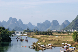
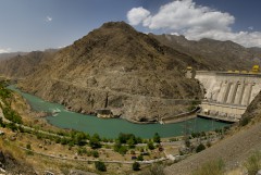
Strategic Basin Planning Ganga River Basin
De Ganges is het dichtst bevolkte stroomgebied ter wereld en is de thuisbasis van de helft van de bevolking van India, waaronder tweederde van India’s armen. Het stroomgebied bedraagt meer dan een derde van het beschikbare oppervlaktewater in India en is de focus van meer dan de helft van het nationaal watergebruik – waarvan 90...
-

Review Climate Change Hindu-Kush-Himalaya
FutureWater provided a comprehensive review study on climate change and the impacts on cryosphere, hydrological regimes and glacier lakes in the Indus, Ganges, and Brahmaputra river basins. This review study was done in the context of future hydropower development in the region.
-
Demonstration of Remote Sensing Information for Integrated Reservoir Management in the Red River Basin in Northern Vietnam
In 2011 the Vietnamese and Dutch government signed a Memorandum of Understanding on the establishment of a Government to Government (G2G) program for improved integrated planning and monitoring of water resources for transboundary water management and disaster risk management. This project was formulated as part of the G2G trajectory towards...
-
Bodemvochtgegevens ter ondersteuning van Leverbot analyses
De Gezondheidsdienst voor Dieren (GD) heeft in de afgelopen jaren een analyse van leverbotbesmettingen uitgevoerd. Dit onderzoek heeft laten zien dat verschillende omgevingsfactoren een rol spelen zoals grondwaterstand, neerslag, temperatuur en bodemtype. Daarnaast is op basis van landsdekkende bodemvochtschattingen door FutureWater vastgesteld dat ook bodemvocht en leverbotbesmettingen gecorreleerd zijn, wat...
-

HI-AWARE: Himalayan Adaptation, Water and Resilience
HI-AWARE aims to contribute to enhanced adaptive capacities and climate resilience of the poor and vulnerable women, men, and children living in the mountains and flood plains of the Indus, Ganges, and Brahmaputra river basins. Research, including modeling, scoping studies, action research, and randomized control trials, is conducted at 12...
-
Central Asia Regional Risk Assessment for Water Related Energy Sector Impacts
The objective of this study was to support the “Central Asia Regional Energy Sector Vulnerability Study” led by Industrial Economics (IEc) and funded by the World Bank, by carrying out an expanded risk assessment for water availability and water related energy sector impacts in Central Asia. The work built on...
-
OWASIS-UK: Observatory of Water Availability – System of Integrated Services
The main objective of this study is to explore the potential to combine optical and gravity data from Earth Observation with meteorological data, together with innovative in situ sensors, hydrological modelling and crowd sourcing technologies, and the advanced visualization of the information through situation awareness platforms and decision support tools,...
-
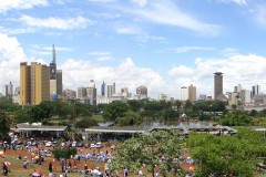
The Nairobi Water Fund: hydrologic modelling and economic valuation of investment options
In 2013 The Nature Conservancy (TNC) started working to launch the first Water Fund in Africa to restore and protect the condition of the Tana River and improve Nairobi’s water security. Key questions that needed to be answered were “Where and in what activities should the fund invest its money?”...
-
Gridded Meteorological Datasets and Hydrological Modelling in the Upper Indus Basin
Understanding of the hydrological regimes in the mountainous Upper Indus basin (UIB) is essential for water resources management in the region. High-resolution gridded meteorological datasets, which capture the spatial variability of precipitation, are critical for modelling the hydrology of high-mountain regions. Improvements to existing gridded datasets using high-elevation station data...
-
Climate adaptation Colombia
The 2011 floods and droughts in the Magdalena river basin triggered the Colombian government and water institutions to enforce the attention given to water security and dike safety. To improve the capacities of Colombia for adaptation of water management to climate change pilot projects were started in one small and...
-
Online field-scale irrigation management for Romania
In this project a field-scale irrigation planning and management system was setup and tested. The basis for this system is formed by online in-situ ground data on soil moisture content and hydrological model calculations of the root zone and shallow subsoil. Weather stations and soil moisture sensors were installed at...
-
Monitoring of Glacier, Climate and Runoff in the Hindu – Kush Himalayan Mountains
For this project a review was conducted of current state of knowledge in (i) climate change datasets and downscaling used for glacier and high mountain modelling, (ii) glacier and snow contribution to river runoff in the Hindu – Kush Himalayan (HKH) region, (iii) hydrological modelling studies used for glacier and...
-
Assessment of the Irrigation Potential in Nile Countries in Central Africa
In order to fill gaps in the Nile Basin Initiative and member country information bases on agricultural water use the irrigation potential of seven Nile countries was assessed. This project consisted of several consecutive steps, in which hydrological modelling, the use of remote sensed data, ArcGIS analyses, consultation workshops and...
-
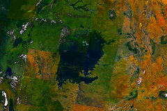
Irrigation Potential Lake Victoria, Tanzania
A study was undertaken to evaluate and rank five potential irrigation schemes in the Tanzania part of the Lake Victoria Basin. The study focused on the following five thematic areas: (i) land suitability, (ii) water resources assessment, (iii) water requirements, (iv) environmental considerations, and (v) institutional aspects.
-

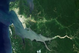
Mekong River Basin Modeling Framework Development
The Mekong River Commission (MRC) Information and Knowledge Management Programme (IKMP) is developing and expanding its modeling framework. FutureWater was asked to support the process by developing a complete strategy and to prepare a set of tender documents for implementation of the strategy. The project resulted in six specific Program...
-
Remote Sensing and Hydrological Modelling of the Rio Bravo, Aguascalientes and Central Northern Valleys
The project has shown how modern analytical tools such Remote Sensing, GIS and simulation models can help to swiftly obtain data to support the water management decision making process. A diagnosis of the Rio Bravo and Northern Central Aquifers has been made to demonstrate management options as well as how...