
Uitdaging
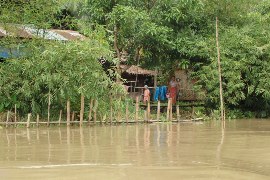
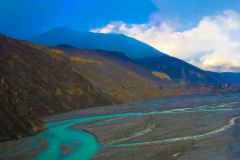
Klimaatverandering, een toenemende vraag naar water, een toenemende vraag naar voedsel en andere producten, sterkere en toenemende droogtes en overstromingen. Slechts een paar voorbeelden die aantonen dat de druk op onze planeet en onze natuurlijke hulpbronnen toeneemt. Verwachtingen voor de toekomst laten zien dat de druk waarschijnlijk verder zal toenemen. Dit geeft wel aan dat het steeds belangrijker wordt om meer (wetenschappelijke) kennis te verzamelen over het duurzaam gebruiken van onze natuurlijke hulpbronnen. Dit is pas effectief als deze kennis zoveel mogelijk wordt gedeeld met zoveel mogelijk mensen en organisaties. Het is daarom belangrijk dat het delen van kennis leidt tot het opleiden van mensen die deze kennis verder kunnen ontwikkelen en verspreiden.
Kennis delen is echter een vak op zich. Mensen en organisaties verschillen vaak qua inhoudelijke achtergrondkennis, gaan anders om met het verzamelen, delen en gebruiken van (open source) data, en bovendien kunnen de gehanteerde modellen en technieken ook enorm verschillen per land en per organisatie. Een organisatie die een training geeft heeft daarom een grondige kennis van het onderwerp, de vraag van de klant en de achtergrond van de deelnemers nodig. Het geven van een training is dus vaak gebonden aan zeer specifieke randvoorwaarden.
FutureWater-aanpak
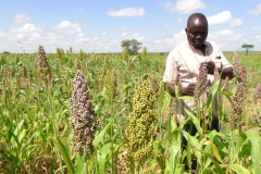
Het trainen van mensen en organisaties is iets waar FutureWater veel ervaring mee heeft. FutureWater heeft een unieke combinatie van wetenschappelijke kennis gecombineerd met advieswerk in (agro-)hydrologie, klimaatverandering, satellietdata en remote sensing en drones (flying sensors). Door deze combinatie is FutureWater zeer goed in staat om complexe inhoudelijke wetenschappelijke concepten en technieken begrijpelijk en inzichtelijk te maken voor een zeer divers publiek. In de afgelopen jaren heeft FutureWater in verschillende landen over de hele wereld trainingen gegeven om lokale organisaties op te leiden in het gebruik van bijvoorbeeld hydrologische modellen (SPHY) en waterallocatie modellen (WEAP), het gebruik van satelliet gegevens (Google Earth Engine) en het gebruik van drones. De deelnemers aan deze trainingen zijn vaak zeer verschillend, van beleidsmakers tot experts.
De trainingen die FutureWater verzorgt worden daarom vrijwel altijd op maat gemaakt, afhankelijk van de vragen van de betreffende organisatie en de kennis en achtergrond van de deelnemers aan de trainingen. Over het algemeen wordt voor elke training een unieke handleiding ontwikkeld, waarin zowel theorie als inhoudelijke opdrachten worden gecombineerd. De trainingen van FutureWater zijn vaak op locatie in het land van de organisatie, maar ook “eLearning” is iets waar FutureWater de laatste jaren steeds meer gebruik van maakt. FutureWater vindt het delen van kennis van groot belang en vindt het net zo belangrijk dat de overgedragen kennis na een training ook daadwerkelijk wordt gebruikt door de deelnemers. Daarom wordt in de trainingen vrijwel altijd gebruik gemaakt van open source software en data. Daarnaast biedt FutureWater vaak een periode na de training waarin de deelnemers vragen kunnen stellen aan de trainers van FutureWater. Zowel het gebruik van open source producten als de mogelijkheid om vragen te stellen na een training maakt het voor deelnemers makkelijker om de opgedane kennis daadwerkelijk in de praktijk te brengen.
Gerelateerde projecten
-
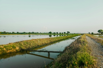
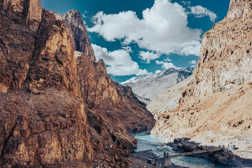
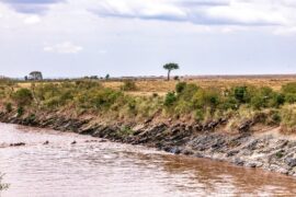
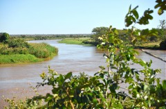
Waterboekhouding voor het Indusbekken en de provincies Punjab en Sindh in Pakistan
Het project heeft tot doel een uitgebreid waterboekhoudsysteem te ontwikkelen voor het Indusbekken en de provincies Punjab en Sindh, waardoor het vermogen van Pakistan wordt versterkt om watervoorraden, -behoeften en -gebruik op verschillende niveaus en in diverse sectoren in kaart te brengen. In samenwerking met de Voedsel- en Landbouworganisatie van...
-
Regionale training over REWEFe en de WEFE-nexus voor de lidstaten van de ASEAN
In april 2026 organiseerde FutureWater in Manilla, Filippijnen, een vierdaagse regionale training over de toepassing van de toolkit voor snelle evaluatie van water, energie, voedsel en ecosystemen (REWEFe) en de water-energie-voedsel-ecosysteem (WEFE)-nexus in het kader van geïntegreerd stroomgebiedbeheer (IRBM). De training werd georganiseerd in het kader van het GEF/UNDP/ASEAN-project voor...
-
Support to Develop a Climate Adaptation Investment Plan (CAIP) in Lao PDR and Timor-Leste
De opdracht past het CAIP-TA-raamwerk van de ADB toe en omvat het uitvoeren van strategische Klimaatrisico- en Adaptatiebeoordelingen (CRA’s), evenals het ontwikkelen van een financierbare pijplijn van adaptatieprojecten voor publieke en private financiering. Voor zowel Laos (Lao PDR) als Timor-Leste worden de CRA en CAIP ontwikkeld met een sterke nadruk...
-
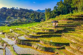
Smart Sprayer: efficiënte terrasirrigatie in Nepal
Het project introduceert het Smart Sprayer-pakket, een geïntegreerde oplossing die bestaat uit: 1) Een goedkoop, zwaartekrachtgevoed micro-pivotirrigatiesysteem (de Sprayer), ontworpen om te functioneren bij zeer lage waterdruk en -debiet, ideaal voor heuvelachtig terrein en afgelegen boerderijen. 2) Een mobiele Smart Irrigation Tool die boeren dagelijks, gewasspecifiek irrigatieadvies stuurt via WhatsApp...
-
Droogtevoorspellingsmodel voor Somalië/Somaliland
Dit project heeft als doel om de paraatheid en respons op droogte in Somalië en Somaliland te versterken door de technische en operationele capaciteit van het Somali Disaster Management Agency (SODMA) en de National Disaster Preparedness and Food Reserve Authority van Somaliland (NADFOR) te verbeteren. Onder leiding van het Wereldvoedselprogramma...
-
Shiraka Trainingsprogramma over klimaatvriendelijk water in de landbouw
Tunesië wordt steeds meer geconfronteerd met de gevolgen van klimaatverandering, waaronder stijgende temperaturen, langdurige droogtes en onregelmatige regenvalpatronen. Deze veranderingen verergeren de waterschaarste en zetten de landbouw, ecosystemen en beschikbare watervoorziening onder druk. Om deze uitdagingen aan te pakken, organiseert FutureWater, in samenwerking met het Shiraka-programma en de Tunesische autoriteiten,...
-
WE-HARP: WEAP Permits Tool for ARA-Sul
FutureWater is carrying out an assignment to improve the WEAP-Permits Tool, which supports ARA-Sul in evaluating water use licenses in the Pequenos Libombos area. This project builds on earlier efforts, refining the tool based on feedback from ARA-Sul’s technical professionals. By embedding the tool within ARA-Sul’s operations, FutureWater aims to...
-
Versterking van de capaciteit op het gebied van modellering van geologische gevaren en klimaatrisico’s
In het kader van het IRCCR-project van het UNDP wordt een online opleidingsprogramma aangeboden ter ondersteuning van het Instituut voor Ecologie (IoE) in Abchazië. Het technische team van het IoE is toegerust om klimaatgerelateerde geologische gevaren in de context van Abchazië te modelleren, met de nadruk op erosie van rivierbeddingen,...
-
Water Accounting in Mongolia
Water Accounting offers data-driven insights into water availability, use, and allocation, helping policymakers balance demands across sectors like agriculture, industry, and urban development. It supports sustainable growth by ensuring efficient water use while protecting resources for the future. By accounting for different interventions and projections, it offers climate-resilient water resources...
-
SPHY QGIS Plugin for Hydrological Modeling
SPHY (Spatial Processes in Hydrology) is a conceptual, spatially distributed (raster-based) “leaky-bucket” type water balance model. Developed by FutureWater, with the support of national and international partners, SPHY has emerged as a robust, user-friendly tool for undertaking operational and strategic water resource management decisions. It stands out for its physical...
-
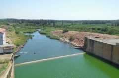
Monapo Catchment Water Allocation Model in Support of ARA-Norte in Mozambique
The aim of this project is to advance water system analysis for ARA-Norte, the regional water administration authority in Mozambique, focusing on the Monapo Catchment. In collaboration with ARA-Norte's hydrologists, we're crafting a Water Allocation Model employing the Water Evaluation And Planning (WEAP) system.
-
Model Development and Hydrological Assessments to Inform Ecosystem-based Adaptation Solutions in Lao PDR
The GCF project “Building resilience of urban populations with ecosystem-based solutions in Lao PDR” aims to test an alternative approach to flood control in urban Laos, moving away from a traditional focus on grey infrastructure, such as dams and concrete drainage systems, and towards Ecosystem-based Adaptation (EbA). A consortium led...
-
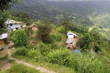
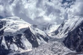
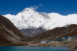
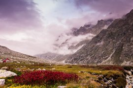
Springshed Management in the Indian Himalayas
Springs in the Hindu Kush Himalaya (HKH) region are essential for water security, agriculture, economic activities, ecosystem services, biodiversity, and cultural heritage. They sustain nearly 240 million people, including 50 million in India who depend directly on these springs for their water needs. However, almost half of the perennial springs...
-
Capacity Building on Water Accounting Under the Water Scarcity Program in Lao PDR
The capacity-building program on water accounting in Lao PDR focuses on enhancing participants' understanding of the status of water resources in the Nam Ngum pilot basin and enabling them to quantify the fluxes using various tools, including remote sensing.
-
Increasing Investments in Early Warning Systems to Strengthen Climate and Disaster Resilience
This project aims to support the development of a new multi-hazard Early Warning System (EWS) facility, addressing the significant exposure of countries in Asia and the Pacific region to disaster risks. The enhancement of EWS aligns with global commitments, such as the Paris Agreement, Nationally Determined Contributions (NDCs), Sustainable Development...
-
RoSPro: Roadside Spring Protection to Improve Water Security in Nepal
De midden- en hooggelegen gebieden in de Himalaya hebben te kampen met waterschaarste, waardoor ze een van de meest kwetsbare regio's ter wereld zijn. Bronnen zijn essentiële levensaders voor miljoenen berggemeenschappen en vormen de primaire bron voor huishoudelijk water en lokale voedselzekerheid. Helaas is het debiet van bronnen in de...
-
Water Evaluation And Planning Training for the Umbeluzi Catchment
ARA-Sul is improving their decision-making procedures. One component is improved water allocation planning. FutureWater has developed for the Umbeluzi two Water Allocation Models (WAMs) in 2014. A refreshing workshop for water managers and decision makers was held in June 2023.
-
WEAP Ground Water Modelling in Mozambique
Groundwater availability is critical to the Umbeluzi Catchment. Currently, there is a need for a simple tool that can asses the availability of resources in the ground. This especially to asses the permits for groundwater extractions. It is expected that a simplified modelling approach can provide a trend analysis sufficient...
-
Capacity Building on Water Accounting Under the Water Scarcity Program for Asia-Pacific
Growing water scarcity continues to threaten the agricultural sector in Asia. In order to address this critical issue, FAO and partners have been developing a comprehensive Asia Pacific Water Scarcity Programme (WSP) since 2019. Under this program, a series of trainings on water accounting will be held in Indonesia, Vietnam...
-
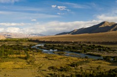
Integrated Water Resources Management in Tajikistan
Given the abundant freshwater resources in Tajikistan, water plays a crucial role in the country's socioeconomic development. However, the rising population, economic growth, and the growing impacts of climate change pose significant challenges to ensure water availability and accessibility. This project aims to address the aforementioned information gap by improving...
-
Climate Risk and Adaptation Assessment for Hydropower Project in Nepal
Climate risk and adaptation (CRA) assessment is required for the 635 MW Dudhkoshi hydroelectric project (DKSHEP) to ensure the project addresses climate change mitigation and adaptation in accordance with ADB’s requirements. The initial Climate Risk Assessment (CRA) by FutureWater in 2021 suggested the project is likely to be affected by...
-
Climate Change Impact Modelling Tana Basin, Kenya
FutureWater held for knowledge exchange sessions with the Water Resources Authority responsible for the WEAP model of the Tana Basin. The training focused on how to extract Climate Change data, how to interpret this data, and how to set-it up within the WEAP model.
-
Capacity Building on Water Accounting in Pakistan
The Food and Agriculture Organization of the United Nations (FAO) in Pakistan has recently secured Green Climate Fund (GCF) funds for increasing the climate resilience of agriculture and water management in the Indus Basin. Given the region’s climate vulnerability, it is critical to improve information services and build the country’s...
-
Tailor-made Training on Geo-spatial Data Skills Development in Zambia
This tailor-made training, funded by Nuffic and requested by the staff of the The Ministry of Agriculture of the Government of the Republic of Zambia (GRZ), aims to help improving soil water management and crop productivity at the national level. The training focuses on building capacity of participants in accessing...
-

Follow the Water: Reuse of Water in Irrigated Systems
Reuse of water in irrigated systems is a key component in design and management of irrigation systems. FAO and FutureWater developed a Guidance document, a Tool and a Training package demand for a better understanding of the role of reuse of water in irrigated agriculture systems. Those outcomes will support...
-
Training on Real Water Savings for FAO’s Regional Water Scarcity Program
The Regional Office for Asia and the Pacific (RAP) of the Food and Agriculture Organization of the United Nations (FAO) has recently secured funds to continue a program of training on ReWaS, which is a simple tool to estimate the potential for generating real water savings from various agronomic, water...
-
Tailor-made Training on Climate Smart Irrigation Strategies to Improve Salinity Control and Enhance Agricultural Production
This tailor-made training, funded by Nuffic and requested by the staff of the college of Agriculture of Basra University, aims to help mitigate soil and water salinization problems hampering agricultural production in Iraq. The training focuses on accessing and using innovative data and tools in the public domain, to gain...
-
A Practical Farmers’ Toolkit – Geodata for Climate Smart Agriculture in Egypt
The 'Farmers Toolkit' as presented in this project contains various geodata tools applicable for farmers to assist their decision-making and adopt climate smart agricultural practices. This project launches a training program on these tools, which are: Flying Sensors, irrigation advisory services (IrriWatch portal), WaPOR and Google Earthengine Apps, and Climate...
-

Bio-Physical Assessment and Hydrological Analysis for Mukungwa and Akagera Lower catchments in Rwanda
FutureWater will conduct the bio-physical assessment and hydrological analysis for the Mukungwa and Akagera Lower Catchments in Rwanda. The project will be the basis for two catchment plans to be developed through the “EIWRM Project”, funded by the Government of the Netherlands and implemented by a consortium led by the...
-
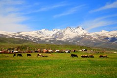
Development of a Glacio-Hydrological Model and IWRM Plan for the Uttarakhand subbasin in India
The Swiss Agency for Development and Cooperation’s (SDCs) Global Programme Climate Change and Environment (GP CCE) India is supporting the operationalization of climate change adaptation actions in the mountain states of Uttarakhand, Sikkim and Himachal Pradesh through the phase two of the “Strengthening State Strategies for Climate Action” (3SCA) project...
-

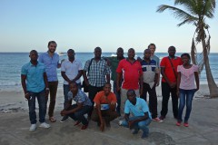
Tailor-made Advice and Training on Flying Sensors for Agriculture in Jordan
This online training was provided over a period of 8 weeks for 25 participants selected by NARC (National Agricultural Research Centre) Jordan. The online training consisted of self-paced exercises and regular live (video) sessions provided through the OpenCourseWare website of IHE Delft. The four modules provided in this training will...
-
Tailor-made Training on River Morphology and Flood Risk using State-of-the-Art Open Satellite Data and Processing Tools
The main objective is to enhance the capacity of DWIR staff in using innovative data and tools to analyze water resources and support water management. The training is organized with a very practical approach and strongly built upon the ‘learning-by-doing’ principles. Participants use freely accessible satellite-derived data to gain insight...
-
Tailor Made Training for the Rwanda Water Resources Board (RWB) on Water Allocation Modelling and Remote Sensing Analysis
FutureWater will provide a Tailor Made Training to water professionals at the Rwanda Water Resources Board (RWB) on Water Allocation Modeling and Remote Sensing Analysis. About 20 participants of the RWB are thought to work with the Water Evaluation And Planning model WEAP and the Remote Sensing platform of Google...
-
Training in Hydrology and Water Allocation Modelling for Kenyan Water Resources Professionals
This course on hydrology and water allocation modelling is organized for the Kenya Water Resources Authority (WRA) and funded by the Blue Deal program of the Netherlands. The first four-week course block introduces the participants to the main concepts in hydrology, hydrological modelling and data collection, including remote sensing. Exercises...
-
Tailor-Made Training on Crop Models and Remote Sensing for Water Management in Agricultural Systems
FutureWater, HiView and ThirdEye Kenya have partnered with Egerton University (Crops, Horticulture & Soils Department) to conduct a tailor-made training on 'Crop models and remote sensing for water management in agricultural systems'. This training project is funded by the NUFFIC - TMT program.
-

eLearning on Hydrology and Climate Change for Hydropower Professionals
Hydropower production in Indonesia is the main renewable energy source in the country. There is a potential to double the capacity by building new hydropower plants and to optimize current plants. PLN is the main hydropower company in the country. The project aims at enhancing the capacity of its staff...
-
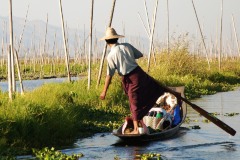
Boundary Demarcation and Ecosystem Services Mapping of Inle Lake Region, Myanmar
The assignment supports the newly established Inle Lake Management Authority (ILMA) by developing up-to-date, spatial datasets, which are to be included in the ILMA geodatabase. More specifically, the existing Inle Lake MAB boundary and zoning are confirmed and updated. Maps of land-use and different ecosystem services are produced and validated...
-
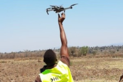
Incorporating Flying Sensors to Increase Agricultural Productivity in Central Mozambique
The PROMAC II project is an ongoing project of NCBA Clusa introducing conservation farming practices to various locations in the Manica, Tete and Zambezia provinces, with the objective to increase agricultural productivity. This project incorporates flying sensor activities in the PROMAC II project as a M&E indicator of the practices...
-
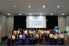
Tailor-Made Training for water professionals in Myanmar
This tailor-made training enhanced capacity of Yangon Technological University (YTU) educational staff in using Google Earth Engine to analyse water resources and support water management. Technical staff of Department of Meteorology and Hydrology (DMH) and the Department of Water resources and Improvement of River systems (DWIR) also participated to gain...
-
Training Package and Technical Guidance for Water Productivity and Real Water Savings
The overall project objective is to compile an inventory of agricultural field interventions and develop a training package to evaluate Real Water Savings from irrigated fields, to systems and basins. A guidance document is developed for agricultural field interventions by compiling a literature database containing published experiences and results of...
-
Training on Using Open Source Platforms for Hydrological Modelling of Data Sparse Regions in Nepal
This training was attended by sixteen researchers (seven female and nine male) from IOF, Department of Hydrology and Meteorology (DHM), Central Department of Hydrology and Meteorology (CDHM), Department of Forests and Soil Conservation and the Institute of Engineering (IOE). The overall objective of this training was to ensure the use...
-
APSAN-Vale: Piloting Innovations to Increase Water Productivity and Food Security in Mozambique
The project has as its overall aim to increase climate resilient agricultural productivity and food security, with a specific objective to increase the water productivity and profitability of smallholder farmers in Mozambique, prioritizing small (family sector) farmers to increase food and nutritional security. This project will demonstrate what the best...
-
Remote Sensing Course in Angola
The project "Knowledge-to-Knowledge" (K2K), aims to strengthen and enhance the capacity of the main Angolan knowledge institutions in agricultural sciences, to establish a strong relate between knowledge and practice. FutureWater collaborates with Wageningen University on giving a training on remote sensing and GIS techniques in agricultural applications and services to...
-
Catchment Study: Water Balance and Allocation Modelling in Rwanda
In an effort to introduce integrated land and water management, the Government of Rwanda, through Water for Growth Rwanda, commenced the development of catchment plans. FutureWater supported this effort by using the WEAP framework to develop catchment models for four selected demonstration catchments. Subsequently, the WEAP framework was used to...
-
Training in Water Resources Modelling for ARA-Sul
A Tailor-Made Training on Water Resources Modelling was required to equip the staff of the water agencies in Mozambique (ARAs) with additional knowledge to have a stronger advisory role towards policy and decision makers, and people living in the area. FutureWater provided this training to ARA-Sul and ARA-Norte. This training...
-
Development of a Water Allocation Model of the Incomati River Basin
Two water allocation models were developed in this project as a tool to support policy evaluation and improve strategic and operational decision making procedures of ARA-Sul. WEAP (Water Evaluation And Planning) was chosen as modelling framework. Different scenarios were implemented in WEAP to show the impacts of possible changes and...
-
Strategic Basin Planning Ganga River Basin
De Ganges is het dichtst bevolkte stroomgebied ter wereld en is de thuisbasis van de helft van de bevolking van India, waaronder tweederde van India’s armen. Het stroomgebied bedraagt meer dan een derde van het beschikbare oppervlaktewater in India en is de focus van meer dan de helft van het nationaal watergebruik – waarvan 90...
-
Training in Water Resources and Allocation Models
A Tailor-Made Training was provided to three ARAs in Mozambique, being ARA-Centro (Beira), ARA-Centro-Norte (Nampula), and ARA-Norte (Pemba). The provided Tailor-Made Training focused on learning to work with a Water Resources and Water Allocation Model, and apply them to a catchment in Mozambique. Emphasis was put on how these tools...
-
Water Allocation Model Development to Support Decision Making Procedures
Two water allocation models were developed in this project as a tool to support policy evaluation and improve strategic and operational decision making procedures of ARA-Sul, which is one of the five water management organizations in Mozambique. WEAP (Water Evaluation And Planning) was chosen as modelling framework. Different scenarios were...
-
Mainstream Climate Change Adaptation and Mitigation Into Agriculture in the Southern Caucasus
This study contributes to the agriculture sector climate change impact assessment and adaptation and mitigation strategy identification and evaluation. The study encompasses the three countries of the Southern Caucasus region: Armenia, Azerbaijan, and Georgia. The project also includes components for capacity building among in-country staff, and support of the World...
-
Impacts of Global Climate Change on the Water Resources of the Bunyala plains, Kenya
In this project an Integrated Water Resource Management Planning Tool for improved planning and management of sustainable food and sustainable livelihoods for the Bunyala flood plains of western Kenya was developed together with training materials for technical support in the maintenance and implementation of the planning tool and the facilitation...