![]()
Inleiding
SPHY (Spatial Processes in Hydrology) is een conceptueel, ruimtelijk gedistribueerd (op rasters gebaseerd) waterbalansmodel van het type “leaky-bucket”. Het integreert dominante hydrologische processen, waaronder:
- Regenval-afvoer
- Afvoer van meren/reservoirs
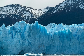
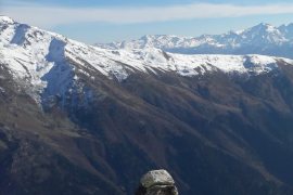
- Cryosferische processen (sneeuw, ijs, gletsjers)
- Evapotranspiratie
- Bodem hydrologische processen
SPHY heeft zich in de loop van de tijd ontwikkeld door de beste componenten van gevestigde simulatiemodellen op te nemen, zoals SRM, VIC, HydroS, SWAT, PCR-GLOBWB, SWAP en HimSim. Het legt relevante terrestrische hydrologische processen vast op verschillende ruimtelijke schalen (lokaal, regionaal en mondiaal) en is aanpasbaar aan verschillende veranderingen in landgebruik, extreme weersomstandigheden en klimaatscenario’s.
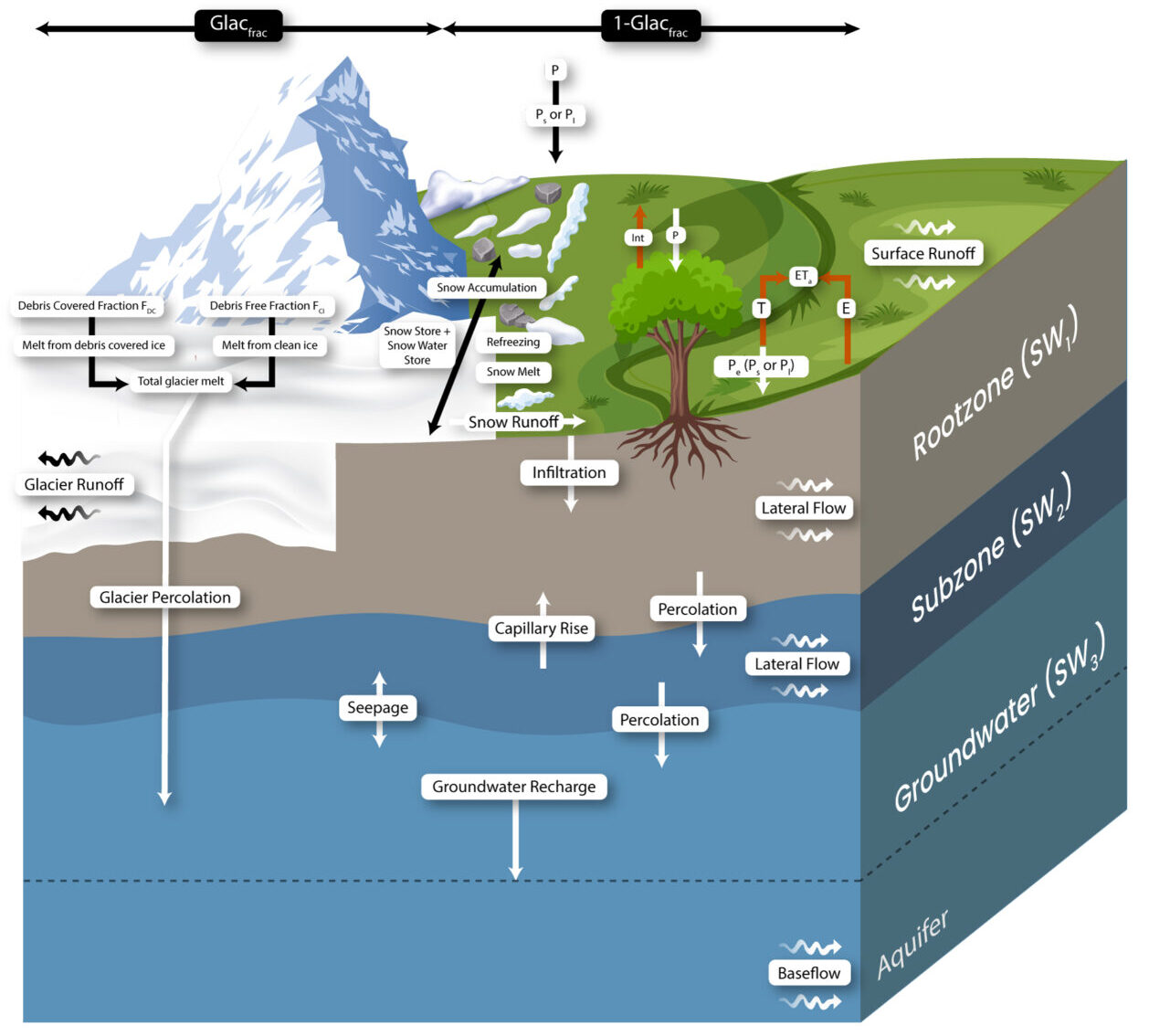
De onderstaande figuur geeft een overzicht van de concepten van het SPHY-model:
Belangrijkste kenmerken
Massabehoud is het kernprincipe van het SPHY model. De dominante hydrologische processen worden gedefinieerd door fysische vergelijkingen en parameters. Het model maakt gebruik van een benadering met subgridvariabiliteit om fijnschalige processen nauwkeurig weer te geven. Elke modelcel kan:
- Gletsjervrij
- Gedeeltelijk bedekt met gletsjers
- Volledig bedekt door gletsjers
Niet-gegletsjeriseerde cellen kunnen verschillende soorten landgebruik bevatten. Sub-grid variabiliteit wordt voornamelijk beïnvloed door fractionele vegetatiebedekking, wat processen beïnvloedt zoals interceptie, effectieve neerslag en potentiële evapotranspiratie.
Het model verdeelt de bodem/land kolom in:
- Twee bovenste bodemlagen
- Een derde grondwaterreservoir
Elk reservoir heeft corresponderende drainagecomponenten: oppervlakteafvoer, laterale stroming en basisstroming. Gletsjersmelt draagt via twee wegen bij aan rivierafvoer:
- Langzame component: Percolatie in het grondwaterreservoir, die uiteindelijk basisstroom wordt.
- Snelle component: Directe afstroming.
Mogelijkheden van het model
SPHY simuleert het dynamische gedrag van gletsjers door belangrijke processen zoals accumulatie, ablatie en ijsmassaoverdracht van accumulatie- naar ablatiezones te integreren. Als een gletsjer massa verliest, wordt ijs uit de ablatiezone herverdeeld volgens de principes van volume-ijsherverdeling.
Extra modules omvatten:
- Meermodule: Houdt het niveau en de opslag van meren in de loop van de tijd bij en gebruikt een geavanceerd routingschema om de waterstroom van meren naar regio’s stroomafwaarts te leiden.
- Erosiemodule: Berekent bodemerosie door regendruppels, overlandstromen en rivierstromen.
Er is niet één optimaal hydrologisch model voor alle toepassingen; de optimale keuze hangt af van de projectdoelen. SPHY onderscheidt zich echter door zijn veelzijdigheid en brede scala aan functionaliteiten, waaronder:
- Ruimtelijke schaal: SPHY kan op verschillende ruimtelijke schalen worden toegepast, van kleine boerderijen tot grote regionale en wereldwijde toepassingen. Gebruikers kunnen hydrologische variabiliteit analyseren op verschillende resoluties (bijv. 50 m voor gletsjers, 1000 m voor algemene hydrologie).
- Temporele schaal: Het model ondersteunt tijdsstappen van een dag tot een jaar, waardoor flexibiliteit mogelijk is op basis van de beschikbaarheid van gegevens en de dynamiek van processen.
- Aanpasbaarheid: SPHY kan worden aangepast voor verschillende klimatologische omstandigheden. Gebruikers kunnen niet-relevante processen uitschakelen (bijv. gletsjersmelt in tropische gebieden) om simulaties te stroomlijnen.
- Gegevensvereisten: SPHY kan werken met minimale gegevens of uitgebreide datasets integreren, zoals hydrologische metingen, cryosferische gegevens, gewascoëfficiënten en meer/reservoir informatie.
- Gebruiksvriendelijkheid: SPHY is ontworpen met het oog op toegankelijkheid en maakt invoer mogelijk via statische waarden, tijdreeksen of ruimtelijke rastergegevens. De uitvoer bestaat uit gedetailleerde ruimtelijke kaarten en tijdreeksgegevens die zijn aangepast aan de voorkeuren van de gebruiker.
Toepassingen voor FutureWater
FutureWater gebruikt SPHY voor verschillende hydrologische studies en toepassingen:
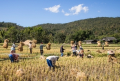
- Hydrologische veranderingsanalyse: Beoordeling van hydrologische regimes in verleden en toekomst in projecten zoals IWRM-Bhagirathi en IWRM-Tajikistan.
- Stroomgebiedbeheer: Ondersteuning van strategische planning voor grote stroomgebieden, zoals het stroomgebied van de Ganga.
- Irrigatiebeheer: Boerderij-specifiek irrigatieadvies, zoals in Roemenië en Angola.
- Debietvoorspelling: Gebruikt bij operationele stroomvoorspelling in Chili.
- Bodemdegradatie en herstel: Toegepast in landschapsbeheerprojecten zoals in Madagaskar.
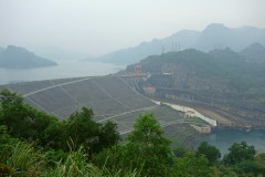
- Waterkrachtevaluaties: Ondersteuning van waterkrachtontwikkeling in Georgië, Indonesië, Kenia en andere locaties.
- Overstromingsrisicobeoordeling: Evaluatie van de gevolgen van extreem weer in projecten zoals SYSTEM-RISK en IMPREX.
Meer informatie
Ga voor meer informatie naar sphymodel.com.
Gerelateerde projecten
-
MountAInWater: Wereldwijde heranalyse van watervoorraden in berggebieden en toekomstige omslagpunten
Bergen voorzien miljarden mensen van zoet water, maar ons inzicht in hoe gletsjers, sneeuwpakketten en permafrost reageren op klimaatverandering is nog steeds onvolledig, met name op wereldschaal. Kritieke omslagpunten in de cryosfeer kunnen de beschikbaarheid van water stroomafwaarts fundamenteel veranderen, met verstrekkende gevolgen voor de landbouw, energievoorziening en ecosystemen. Om...
-
SPHY QGIS Plugin for Hydrological Modeling
SPHY (Spatial Processes in Hydrology) is a conceptual, spatially distributed (raster-based) “leaky-bucket” type water balance model. Developed by FutureWater, with the support of national and international partners, SPHY has emerged as a robust, user-friendly tool for undertaking operational and strategic water resource management decisions. It stands out for its physical...
-
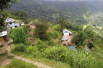
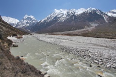
RoSPro: Roadside Spring Protection to Improve Water Security in Nepal
De midden- en hooggelegen gebieden in de Himalaya hebben te kampen met waterschaarste, waardoor ze een van de meest kwetsbare regio's ter wereld zijn. Bronnen zijn essentiële levensaders voor miljoenen berggemeenschappen en vormen de primaire bron voor huishoudelijk water en lokale voedselzekerheid. Helaas is het debiet van bronnen in de...
-

Integrated Water Resources Management in Tajikistan
Given the abundant freshwater resources in Tajikistan, water plays a crucial role in the country's socioeconomic development. However, the rising population, economic growth, and the growing impacts of climate change pose significant challenges to ensure water availability and accessibility. This project aims to address the aforementioned information gap by improving...
-
WE-ACT: Water Efficient Allocation in a Central Asian Transboundary River Basin
Het algemene doel van het WE-ACT-project is het demonstreren van een beslissingsondersteunend systeem (DSS) voor watertoewijzing in een grensoverschrijdende rivier in Centraal-Azië, om gedeelde voordelen te vergroten en de aanpassing van waterbeheer en -planning aan klimaatverandering te bevorderen.
-
SOS-Water: Water Resources System Safe Operating Space in a Changing Climate and Society
Het SOS-Water Project probeert de grenzen aan te geven waarbinnen de capaciteit van de aarde om levensondersteunende systemen voor de mensheid te leveren niet in gevaar komt en de capaciteit van de mensheid om zich aan te passen aan milieuveranderingen niet overbelast raakt. Het overschrijden van dergelijke drempels of omslagpunten...
-

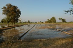
Hoge-resolutie bodemvochtdata ter ondersteuning van onderzoek naar dierziekten
De Gezondheidsdienst voor Dieren (GD) doet onderzoek naar het voorkomen van dierziekten en de relatie met omgevingsvariabelen, zoals klimaat en bodem. Dit project ondersteunt deze werkzaamheiden door het toepassen van een upgrade van de landsdekkende bodemvochtberekeningen die de afgelopen jaren zijn uitgevoerd door FutureWater m.b.v. het hydrologische model SPHY. Het...
-

Development of a Glacio-Hydrological Model and IWRM Plan for the Uttarakhand subbasin in India
The Swiss Agency for Development and Cooperation’s (SDCs) Global Programme Climate Change and Environment (GP CCE) India is supporting the operationalization of climate change adaptation actions in the mountain states of Uttarakhand, Sikkim and Himachal Pradesh through the phase two of the “Strengthening State Strategies for Climate Action” (3SCA) project...
-
Hydrological Assessment for Hydropower in the Lukhra River
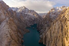
The objective was to develop a hydrological assessment for a planned run-of-river hydropower plant in the Lukhra river basin in Georgia. There is no observed river discharge data available. Hence, the assessment was developed based on hydrological simulations of the basin using the SPHY model (Terink et al., 2015) and...
-
Glacio-hydrological Assessment for Hydropower in the Nakhra River
The objective was to develop a glacio-hydrological assessment for planned run-of-river hydropower plant locations in the Nakhraa river basin in Georgia. The availability of observed river flow data is limited. Hence the assessment was developed based on hydrological simulations of the basin using the SPHY model (Terink et al., 2015)....
-

Training on Using Open Source Platforms for Hydrological Modelling of Data Sparse Regions in Nepal
This training was attended by sixteen researchers (seven female and nine male) from IOF, Department of Hydrology and Meteorology (DHM), Central Department of Hydrology and Meteorology (CDHM), Department of Forests and Soil Conservation and the Institute of Engineering (IOE). The overall objective of this training was to ensure the use...
-
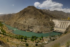
Glacio-hydrological assessment for hydropower, Mestiachala river, Georgia
The objective of this project was to develop a hydrological assessment for two potential hydropower plant locations in the Mestiachala basin in Georgia. The availability of observed river discharge data is limited. Hence the assessment was developed based on hydrological simulations of the basin using the SPHY model (Terink et...
-
Improved catchment management for small hydropower
This study assessed the impacts of various investment portfolios for catchment management activities on the cost-benefits of small hydropower schemes, in two case study catchments in Kenya and Tanzania, and analyzes the return-on-investment for the hydropower developers. Catchment degradation trends, climate change impacts and socio-economic changes increasing competing water use...
-

Pan-TPE: Changes in the Pan-Third Pole Water Tower
The proposed research targets changes in climate, water supply and demand, and suitable adaptation measures for green development of the Silk Road Economic Belt (SREB) in the river basins crossed by the SREB transect. Given the strong role of large scale hydrology in the proposed research activities, the spatial domain...
-

Building Climate Change Resilience in Asia’s Critical Infrastructure
Critical infrastructure in South Asia and Southeast Asia needs to become more resilient to climate change. A Technical Assistance project, supported by Asian Development Bank (ADB), looks at three key sectors: transportation, transport and water. FutureWater is responsible for the assessment of the water sector which will aim to increase...
-

LAUREL: Land Use Planning for Enhanced Resilience of Landscapes
Deforestation, population growth, and climate change are only some of the challenges to sustainable landscape management in Madagascar. Severe impacts of land degradation on crop production, water availability and biodiversity are already observed and expected to exacerbate in the future. To address these challenges, the World Bank is supporting the...
-
Training in Water Resources Modelling for ARA-Sul
A Tailor-Made Training on Water Resources Modelling was required to equip the staff of the water agencies in Mozambique (ARAs) with additional knowledge to have a stronger advisory role towards policy and decision makers, and people living in the area. FutureWater provided this training to ARA-Sul and ARA-Norte. This training...
-
Hydropower Development Assessment for the Tamakoshi River Basin
The overall objective of this project is to improve the understanding of the expected impacts of climate change on water availability in the context of potential hydropower development in the Tamakoshi River Basin. Specifically, the project aims to (i) Understand the current baseline hydrological regime of the Tamakoshi River Basin,...
-
System-Risk: A large-scale systems approach to flood risk assessment and management
System-Risk is a Marie-Skłodowska-Curie European Training Network which aims on developing and implementing a systems approach for large-scale flood risk assessment and management and provides a framework for training and career development of 15 Early Stage Researchers (ESRs). In collaboration with the Royal Meteorological Institute (KNMI), FutureWater is the hosting...
-
Training in Water Resources and Allocation Models
A Tailor-Made Training was provided to three ARAs in Mozambique, being ARA-Centro (Beira), ARA-Centro-Norte (Nampula), and ARA-Norte (Pemba). The provided Tailor-Made Training focused on learning to work with a Water Resources and Water Allocation Model, and apply them to a catchment in Mozambique. Emphasis was put on how these tools...
-
Strategic Basin Planning Ganga River Basin
De Ganges is het dichtst bevolkte stroomgebied ter wereld en is de thuisbasis van de helft van de bevolking van India, waaronder tweederde van India’s armen. Het stroomgebied bedraagt meer dan een derde van het beschikbare oppervlaktewater in India en is de focus van meer dan de helft van het nationaal watergebruik – waarvan 90...
-
Inclusive Development Paths for Healthy Red River Landscapes
Rapid land use changes in the Red River Basin threaten water resources. This project will be working in the Day River Catchment, a Red River distributary important for Hanoi, where most of these problems are manifest. The project will develop equitable and economically viable pathways for the land and water...
-
Demonstration of Remote Sensing Information for Integrated Reservoir Management in the Red River Basin in Northern Vietnam
In 2011 the Vietnamese and Dutch government signed a Memorandum of Understanding on the establishment of a Government to Government (G2G) program for improved integrated planning and monitoring of water resources for transboundary water management and disaster risk management. This project was formulated as part of the G2G trajectory towards...
-
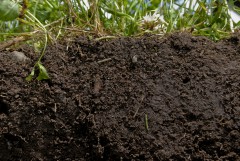
Bodemvochtgegevens ter ondersteuning van Leverbot analyses
De Gezondheidsdienst voor Dieren (GD) heeft in de afgelopen jaren een analyse van leverbotbesmettingen uitgevoerd. Dit onderzoek heeft laten zien dat verschillende omgevingsfactoren een rol spelen zoals grondwaterstand, neerslag, temperatuur en bodemtype. Daarnaast is op basis van landsdekkende bodemvochtschattingen door FutureWater vastgesteld dat ook bodemvocht en leverbotbesmettingen gecorreleerd zijn, wat...
-
SWIMM: Soil Water evaluation system based on Integrated Measurements and Modelling
The main objective of the project was to support policy making, under current and future climate conditions, on optimal water management in nature reserve areas, based on uniform and consistent data collection. The project built upon knowledge developed under the “Klimaat voor Ruimte” framework and refined and demonstrated a method,...
-

HI-AWARE: Himalayan Adaptation, Water and Resilience
HI-AWARE aims to contribute to enhanced adaptive capacities and climate resilience of the poor and vulnerable women, men, and children living in the mountains and flood plains of the Indus, Ganges, and Brahmaputra river basins. Research, including modeling, scoping studies, action research, and randomized control trials, is conducted at 12...
-
Central Asia Regional Risk Assessment for Water Related Energy Sector Impacts
The objective of this study was to support the “Central Asia Regional Energy Sector Vulnerability Study” led by Industrial Economics (IEc) and funded by the World Bank, by carrying out an expanded risk assessment for water availability and water related energy sector impacts in Central Asia. The work built on...
-
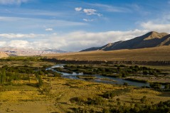
Gridded Meteorological Datasets and Hydrological Modelling in the Upper Indus Basin
Understanding of the hydrological regimes in the mountainous Upper Indus basin (UIB) is essential for water resources management in the region. High-resolution gridded meteorological datasets, which capture the spatial variability of precipitation, are critical for modelling the hydrology of high-mountain regions. Improvements to existing gridded datasets using high-elevation station data...
-
INTOGENER: Integration of EO data and GNSS-R signals for ENERgy applications
The need for accurate short and mid-term forecasting of the water flow generated from snowmelt in mountain basins is an important component for water management and hydropower activities. Due to the remoteness and difficult access to basins especially in cold weather conditions, where in-situ snow measurements, water level monitoring and...
-
Water Availability Analysis for the Upper Indus, Ganges and Brahmaputra River Basins
As part of the Himalayan Climate Change Adaptation Program (HICAP) ICIMOD has contracted FutureWater to generate climate change and water availability scenarios for the upstream parts of the Indus, Ganges and Brahmaputra river basins based on a high resolution hydrological model that FutureWater has developed.
-
Water and Adaptation Interventions in Central and West Asia
To assess the water resources availability in the Central Asia region under climate change hydrological models were developed for the two major rivers in the region, the Amu Darya and Syr Darya. Capacity building activities were undertaken to develop the capacity in each of the participating countries to use the...
-
The Middle East and North Africa Regional Water Outlook
The Middle East and North Africa (MENA) region is considered the most water-scarce region of the world. Water investments absorb large amounts of public funds, which could often be used more efficiently elsewhere. The need for alternative and improved water management options is therefore urgently needed, but a clear overview...
-
Q koorts en fysieke omgevingsfactoren
Er zijn sterke aanwijzingen dat het risico voor besmetting bij de mens met Q koorts afhangt van fysieke omgevingsfactoren, zoals warm weer met droge bodems en een bepaalde wind. Wind met genoeg snelheid en de juiste richting kan stofdeeltjes in de lucht doen komen die de bacterie invangen en deze kunnen vervolgens door mensen en...
-
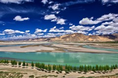
CEOP-AEGIS: Hydrology and meteorology of the Tibetan Plateau
This project delivered a prototype Water Balance Monitoring System (WBMS) and a three-year data set including observations of the water balance terms of the Tibetan Plateau on weekly and monthly basis. These observations contributed to clarifying the role of Plateau hydrology in the onset and intensity of the Asian Monsoon...