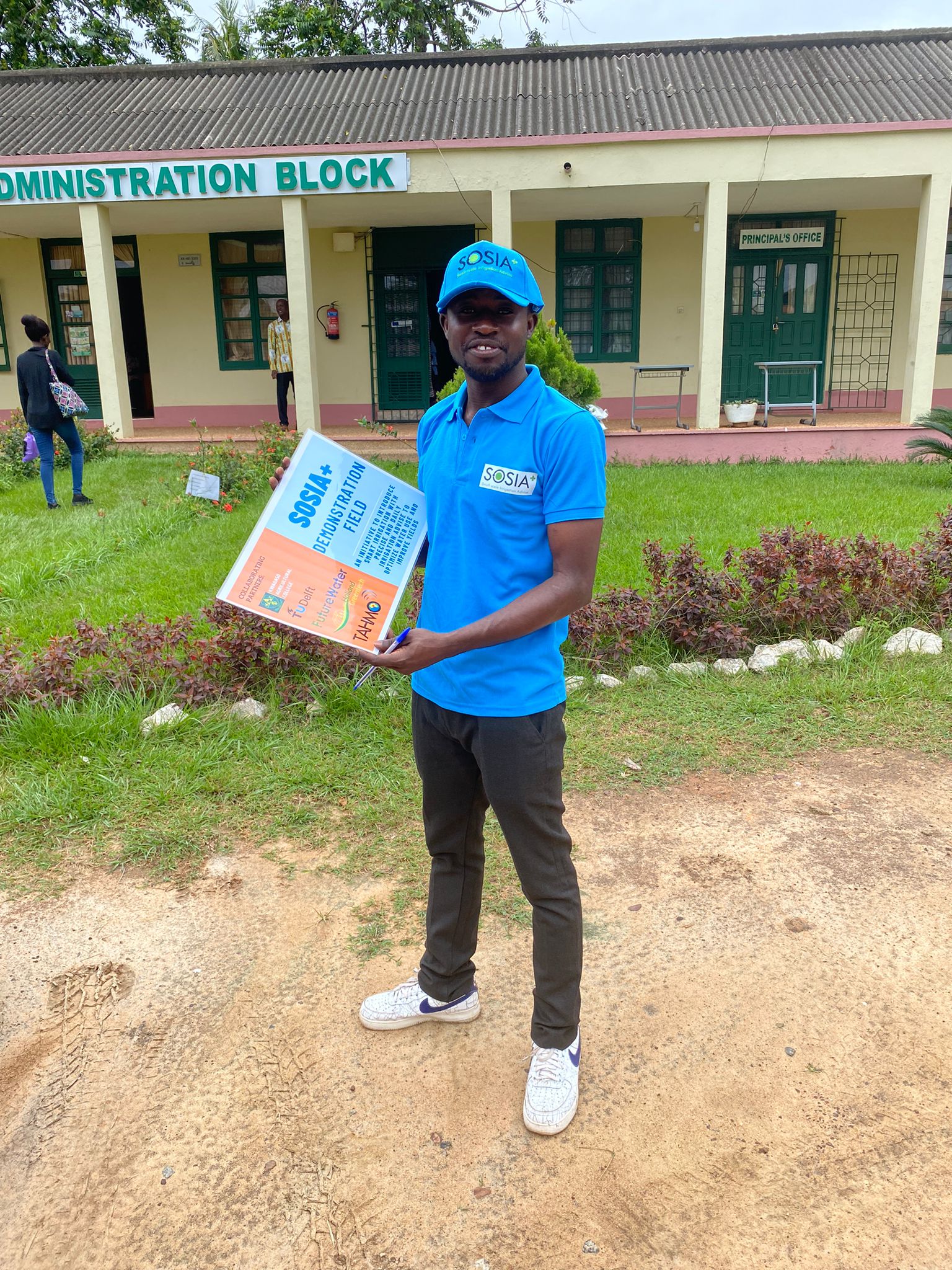
This week a video was created from our partnership in the SOSIA+ project. The video showcases the collaborative efforts of the partners by addressing the question: “How to secure the future of farming in a changing climate in Ghana?” Through the innovative application of smart irrigation technology and advisory tools developed and piloted within the project, farmers are empowered to navigate the challenges posed by unpredictable rainfall and enhance their climate resilience.
With a consortium consisting of Delft University of Technology, stichting TAHMO, Futurewater and Holland Greentech, this pilot project is paving the way for smallholder farmers to access innovative and accessible irrigation solutions. Together, we work hand in hand with local partners such as Kwadaso Agricultural college and a network of farmers dedicated to growing vegetables for Ghana’s rapidly expanding urban centers.
The video provides a glimpse into the transformative impact of smart irrigation technology and services on Ghanaian agriculture. By leveraging data-driven insights and cutting-edge technology, farmers are equipped with the knowedge and tools needed to optimize water usage, increase crop yields and mitigate the effects of climate change.
The video is part of The Partners for Water 5 programme (2022 – 2027), which follows several projects that received the Partners for Water subsidy from start to finish.
For the first interview of the Innovation in Progress series, we speak to Saroj Yakami and Sanjeev Bhuchar. They are part of the team currently working in Nepal’s mountainous Dhankuta municipality and Chhathar Jorpati Rural Municipality of the Dhankuta district. The project aims to enhance natural springs while at the same time improve road infrastructure in the area.
Saroj is a water resource expert and Country Manager for MetaMeta Research in Nepal. Sanjeev works for the International Centre for Integrated Mountain Development (ICIMOD), managing the interventions on sustainable springs. For the RoSPro project he is responsible for the co-design process, intervention and spring conservation.
We meet over Teams, as they are both in Nepal. During our conversation it becomes clear that this innovative project aims to make a big impact, not only in Dhankuta, but across the Hindu Kush Himalayan (HKH) region.
Hydrogeological Mapping
Innovative approach
Saroj studied International Land and Water Management at Wageningen University. He joined MetaMeta Research in 2014 where he became involved in the Green Roads for Water initiative. “Roads affect how water flows, but water also affects roads. Most road damages are due to water. By reimagining roads as tools for landscape improvement we can manage water supplies and increase the lifespan of roads”, explains Saroj. “For the RoSPro project I coordinate the activities in Nepal, focusing on stakeholder collaboration, data collection, impact analysis and co-design processes.”
Making a bigger impact
For ICIMOD and Sanjeev this project is relevant for the entire HKH region, which spans across eight countries. “Nearly 100 million people in the region depend on springs for their water security, of which approximately 10 million in Nepal. Spring water is a lifeline, catering to drinking, domestic, and agriculture needs, but many of these sources are dwindling. This is mostly due to the rapid expansion of road networks, in addition to changes in land cover and climate.
Road development alters the spring’s natural outflow, while rock cutting disrupts the location of spring orifices. For a long time, this problem has largely gone unnoticed, which poses a significant threat to the local communities and their water resources.” In an effort to address both the depletion of springs and the rapid expansion of roads, this project combines the roadside guidelines published by MetaMeta Research and the Department of Local Infrastructure (DoLI) with ICIMOD’s hydrogeology-based spring revival protocol.
Consortium Partners
The consortium is led by MetaMeta Research. Saroj explains: “MetaMeta had been working on roadside spring protection guidelines specifically for local road network in Nepal, as part of the Green Roads for Water initiative. With the intention on integrating our work, we shared our ideas with ICIMOD, as they are experts on spring revival in the HKH region”.
Sanjeev: “For ICIMOD this was very interesting. We had been developing a protocol for spring revival as well as decision support tools for mountain hydrology. Together we could address both problems at once. FutureWater, highly specialized in water management in the HKH context, contributes to the project by creating a digital twin and decision support toolkit. Through the integration of advanced techniques and tools, the project endeavors to secure safe and dependable water provisions for mountain communities while also preserving the quality of road infrastructure and sustaining connectivity”. DoLI will oversee the implementation.
Collaborating with the local community and local partners
Sanjeev: “Our main focus from the start was getting the local community and local government involved, making sure to include women in every step of the process. Promoting gender and social inclusion is an integral part of this project. Women are a vital part of communities, but are rarely in decision making positions. We make a conscious effort to change that”. The bottom-up approach and participatory process was essential for getting the problem recognized and endorsed by local governments. Saroj: “It enabled us to incorporate valuable local knowledge in the Nature-based Solutions, with respect for local traditions”.
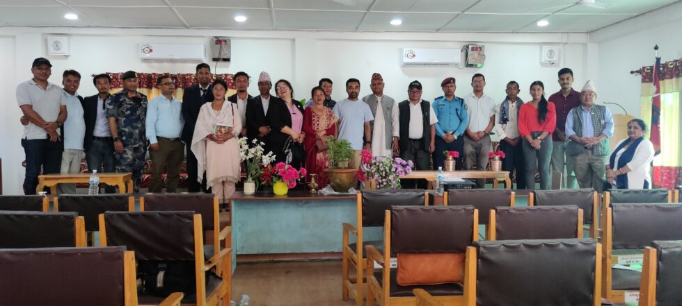
Kick-Off workshop with Dhankuta Municipality and Chhathar Jorpati Rural Municipality
In the field
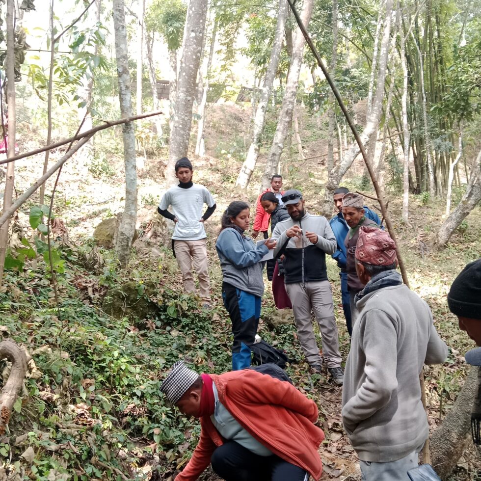
Since the start of the project in July 2023 a lot has been accomplished. Sanjeev begins: “We organized a kick-off to share the objective of the project with different stakeholders and started the process to co-select four roadside springs for piloting. There we conducted a hydro-geological study at field level. With the data from hydro-geological mapping, we were able to create 3D images of the area”.
Saroj adds: “We gathered a large amount of data to use in the co-design process. For example, we held household surveys and explored the area with locals to gather information about water quantity and changes in spring flows among other things. In Focus Group discussions we asked them to draw their own map of the region. This revealed all sorts of interconnections between their water supply and sources, built infrastructure, and other types of land uses. Valuable information that only locals have”.
Understanding how roads are affected by unmanaged roadside springs and vice versa.Knowing the project area together with communities during Focus Group DiscussionCo-design process: With Community members, Engineers from municipality and local partner HUSADEC for RoSPro implementation.
Next step
Saroj is excited about the next phase: “At this moment, we are in the process of finalising the co-design process for the measures for improvements of both springs and roads to be implemented in four pilot sites by May 2024. We have a short time frame before the monsoon starts.”
Innovation in progress series
During the Partners for Water programme 2022 – 2027, several projects that received the Partners for Water subsidy will be followed from start to finish. Over the next few years, they will take you with them on their transformative journey. You’ll be able to gain insights into their promising solutions, innovative processes and collaborations with local partners, as well as their struggles, challenges and valuable lessons learned.
More information about the project can be found here.
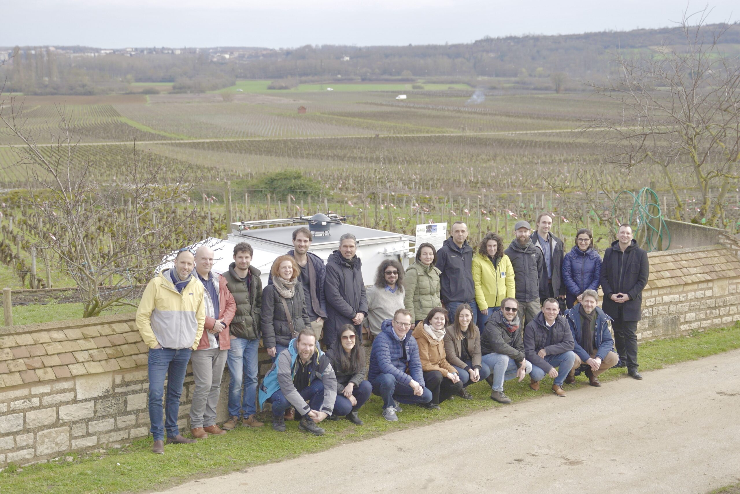
This week marked a significant milestone for the MAGDA Project as the Mid-term Review Meeting was held in the city of Beaune, France. Over the course of two days, the consortium gathered to conduct a comprehensive assessment of the progress achieved during the first half of the project. Reflecting on past achievements, the gathering also served as an opportunity to outline the roadmap for the project’s successful completion.
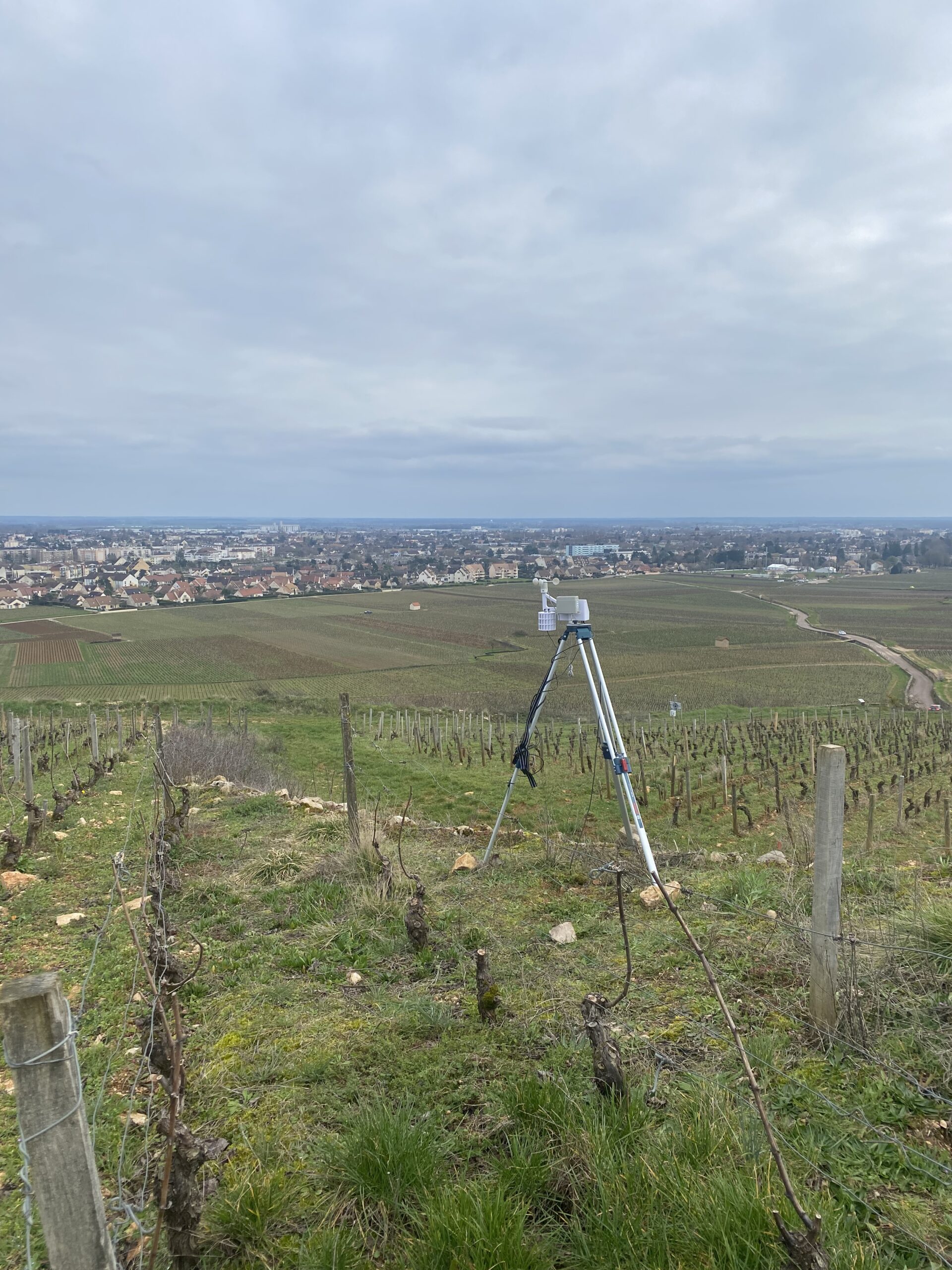
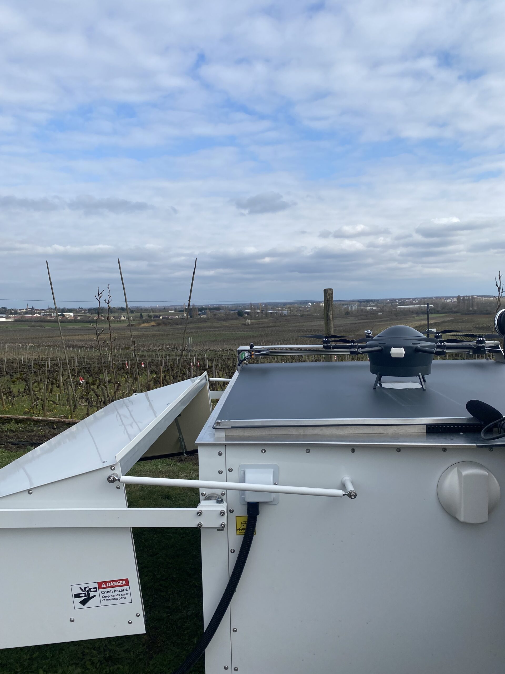
A highlight of the event was a field visit to one of the project’s pilot areas, offering firsthand insights into the practical implementation of MAGDA equipment. The field visit provided a unique opportunity to witness the innovative solutions in action, including the cutting-edge metodrone developed by MeteoMatics and state-of-the-art meteorological stations provided by CAP2020.
As the MAGDA Project enters its second phase, the momentum generated in Beaune sets a promising roadmap for continued success.
The MAGDA project aims at providing an integrated – but modular – system to provide severe weather forecasts and irrigation advisories enhanced by means of various satellite-borne, drone-borne and ground-based weather-observing technologies. The main applications will be in providing both warnings about severe weather that could affect crops and irrigation advisories based on enhanced rain forecasts. These warnings and advisories will be channelled through a Farm Management System to ensure the capability to effectively reach farmers and agricultural operators.
Consortium at the meteodrone locationMeteorological station at the demo siteMeteodrone before performing demo flight
Ghana, like many other Sub-Saharan African countries, is experiencing extreme drought and irregular weather patterns. These climate change challenges are expected to increase and require adaptation and mitigation measures. To adapt, farmers need localised, climate smart irrigation advice. TU Delft, FutureWater, Holland Greentech and TAHMO are making this vital information accessible to local smallholders. TAHMO’s CEO and TU Delft lecturer, Frank Annor, reveals the underlying technique and processes behind their inclusive solution.
From his office at TU Delft, Frank discusses the innovative technology behind SOSIA+. As a Civil Engineer at TU Delft, he knows exactly how to implement the ideas of this elaborate service. But first, he explains the role of the other organization he works for: “TAHMO aims to develop a dense network of weather stations across Africa to enable precise weather monitoring and forecasting, and to facilitate openly accessible data. Our role in the SOSIA+ project is to provide the technology for the weather stations and moisture sensors, and to monitor and deliver real-time weather and climate data.”
SOSIA+ technology
“Small-scale farmers receive localised irrigation advice on required water volumes and duration of irrigation from us to enhance water security and improve crop production,” Frank explains. “We’ve combined TAHMO’s data-collection technology with an algorithm created by FutureWater. Additionally, we offer training on the use of this system through the TU Delft partnership with Ghanaian universities and knowledge institutes and the Holland Greentech Ghana team.”
The irrigation advice is communicated through various channels, including an app, text messages, WhatsApp and in person. Frank explains: “Effective communication channels are crucial because we rely on farmers to collect and share data from their farms. This allows us to validate our advice and tailor it to the unique conditions of each farm. That’s why we created a modular communication system. The channels we use and the information we provide are based on the farmer’s preference and skills.”
An accessible service
“This technology stands out because it provides highly localised information that is directly applicable to the farmer’s field,” Frank explains. “Typically, such advanced technology is only accessible to large-scale farmers. However, we’ve developed a concept that allows multiple individual smallholder farmers to purchase the service collectively. Moreover, we’ve employed cost-effective, low-maintenance technology and a modular system that can be scaled to suit the farm’s size and the farmer’s level of expertise.”
Co-creation
“One of the key success factors of SOSIA+ is that we’ve developed the service and technology in collaboration with the farmers via an iterative process,” Frank reflects. “Our starting point was to discuss their needs and demonstrate how the system’s features could meet those needs. Then we created a mock-up, returned to the farmers for feedback, adjusted accordingly, and repeated the process. This approach significantly improved the usability and adoption of the service. It truly has been an invaluable lesson for developing solutions that genuinely meet the users’ needs.”
Scalability
Both Holland Greentech and TAHMO have teams operating in over 20 African countries. Frank explains, enthusiastically: “We already have the necessary connections in various areas, and the system’s modular design is great for scalability. The modularity ensures the technology is easily adaptable to meet the needs of new users in different locations.” He continues: “Challenges exist, such as establishing a viable business model. However, the funding from Partners for Water allows us to test our business model and value proposition in the pilot project and to develop a sound strategy on how to sustain the service moving forward.”
Innovation in progress series The Partners for Water 5 programme (2022 – 2027) follows several projects that received the Partners for Water subsidy from start to finish. Over the next few years, these projects will take you on their journey of testing the feasibility or application of innovative solutions to enhance water safety and water security abroad. You’ll be able to gain insights into their processes, collaborations with local partners and their potential solutions; as well as their struggles, challenges and their lessons learned. Stay tuned via the Partners for Water LinkedIn page!
For the development of SOSIA+, a smart irrigation tool tailored to small-scale commercial farmers, FutureWater joined forces with Holland Greentech, TU Delft, Stichting TAHMO, and the Kwadaso Agricultural College (KAC). The project is co-funded by Netherlands Enterprise Agency (RVO) partners for water.
The SOSIA+ project aims to optimize irrigation practices through the use of satellite and weather station data, creating an comprehendible advice that is sent to the farmers’ phone everyday. The farmers now receive daily irrigation advice tailored to their specific needs. This personalized guidance not only helps them conserve water, energy and money but also optimizes their crop yields.
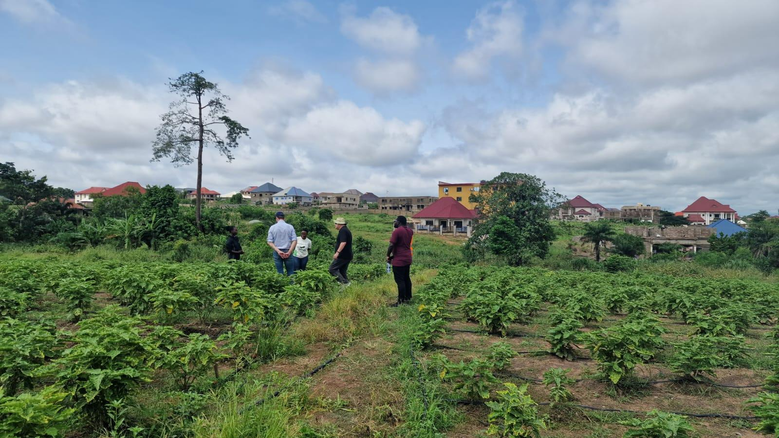
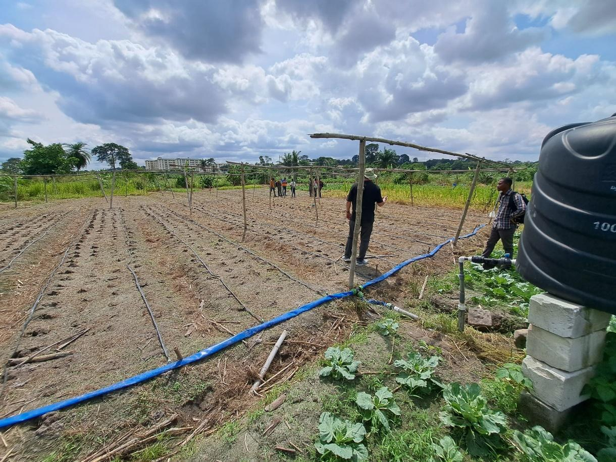
Last month marked the official start of the irrigation advisory trials at Kwadaso Agricultural College, bringing together several project members and the lead farmers from the region. The start of the trials means that the irrigation advisory tool is now tested with 10 lead farmers around Kumasi and Wenchi, which we had the privilege to visit. These farmers have been carefully selected to be a part of this initiative. During the visits, we conducted experiments in the fields equipped with drip irrigation systems, to check the operational quality.
To ensure the success of this project, the Holland Greentech team and KAC students will provide invaluable support through monitoring and guidance. Additionally, two students from Wageningen University & Research will also be joining the effort.
The SOSIA+ project is not just about irrigation; it’s about empowering Ghanaian farmers with the tools and knowledge they need to thrive in an ever-changing agricultural landscape. Our collaboration with dedicated partners and the unwavering commitment of these lead farmers in Kumasi and Wenchi give us hope for a more sustainable future for farming in Ghana.
As we continue this journey together, we remain steadfast in our mission to transform agriculture through innovation, data, and cooperation. Together, we can make the SOSIA+ tool a game-changer for small-scale commercial farmers in Ghana, and in doing so, contribute to food security and sustainable farming practices across the region.
Field demonstration of SOSIA+ in Ghana
In May, FutureWater joined TU Delft, Tahmo and Holland Greentech for a trip to Ghana for the SOSIA+ project.
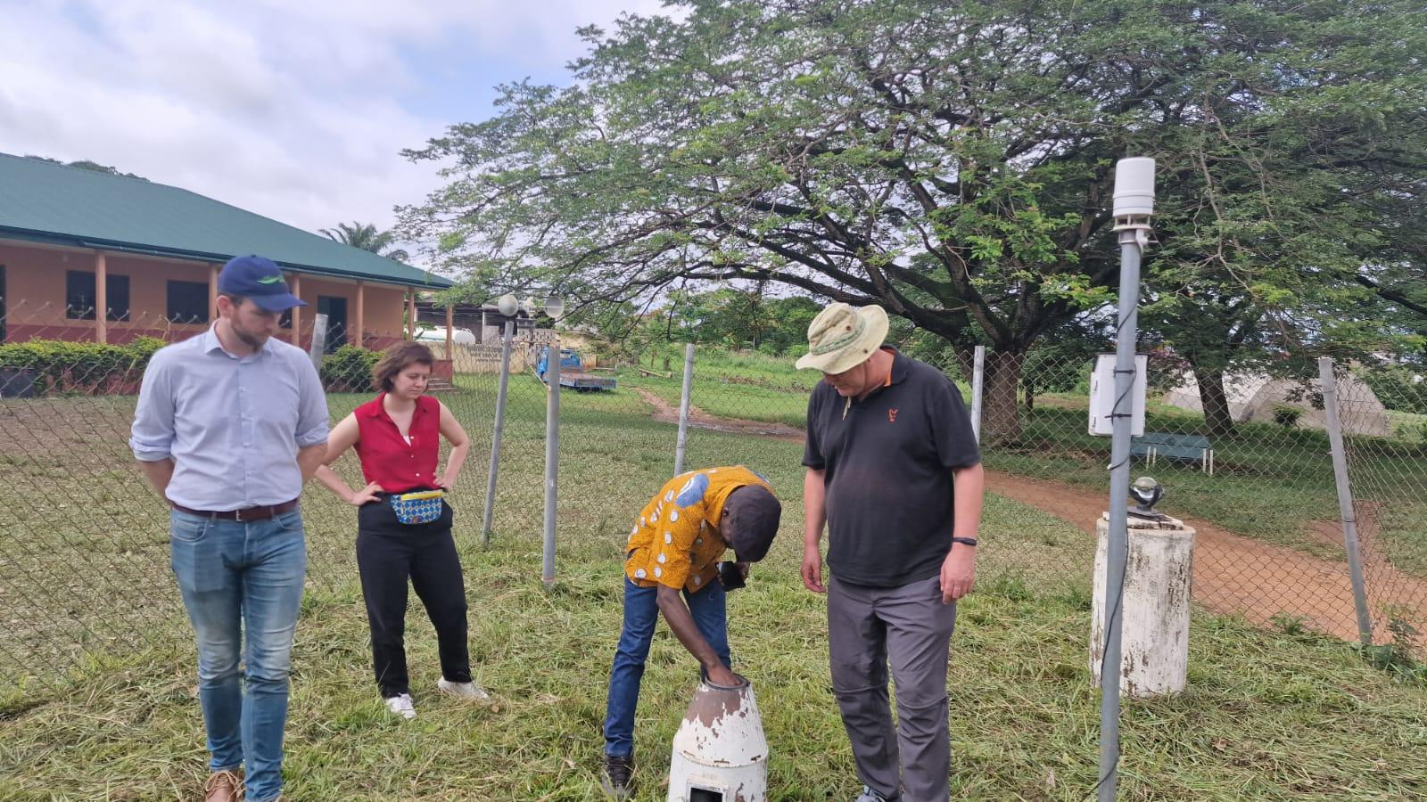
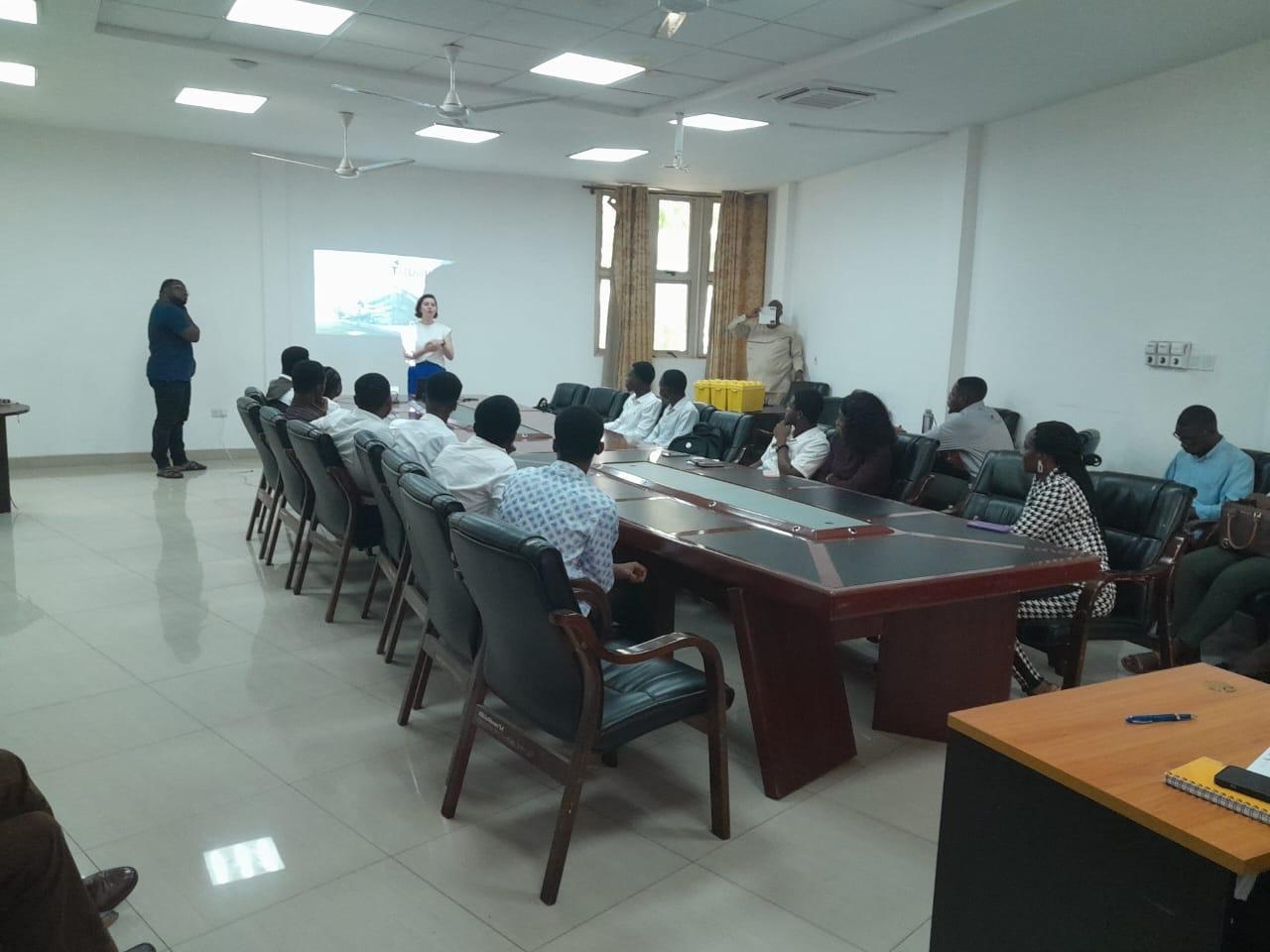
During this week, the team further developed the dashboard and irrigation service, refining the dashboard’s usability, expanded crop choices, and optimized the layout. The team presented demonstrations to the irrigation engineers of Holland Greentech in both Accra and Kumasi, incorporating valuable feedback to enhance the user-friendliness of the dashboard.
At visits to the KNUST (Kwame Nkrumah University of Science and Technology) Business Incubator and Kwadaso Agricultural College the dashboard’s capabilities were showcased, amongst others to business students interested in merging technology and agriculture. Additionally, the team explored various agricultural sites around Kumasi to gather information to enhance the operational side of the SOSIA+ service.
Finally, preparations have been made for conducting the trials for incorporating the SOSIA+ advice in the growing season, which starts in September. During the visit, valuable insights were gained, highlighting the need for optimized irrigation practices.
Demo plot at KACField visit in KumasiInspecting a TAHMO station at KACPresentation for Business Students at KBI
Over the last months, FutureWater developed and launched its What-to-Plant application for the Mavo Diami project in Angola. The What-to-Plant service from FutureWater provides planting advice to farmers for the upcoming crop season, so that farmers can anticipate on which seeds to buy. The consortium will continue with keeping services operational so it can be used in Angola and exploit relevant opportunities to increase the added value for the smallholders.
This Geodata for Agriculture and Water (G4AW) project started in 2019 to improve sustainable food and income security for smallholder farmers in Angola, by accelerating their agri-business performance through informed decisions supported by the Mavo Diami services built on weather, soil and crop signals and other relevant data and indicators. The project was carried out in a consortium with World Vision, eLEAF, Weather Impact, Aequator, GaiaVision and KRES.
The partners developed various microservices, such as a meteorological forecast application, a rain season indicator and weather suitability predictor by Weather Impact, the What-to-Plant application by FutureWater and the When-to-Plant application by eLEAF. All microservices where validated by three different validation tests. Local implementation was assured by training several hundreds of extensionists, responsible for onboarding new farmers and providing them with valuable information from the Mavo Diami service. The What-to-Plant service from FutureWater provides planting advice to farmers for the upcoming crop season, so that farmers can anticipate on which seeds to buy. With this service, farmers get an insight on which crops are suitable for planting or not. To provide this advice, land suitability maps for several crops are calculated, based on remote sensing, historic data and a range of parameters such as historic temperature and rainfall, soil hydraulic properties, cropping calendars and the Normalized Difference Vegetation Index (NDVI). These land suitability maps provide a number from 0 to 1 for every pixel for the crop modelled, with 0 being unfit to plant and 1 being very good to plant. With the seasonal weather forecast input provided by Weather Impact, the modelled land suitability maps can be turned into a monthly what-to-plant advice, thus giving information if a crop is suitable or not for the coming three months based on current weather information.
During the project, continuous improvements and various updates have taken place based on feedback from local partners and users. With the launch of the newest version of the Voicebot and Chatbot, that enables farmers to obtain the What-to-Plant information through their mobile phone, the project has formally come to an end. The consortium will continue with keeping services operational so it can be used in Angola and exploit relevant opportunities to increase the added value for the smallholders.
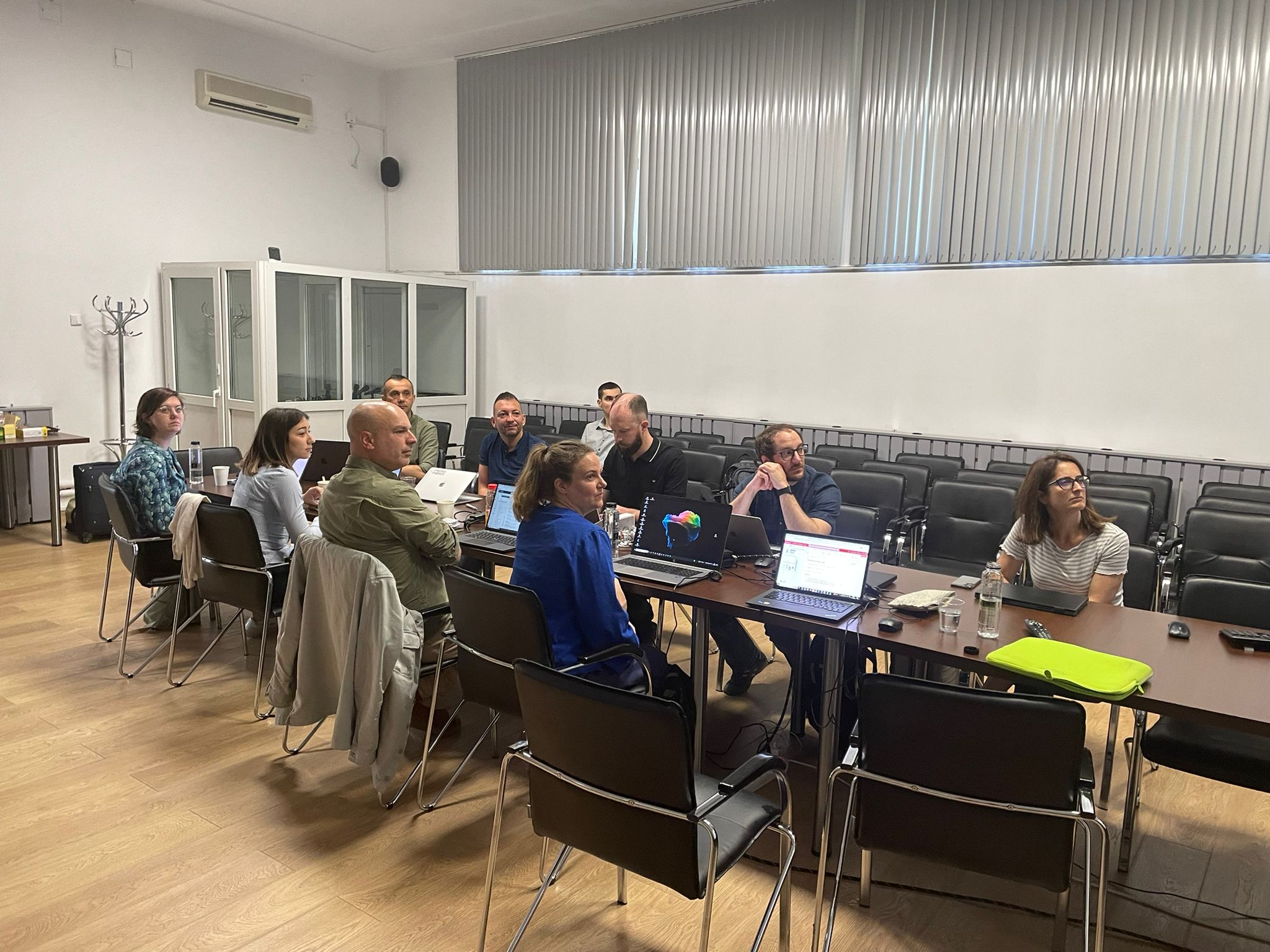
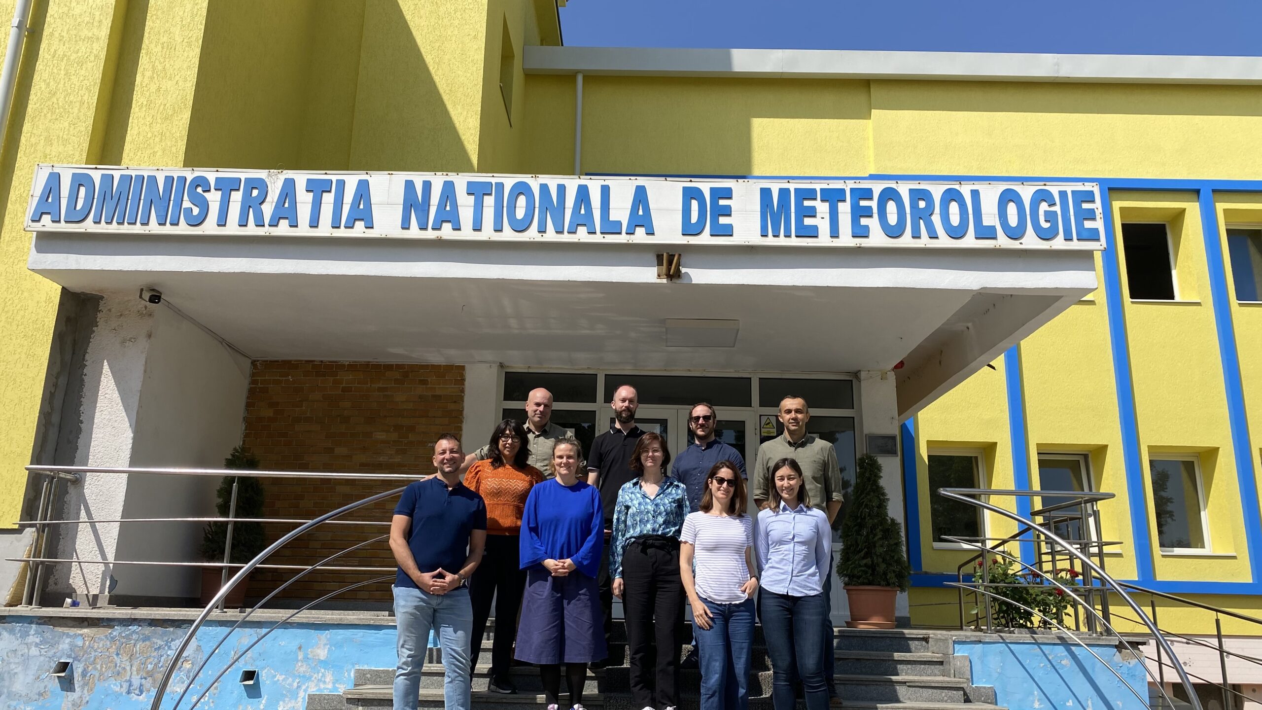
On May 22-23, FutureWater attended the Preliminary Design Review Meeting (PDR) for the MAGDA project in Bucharest, Romania.
The meeting was hosted by the National Meteorological Administration, and it was a great opportunity for project partners to meet in person and present the latest achievements. The major outputs from the first six project months were the following:
Selection of the three major MAGDA demo sites in France, Italy and Romania.
Analysis of MAGDA user requirements (surveys for the agricultural and water sectors are still open for participation!)
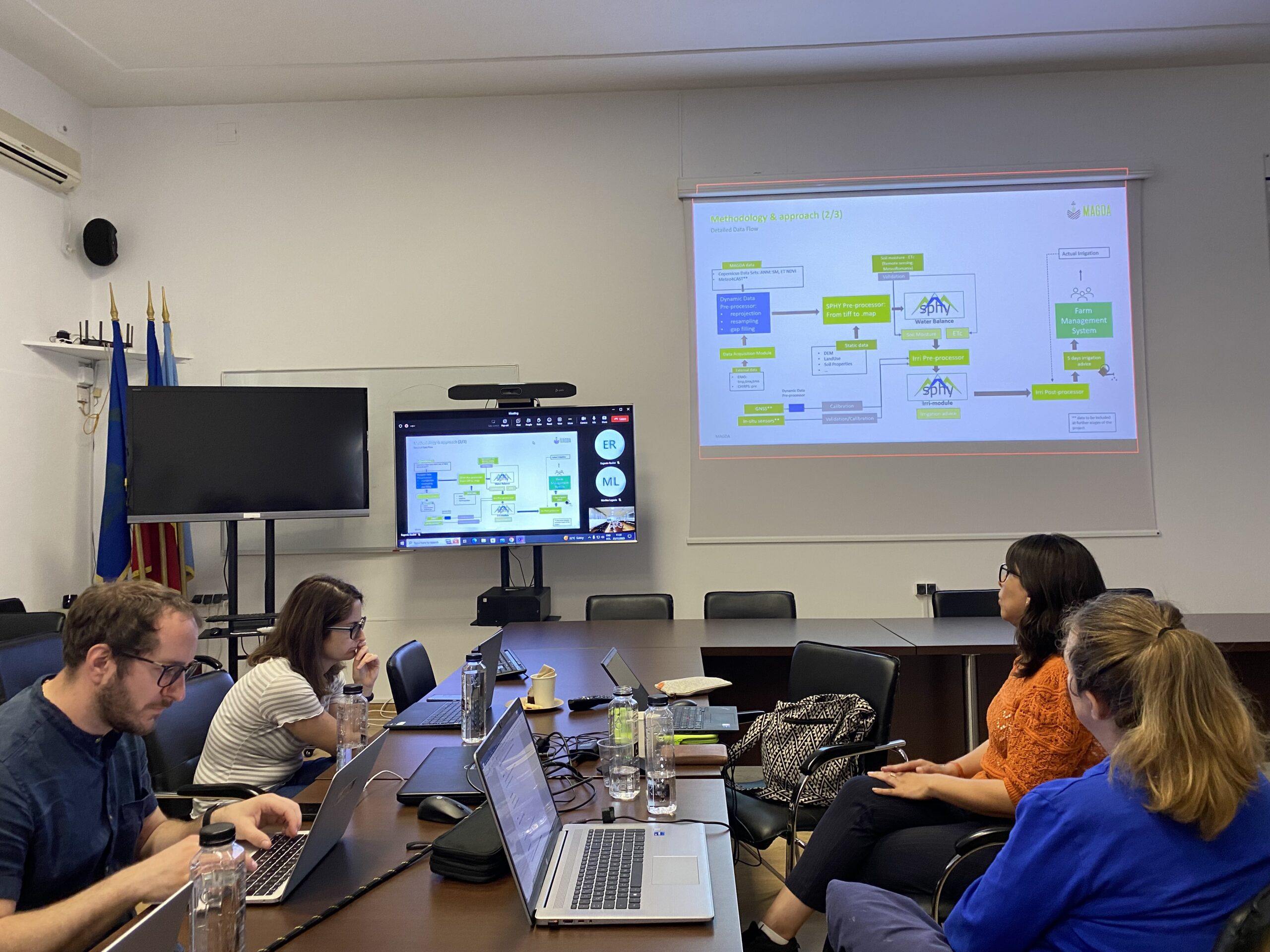
Detailed MAGDA system design: Summary of the technical data requirements of GNSS stations, IoT sensors, Meteodrones, remote sensing, weather forecast and hydrology modelling with SPHY.
The next months will now be used to install the equipment at the demo sites and start with the first modelling and site measurements, as well as the evaluation of historical data for calibration.
FutureWater is leading the irrigation advisory service of MAGDA, making use of hydrological modelling using SPHY (Spatial Processes in Hydrology). The output expected consists of an operational irrigation service to provide advice on when and how much to irrigate at certain moments during the cropping season, using as input data improved weather forecasts.
More information about the project can be found here and visiting the MAGDA Project website.
FutureWater presentation on MAGDA System ArchitecturePreliminary Design Review MeetingMAGDA Partners at MeteoRomania
Looking at global climate change patterns and its increased pressure on natural resources, West African countries like Ghana will be hit very hard. In particular, agriculture, which is the largest water user in Ghana, will be affected by high temperatures and changes in the variability of rainfall. This variability in climate makes crop production and yield more uncertain, as well as farm income. The periods of droughts in Ghana are getting longer and there is increased pressure on water availability from the river basins due to climate change, putting many people and farmers in risk of having too little water. Therefore in this project, we will develop and pilot in the field an innovative tool that will significantly enhance water security in Ghana by reducing the quantity of water needed for irrigation per hectare (up to about 40% less of current water use).
To support the Ghanaian farmers in making the transition to a water secure future, they expressed a need for locally adapted, climate smart irrigation technologies and innovative advice to improve their irrigation practices. To develop such a smart irrigation service, FutureWater is working together with knowledge institute TU Delft, horticulture company Holland Greentech, and social enterprise TAHMO to develop this innovative tool and implement it in the field. This smart irrigation service should be able to translate various weather parameters and data (historical but also real-time data) into crop specific irrigation advice in volumes, but also in minutes for small-scale farmers. The unique and innovative part of this smart irrigation service, called SOSIA+ (Small-scale Open source, Satellite based Irrigation Advice), will be the algorithm to provide advice on how many minutes a farmer should irrigate a specific crop – based on the combination of the TAHMO local weather data and real-time data (normally not taken into account), that will be tailor-made for small scale farmers (normally these services are only for large scale farmers while the predominant type of farmers in Ghana are small scale) and is linked to the innovative drip irrigation systems that Holland Greentech Ghana already sells to farmers (so closely linked to an existing customer base of farmers and a product).
SOSIA+ will initially focus on the city of Kumasi and the Ashanti region, targeting more than 500 farmers and a growing population of more than 4 million people that needs to be fed and are affected by the changing weather patterns and increased water demand. In the long-term, the goal is to transform the horticulture sector in Ghana towards a smart and sustainable practice. By developing the Irrigation Advisory Tool, we can prevent over-irrigation to reduce water use and hence work towards the desired situation of sustainable food production and water security. This project will focus on gathering better weather information, piloting an innovative irrigation tool that is linked to a drip irrigation system to reduce water losses and implement this in the field with lead farmers. This will change the current traditional practices of the farmers leading to less water and energy losses, hence increasing availability of water and the sustainability of food production in light of climate change.
Earlier this year FutureWater and Holland Greentech developed a very first draft of the irrigation advisory application ‘SOSIA’ for Rwanda, with promising results. As one of the main problems in many African countries is that there is no ground network of weather stations, making it very difficult to efficiently manage water resources or generate weather forecasts that are localised and essential for food production, the initial SOSIA project used satellite remote sensing data to overcome this problem. But given the rapidly changing weather patterns due to climate change, the collection of ground data is also essential. This is why TAHMO has been set-up to develop a dense network of weather stations all over Africa and using their data will be very valuable to use for the irrigation tool.
The video below gives a brief summary of the tool created in the previous SOSIA project.
“How long do you irrigate per day?” we asked Madame Christine, a small-holder farmer with an eye for business. “Well, I used to irrigate for up to three hours every day, but not anymore. I can now double my fields under cultivation and sell more crops while using the same amount of water!”
We received this reaction during our field trials in Zambia for our newly developed Satellite Open-Source Irrigation Advisory (SOSIA) tool. This tool was developed within the two-stage call for innovations based on open-source geodata launched by the Netherlands Space Office (NSO), which aimed at positively impacting food security and sustainable land and water management in Africa. In response to this challenge, FutureWater and Holland Greentech developed the SOSIA tool to help small and medium farmers make informed decisions about their irrigation practices. Because – while irrigation is a crucial aspect of agriculture, over-irrigation can lead to significant environmental problems, and it reduces profits for farmers. Using less water can lead the farmer to spend less time irrigating, having a lower electricity/fuel and water bill, improving the water productivity of crops and contributing to a sustainable environment.
What is the SOSIA tool?
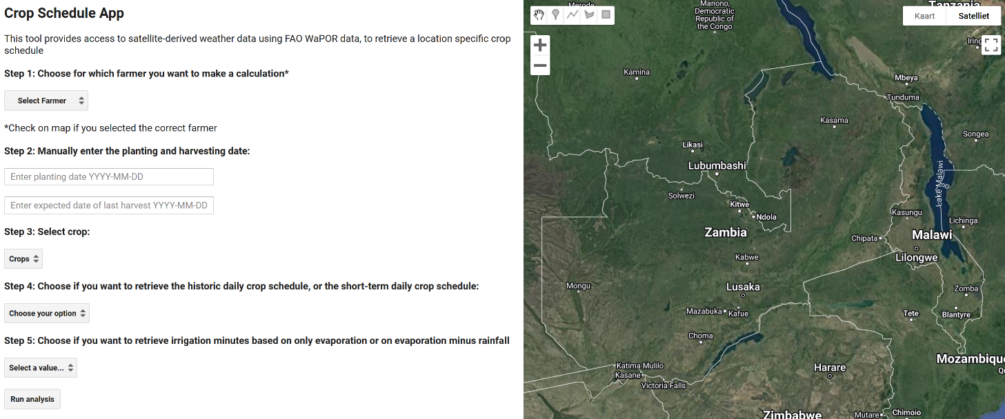
SOSIA is a state-of-the-art, open source, satellite-based tool that provides both historical and near real-time information on irrigation water requirements for smallholder farmers, calculated based on open-source geodata and specific additional farmer and crop information. The tool was developed to overcome the often-limited ground data availability for calculating crop water requirements. The only data farmers can rely on are traditional weather stations, often far away from their fields. With the SOSIA tool, the farmer receives information based on open geodata for their location, by converting the spatial data into Virtual Weather Stations (VWS)!
Seasonal and hindcasted irrigation information
The SOSIA tool provides a farmer with irrigation advice, expressed in minutes of irrigation duration, throughout the crop season. Before the farmer plants the crop, an extension officer of Holland Greentech uses the SOSIA tool to provide the farmer with their tailor-made seasonal crop schedule, which is an overview of expected irrigation minutes for the rest of the season, calculated based on the average evapotranspiration of WaPOR of the 10 years.
Figure 1. Graphical User Interface of the SOSIA tool, hosted on the Google Earth Engine platform.
As climate is changing, the average of the last 10 years does not always give an accurate depiction of what is happening in the field. Therefore, the SOSIA tool calculates the irrigation requirements for the last week based on open source geodata. The irrigation engineer uses this functionality on a weekly basis to make use of the actual climate data and informs the farmer only if additional irrigation is required, compared to the seasonal reference schedule.
Testing the SOSIA tool with farmers
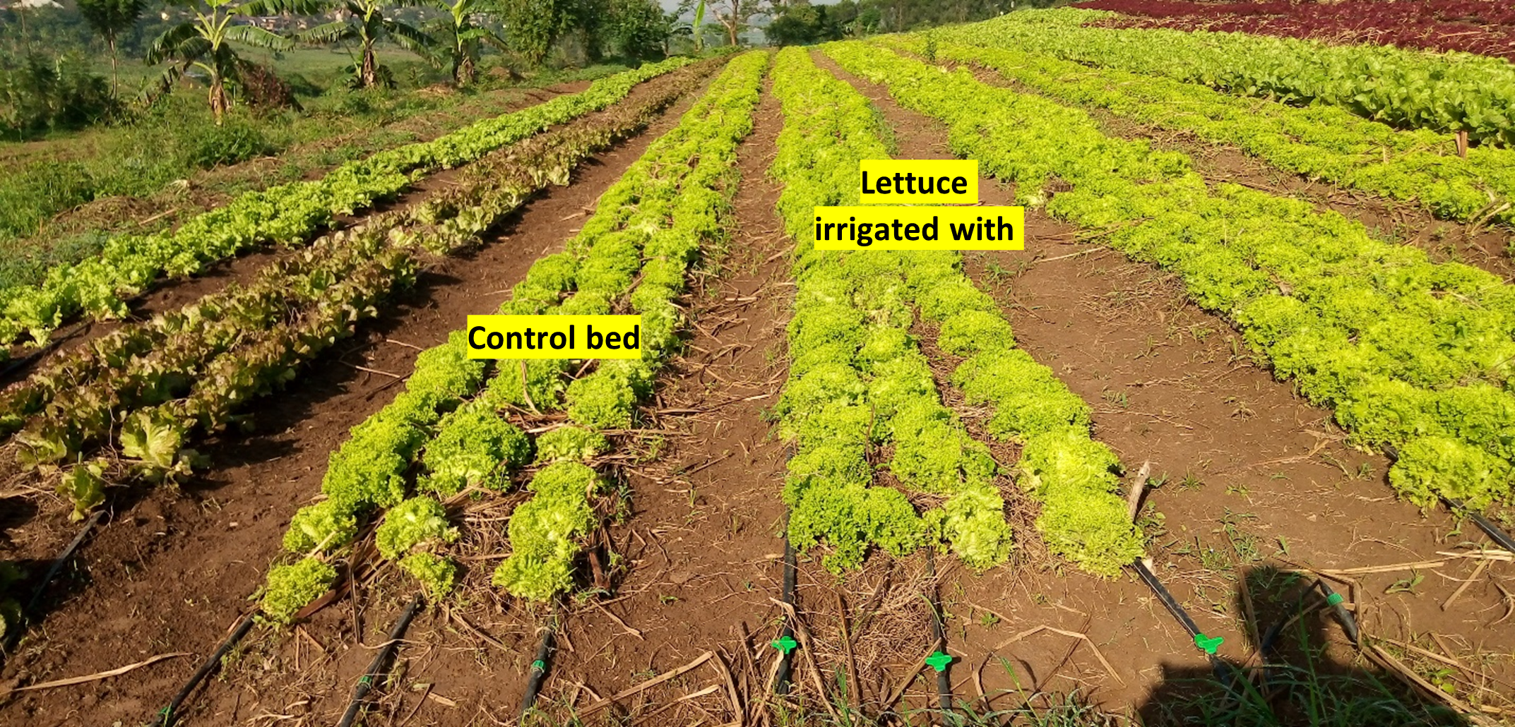
To test the tool in the context of Sub-Saharan Africa, trials were set out in both Zambia and Rwanda with farmers from the Holland Greentech client base. The farmers were quite positive about the observed impact of using the tool. Many were surprised that the advice indicated less irrigation time than they were used to. While following the advice, the farmers also kept records of the realized number of minutes of irrigation, estimation of soil moisture and signs of drought stress. No farmer recorded any drought stress on the crops. The observations of the farmers showed that the crop performance of the SOSIA irrigated trial was visually the same as fields irrigated under their normal irrigation regime (Figure 3). The farmers were enthusiastic about this water saving, mainly because of the related decrease in electricity / fuel costs. For most of the farmers involved in the field trials, SOSIA reduced irrigation water requirements while optimizing yield.
Back to Madame Christine: she indicated that she usually irrigates her lettuce fields 1 hour in the morning and 1 hour at the end of the afternoon. She was surprised that the SOSIA advise only advised her to irrigate in the range of 50-57 minutes daily. When applying the advice, she did not notice any drought stress in her lettuce crop, and the harvest was visually the same for both the demo and control field.
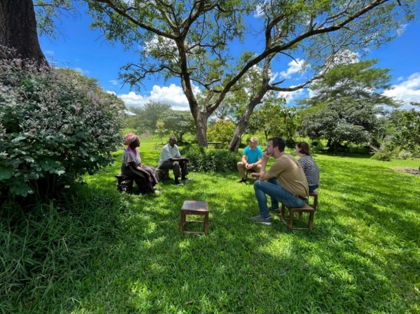
Figure 2. Conducting an interview with farmers in Zambia.
Benefits for extension advisors
Extension officers are the primary intended users of the SOSIA tool on a daily basis. During the piloting phase, the extension officers from Holland Greentech received the tool with great enthusiasm. They praised the user-friendliness, quality and spatial detail of the information, and efficiency compared to traditional methods to provide advisory services.
Conclusion
In conclusion, SOSIA is a valuable tool for anyone involved in irrigation management for small and medium farmers, particularly in an African context. By providing near real-time information on irrigation water requirements, it helps farmers to irrigate more efficiently and thus to realize a more sustainable use of water resources. By leveraging the power of open source geodata, costs are kept relatively low while access to a wealth of localized information is achieved. Initial results from the Zambia and Rwanda trials indicate that application of the SOSIA tool saves farmers water, electricity/fuel, time and improves the water productivity and, potentially, income!
Figure 3. Difference between the SOSIA Demo and Control plot at Sunripe Farm, Rwanda (08/11/2023).