For the two study catchments, satellite imagery and field observations were combined to perform a land degradation assessment and to identify trends. Secondly, baseline hydrological conditions were assessed using a hydrological simulation model. Future changes in hydrology and hydropower generation were evaluated by running the biophysical model for a Business-as-Usual scenario, accounting for land degradation trends, changes in water use, and climate change.
Subsequently, the impacts of three catchment investment portfolios (low, medium, high) containing different catchment activities were quantified with respect to the BaU scenario. Benefits and costs were analysed for the hydropower developers to evaluate whether it makes sense for them to invest in improved catchment activities. For one of the catchments this is clearly the case (Kiwira, Tanzania).
The analysis shows that the impacts of climate change on revenue from hydropower are in the same order of magnitude as the other negative anthropogenic factors: increased domestic water use demand in the catchment and land degradation due to poor conservation of natural areas and poor agricultural practices.
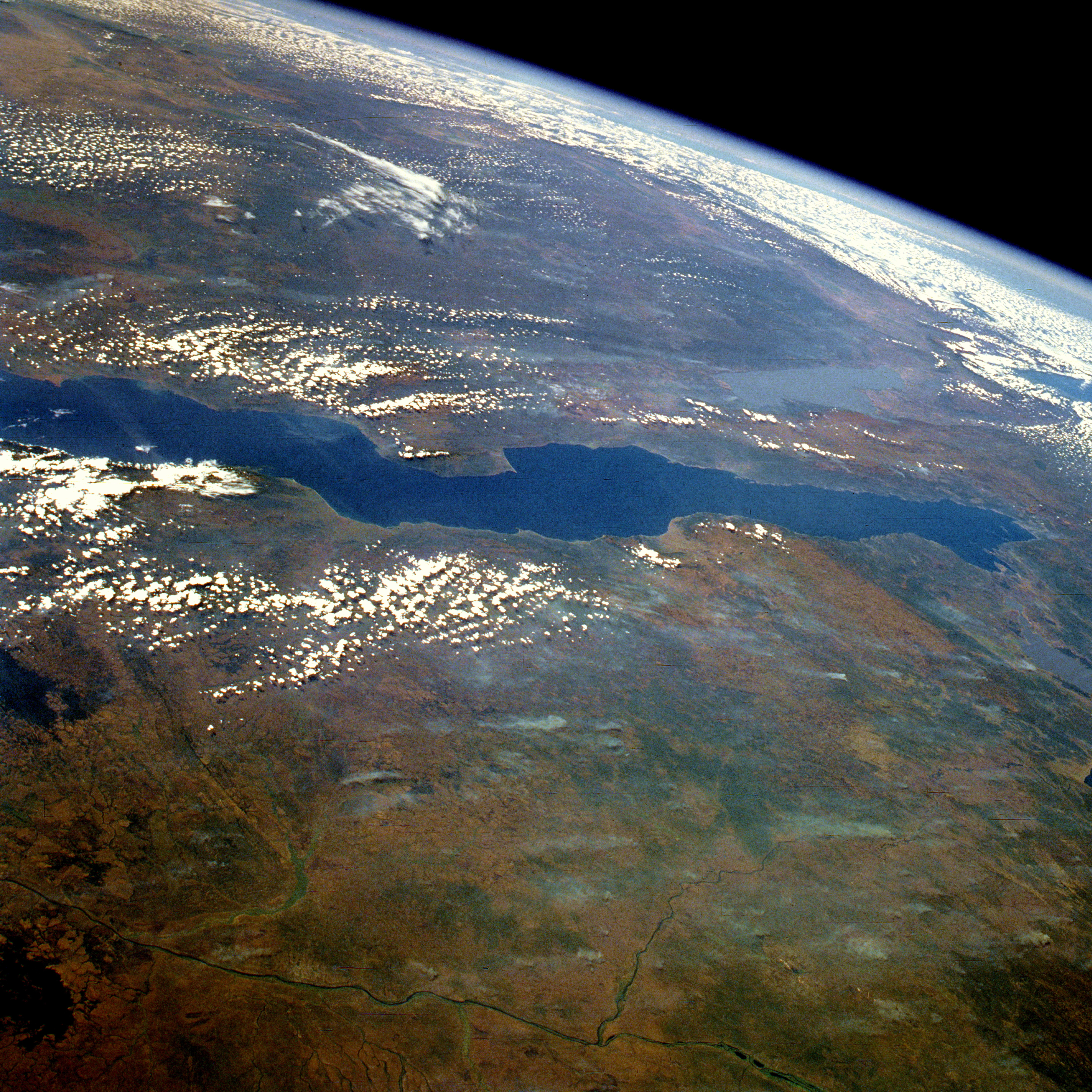
The world’s longest lake, Tanganyika holds 17 percent of our planet’s fresh water and boasts more than 300 fish species. The Greater Mahale Ecosystem encompasses 4.8 million acres of mostly forested landscape and is home to approximately 93 percent of Tanzania’s 2,800 endangered chimpanzees. Local communities of small-scale farmers and fishers still live close to the land, and their lives and livelihoods are dependent upon the area’s rich natural resources.
Lake Tanganyika from space (Wikipedia)
The health of this diverse natural environment and the well-being of its people are threatened extreme poverty compounded by a rapidly growing human population. For this reason, TNC has started in 2013 the Tuungane Project: Uniting People and Nature. The goal of the project is to provide to remote villages better access to health services, education and modern contraception to achieve a more sustainable use by the population of the natural resources.
Land use change over the last decades has caused forest to be cleared for agriculture, and erosion is considered an increasing problem in the watersheds draining to Lake Tanganyika for the loss of fertility upstream but more important for its likely impact on the fishery habitat in the lake. This is likely one of the causes of the declined fisheries in the coastal zones with its negative consequences on the local communities.
The purpose of this consultancy is to support TNC in its effort in a first level scoping assessment on erosion levels in the Tuungane project area. FutureWater will carry out erosion and hydrological modelling to quantify erosion patterns in a number of pilot erosion modelling watersheds and its relations with land use and management. This scoping modeling study will be carried out using gathered data by TNC on land use and climate and other local data.
The specific objectives for the assignment are:
Provide a first level assessment of the erosion and sediment yield levels of selected priority watersheds in the project area
Analyze spatial patterns and its relation with land use management
Obtain an estimate of the range in temporal variability in sediment yield entering the lake for subsequent analysis on fish habitat impacts.
Outline and advise on further activities in terms of more details, expansion to other watersheds and potential interventions.
Within the context of the Nile Basin Initiative (NBI), the Nile Equatorial Lakes Subsidiary Action Program (NELSAP) and the EWUAP (Efficient Water Use for Agricultural Production) are promoting irrigation development in Tanzania. A study was undertaken to evaluate and rank five potential irrigation schemes in the Tanzania part of the Lake Victoria Basin. Schemes included in the analysis are Bugwema, Manonga, Isanga, Ngono and Mara Valley.
The methodology followed in this study to assess the irrigation potential of the five schemes is based on the assimilation approach to ensure the use of all available data, information, publications, local knowledge and expert judgment together. The study focused on the following five thematic areas: (i) land suitability, (ii) water resources assessment, (iii) water requirements, (iv) environmental considerations, and (v) institutional aspects.
Based on testing decision makers preferences it was concluded that three schemes are high in ranking: Mara Valley, Ngono and Isanga. However, only based on the actual decision makers preferences final ranking can be determined.
The Nile Basin Decision Support System (NBI-DSS) will provide the necessary knowledge base and analytical tools to support the planning of cooperative joint projects and the management of the shared Nile Basin water resources on an equitable, efficient and sustainable manner. FutureWater was asked to support this NBI-DSS and to undertake preliminary data collection and compilation.
Details
The developed data base has two main components: spatial data and point data. Regarding the spatial data the following data have been made available
Land cover
Soils
Vegetation Indices
Precipitation FEWS
These data are available over the entire Nile Basin and include a extensive set of attributes. Data have been quality controlled and is ready to apply in the DSS and can be used for various types of hydrological models.
The point data includes over 20 million records from various sources included global and local data sets. Data are stored in PostGreSQL. The data can be considered as the most complete hydro-meteorological dataset available for the Nile so far.
The countries included in the Nile Equatorial Lake sub-basins face an ever increasing pressure on land and water resources, together with rapid population growth. As a result, food production is one of the main concerns and priorities of policymakers in the area. Irrigation and improved water resources management have the potential to boost agricultural productivity in the area, currently almost entirely rainfed. Irrigated crop yields are much higher than rainfed yields, which means that there is a high potential to increase food production in the area.
FutureWater, in collaboration with WaterWatch, will assess the irrigation potential of seven Nile countries in order to fill gaps in the NBI and member country information based on agricultural use. This study consists of several consecutive steps, in which hydrological modelling, the use of remote sensed data, ArcGIS analyses, consultation workshops and meetings form the core of the project.
The specific objectives of this project are:
Determine the irrigation potential of the proposed countries considering the physical resources of ‘soil’ and ‘water’, combined with the irrigation water requirements as determined by the cropping patterns and climate
Provide a preliminary assessment of probable environmental and socio-economic constraints to be considered to ensure sustainable use of physical resources within the Nile basin
Indicate the required resources for the preparation and investment phase
Maps
The assessment of the Irrigation Potential study resulted in a irrigation suitability map. This map can be downloaded as jpeg or as GeoTIFF. Click on the links below to download the suitable format:


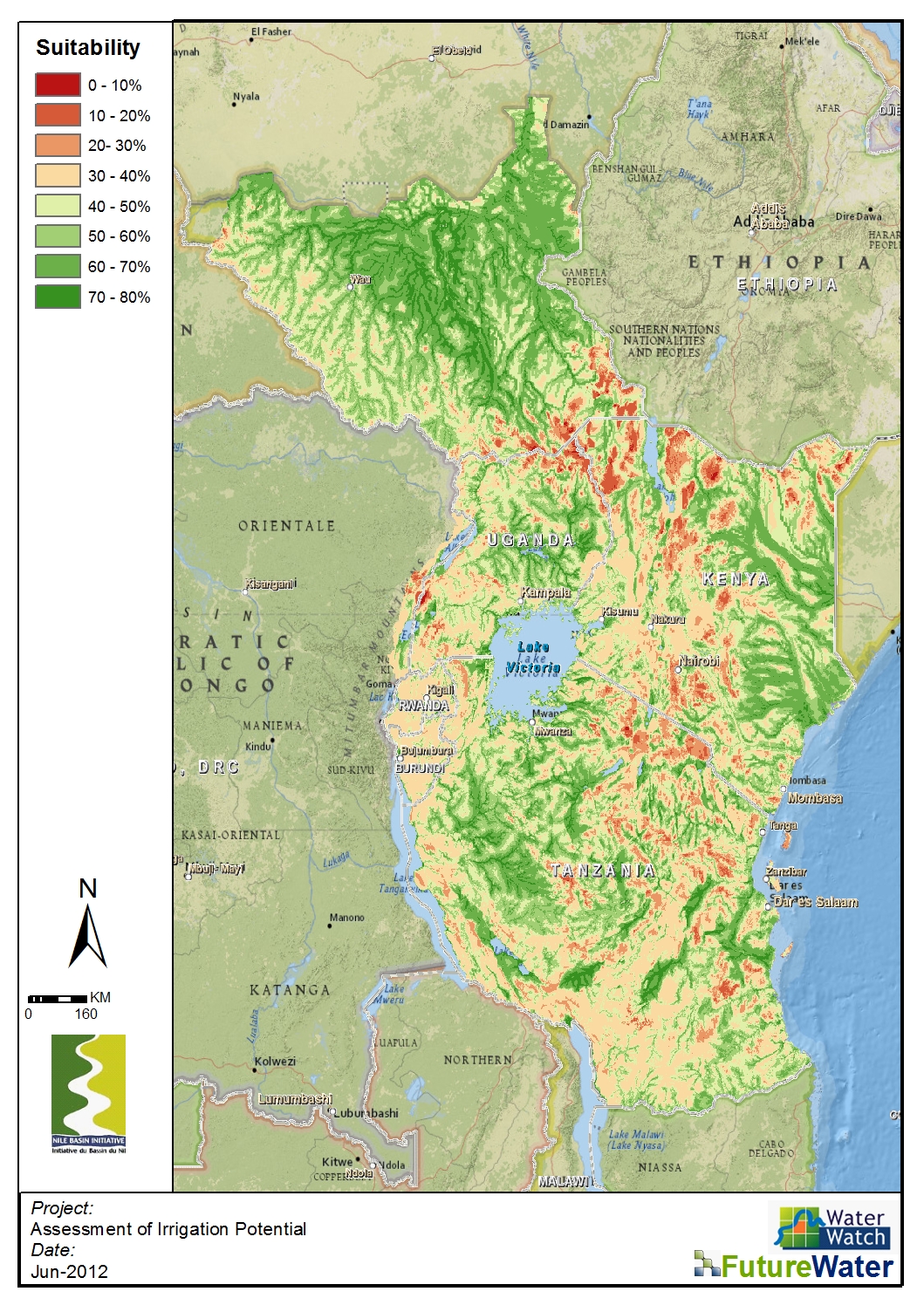