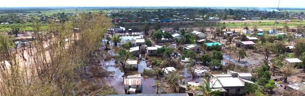
FutureWater, in collaboration with TUDelft and the TWIGA project, has participated in the Precipitation and Urban Hydrology session of the European Geosciences Union (EGU) conference which is held from 4-8 May. In response the ongoing coronavirus pandemic the EGU has gone completely virtual and hosted the EGU2020: Sharing Geoscience Online. This event will offer all geoscientists opportunities to share their research and stimulate scientific discourse during these unprecedented times. During the session the added value of flying sensors (drones or UAVs) for urban hydrology and flood mapping was highlighted: it is a very effective means to map riverbeds and flood extent accurately across a wide area, even while the flood is happening or shortly thereafter. Flood mapping information is also very valuable in a long-term context, for drainage infrastructure planning and management.
The promises and challenges of deploying flying sensors for the purpose of urban hydrological modelling and flood mapping were discussed. This was illustrated a case-study in Kumasi, the second biggest and fastest growing city in Ghana, where urban flooding has become more frequent due to changes in the climate and have a more negative impact due to rapid urbanization and population growth. Not only are the natural flood plains increasingly being used for anthropogenic purposes, the increased population growth also brings along more solid (plastic) waste on the streets and into the riverbeds and riverways. This creates blockages in drains and riverways, which reduces its drainage capacity and adds to the flooding problems. Flying sensors were used to collect elevation information (DEM), riverbed dimensions and land-use. This information was used to construct a hydrological model to predict river flows and flooding.