Our resident Nature-based Solutions expert, Jack Beard, recently travelled to Nigeria to gather evidence to inform a forthcoming pre-feasibility assessment of the potential to develop the country’s first Watershed Investment Programme (WIP). This project is one of a growing number of engagements FutureWater is supporting for the Nature for Water Facility – an organisation seeking to scale the implementation of Nature-based Solutions to Water Security Challenges globally.

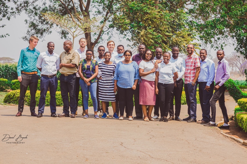
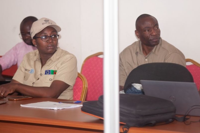
Jack travelled to Nigeria with Nature for Water colleagues from Pegasys consulting. This engagement involved visiting three states in South-West Nigeria to conduct interviews with stakeholders ranging from State Governments to private sector entities and community groups (cover picture shows a meeting with a farmers group in Ogun state). The trip included visits to Oyan Dam, Osogbo sacred grove (home of the river deity Oshun) and a community sand mining enterprise in Lagos Lagoon. The welcome we recieved from stakeholders and local partners was exceptional, with interviews and field visits uncovering some key findings relating to the key Water Security Challenges faced in the region.

We hope that this (FutureWater’s first engagement in Nigeria), is the first of many! A special thanks goes to superstar local partners from Arctic Infrastructure (a Lagos-based consulting firm) for organising meetings and logistics.

Nigeria as a country faces extensive Water Security Challenges (WSCs), from water availability and provisioning to water quality issues. These will become exacerbated by multiple future pressures, including huge increases in population and a changing climate. Oshun and Ogun catchments are located in the South West of Nigeria, in the same area as Lagos. These catchments face multiple challenges including unregulated groundwater extraction and poor sanitation infrastructure which compromise societal access to water.

NbS have the potential to contibute to addressing WSCs by increasing the overall resilience of the hydrological system, helping to increase infiltration to groundwater and buffer water quality issues. Alongside this, NbS can provide a wealth of co-benefits including carbon sequestration and increased biodiversity, complementing more traditional so-called ‘grey’ infrastructure such as pipelines and treatment plants.

Through extensive stakeholder consultation paired with GIS analysis and hydrological modelling, this project will help outline NbS which are best placed to address key WSCs, alongside identifying beneficiaries in the catchments of interest and existing parnerships in the catchment which are capable of delivering projects on-the-ground.

This work lays the foundations for the creation of so-called Watershed Investment Programmes (WIPs) in Osun and Ogun catchments, alongside the identification of further catchments in Nigeria which are disposed towards similar initiatives. WIPs aim to sustain and enhance the provisioning of key water-related ecosystem services by funding the conservation and restoration of lands that protect water quantity and quality. This is achieved through connecting downstream water users (e.g. water utilities, local governments, businesses, and the public) to upstream land managers (e.g. farmers and rural landowners). They unite these parties and others around the goal of enhancing water quality and quantity for societal benefits.

The issue of water scarcity is intensifying across the Asia Pacific region, posing significant challenges for sustainable agricultural production and water resources management. The Water Scarcity Program (WSP), designed by FAO-RAP and partners, aims to bring agricultural water use within sustainable limits and prepare the sector for a productive future with less water. The program aims to assess the ongoing issue of water scarcity in the region, evaluate potential management options, and assist partner countries to implement adaptive management in the agriculture water sector using innovative tools and approaches.

As part of the WSP, FutureWater will design and deliver a two-phase water accounting training program in Indonesia, Vietnam and Thailand, respectively. The first phase of the training will primarily focus on introducing and better understanding the concept of water accounting, its components and approaches. Participants will also work with tools such as REWAS and Follow the Water (developed by FutureWater in collaboration with FAO) to conduct water accounting in agricultural systems at different scales. Through the use of these tools, participants will be able to estimate real water savings at system and basin scale, and also analyze the impact of different irrigation schemes on the overall water availability in the system. The second phase will consist of participants working on the selected basin in each country to develop a detailed water account. Given the data availability and accessibility issues in the region, the participants will learn how to access, process and analyse remotely sensed datasets using Google Earth Engine.

In addition to the trainings, FutureWater will also provide technical inputs for the regional WSP events on water scarcity and highlight the technical challenges of implemeting water accounting and allocation in south-east Asia for the WSP High Level Technical Meeting to be held in June 2024.

In April, FutureWater supported the International Centre for the Study of the Preservation and Restoration of Cultural Property (ICCROM) in delivering a programme to help support five place-based projects in Sudan, Egypt, India, Brazil and Uganda.

These projects aimed to use the historical and cultural stories of specific places to find out how traditional knowledge and practices could contribute to increasing resilience to the impacts of a changing climate. Proposed Nature- and Culture-based solutions ranged from the re-planting of sacred trees in Alexandria to the restoration of defunct water harvesting systems in Jodhpur.

Our expert Jack Beard travelled to Rome to meet the teams for the trainings and learn more about the projects and their Climate Stories. In the first of two training sessions, climate risk assessment frameworks were explored – including how these can be used to understand current and future risks and vulnerabilities. In the second session, the teams discussed how Nature- and Culture-based adaptation measures can represent low cost and highly resilient solutions to mitigate risk alongside providing a wealth of co-benefits.

FutureWater wishes ICCROM and all of the teams the very best in further developing these projects toward implementation. It was hugely inspiring to work with you!

Group picture during the training in Rome

Solidaridad and FutureWater partnered to conduct a tailor-made training on ‘Geo-spatial data skills development for improved soil water management and enhanced crop productivity at the national level in Zambia’.

The training project for the Zambia Agricultural Research Institute (ZARI) was a Tailor-Made Training (TMT), as part of the Orange Knowledge Programme, funded by Nuffic, and enhanced capacity in accessing and using innovative data and tools in the public domain, to analyse crop performance and improve soil water management.

Staff of ZARI and the Ministry of Agriculture were trained on a range of geospatial data skills, including survey design using Kobo Collect, and remote sensing environmental analysis using GIS, Google Earth Engine, Earth Map and InVEST. The feedback received from participants was very positive:

“The TMT is a well-developed program that provides important tools for brushing up one’s skills in data compilation and analysis. The program materials are easy to go through and the instructors were friendly and easygoing. The training package included a good set of free and open-source tools for a wide variety of purposes, including; Land Use, Land Use Change and Forestry (LULUCF) assessments, monitoring agricultural land and urban areas and exploring how changes in ecosystems can lead to changes in the flows of many different benefits to people. The knowledge and insights provided in the TMT program are well delivered”

Chrispin Moyo Principal Agricultural Specialist Ministry of Agriculture Zambia

“This course gave me a good understanding of the applications of GIS and remote sensing in soil and water management. I’m particularly excited about the opportunity to quantify the benefits which regenerative agricultural practices would have on degraded environments using the InVEST tool. This was one of my best learning experiences and I can’t thank the organisers and trainers enough. Thank you to FutureWater, Solidaridad and Nuffic for a well-tailored and excellently delivered training.”

Belinda Kaninga (Ph.D) Senior Research Officer/Soil Scientist Zambia Agriculture Research Institute (ZARI)

More information about the project can be found here.

Trainers and participants during the closing event
Participants during training sessions
Participant during the training sessions  

Over recent months, FutureWater has begun working with the Nature for Water facility to provide technical support to the development of watershed investment programmes globally. The facility aims to provide technical assistance to local “champions” who are developing Watershed Investment Programmes (or Water Funds) in their respective catchments. The facility aims to expedite the delivery of Nature-Based Solutions (NbS) by supporting burgeoning Water Funds to maturity via the provision of expert knowledge relating to the implementation of NbS for water security challenges.

FutureWater’s role in the facility will be to provide experts that can work as Science Technical Leads for Water Funds, helping to (co)develop modelling tools and data-driven assessment methodologies which help better understand water security challenges and prioritise NbS to address these. This partnership is the result of multiple projects FutureWater have worked on over the years, including: Hydrologic modelling and economic valuation of investment options for the Nairobi Water Fund; and a Design Study for the Mombasa Water Fund. The technical expertise developed in these projects on modelling the impact and financial viability of portfolios of NbS will be used to create effective portfolios of NbS which can attract funding from a range of sources for implementation. This sees FutureWater join a pool of experts at the cutting edge of technical work on NbS.

The first engagement that FutureWater have taken part in is the Technical Coordination of the Norfolk Water Fund. In this work, Jack Beard has been supporting local partners to develop GIS and modelling approaches to prioritise the implementation of Nature-based Solutions across several catchments in the area, with an aim of addressing emergent water quality and quantity issues.

We are hugely proud to be supporting this critical work and to continue our collaborations with the Nature Conservancy. Here’s to helping restore ecosystems and putting nature at the heart of water resources management!

To facilitate the needs of ZIPAK, this training aims to build data-driven capacities relevant to sustainable nature conservation practices and ecosystem-based natural resources management in Iran:

  • Leveraging the Climate Change Knowledge Portal (CCKP) for performing climate risk and vulnerability assessments
  • Leveraging the online dashboard Earth Map for environmental hazard mapping and socio-economic risk assessments
  • Applying the InVest model (Integrated Valuation of Ecosystem Services and Tradeoffs) for assessing ecosystem service provision

The training focuses on knowledge and skills development and how how to meaningfully integrate these capabilities into ZIPAK’s objectives on sustainable management of the environment and natural resources.

The beneficiaries of this training, provided by FutureWater together with Solidaridad, belong to the Zambia Agricultural Research Institute (ZARI).
ZARI is a department within the Ministry of Agriculture of Zambia with the overall objective to provide a high quality, appropriate and cost-effective service to farmers, generating and adapting crop, soil and plant protection technologies. This department comprises a number of sections, one of which, for the purpose of this training request is the Soil and Water Management (SWM) division. ZARI and the SWM carry out demand-driven research, trying to find solutions to the problems faced by Zambian small-scale farmers, especially considering the near- and long-term impacts of climate change.
The training programme consists of a hybrid approach of e-learning and in-person training sessions and is structured around the following modules:
  1. Remote sensing-based analysis using Google Earth Engine to assess trends in land use, management, degradation and hotspots for intervention.
  2. Data collection and database management.
  3. GIS and remote sensing to assess suitability for SWC.
  4. Effectiveness and prioritization of SWC using open-source tools.
  5. Independent working on case study.
At the end of the training, it is expected that participants have achieved several objectives such as acquisition of technical skills for extracting relevant data from open access remote sensing products and improved knowledge of data collection and database management.

The practice of using remote sensing imagery is becoming more widespread. However, the suitability of satellite or flying sensor imagery needs to be evaluated by location. Satellite imagery is available at different price ranges and is fixed in terms of spatial and temporal resolution.

TerraFirma, an organization in Mozambique with the task to map and document land rights, hired FutureWater, HiView and ThirdEye Limitada (Chimoio, Mozambique) to acquire flying sensor imagery over a pilot area near Quelimane, Mozambique. The objective of this pilot project is to determine the suitability of using flying sensor imagery for cadastre mapping in an area of small-scale agriculture in Mozambique.

Flying sensor imagery is adaptable and can be deployed at any requested time. The suitability of these remote sensing approaches is piloted in this study for a small-scale agricultural area in Mozambique. A pilot area is used as case study with flights made during a period of a few days in December 2020, by local flying sensor (drone) operators in Mozambique (ThirdEye Limitada).

The flying sensor imagery was acquired over the period of a few days in December 2020, for a total area of 1,120 hectares. This imagery was used as input for various algorithms that can be suitable for classification and segmentation, namely R packages (kmeans, canny edges, superpixels, contours), QGIS GRASS segmentation package, and ilastik software. This study shows some initial results of using flying sensor imagery in combination with these algorithms. In addition, comparison is made with high resolution satellite imagery (commercial and publicly available) to indicate the differences in processing and results.

With the conclusions from this pilot project, next steps can be made in using flying sensor imagery or high resolution satellite imagery for small-scale agriculture in Mozambique. The time and effort needed for the delineation of field boundaries can be largely reduced by using remote sensing imagery and algorithms for automatic classification and segmentation.

Water Funds are a well-established model for facilitating collective action to address water security challenges through the implementation of nature-based solutions (NBS) as a complement for more traditional so-called ‘grey’ infrastructure such as pipelines and treatment plants. This assignment represents the first of many engagements in which FutureWater are employed through an umbrella agreement with the Nature for Water Facility. Via this agreement, FutureWater staff can be assigned as technical experts to help develop and direct the implementation of Water Funds across the world.

The objectives of the Norfolk Water Fund is to secure good quality, long-term water resources for all water users, while protecting the environment and showcasing the county as an international exemplar for collaborative water management. The programme seeks to demonstrate how cross-sector, integrated water management and can deliver multiple benefits and help achieve the county’s net zero targets. FutureWater’s role to date has included: developing a methodology to spatially characterise water security challenges across Norfolk; providing mapping and content inputs to a pre-feasibility report on the potential for NbS to deliver against water-related objectives; delivering a portal to show delivery of NbS projects; helping coordinate a stakeholder engagement event; and more recently, the development of reference material for a call for projects.