Het Interregionale Technische Platform voor Waterschaarste (iRTP-WS), geleid door de Voedsel- en Landbouworganisatie (FAO) van de Verenigde Naties, heeft als doel om de kloof tussen praktijk en innovatie te overbruggen om transformatieve veranderingen in water-, land- en landbouwbeheer te stimuleren, vooral in het licht van klimaatverandering. De focus ligt op het verbeteren van de paraatheid van systemen voor water-, voedsel- en klimaatuitdagingen door middel van beter bestuur, capaciteitsopbouw en e-learning.
Voor 2024-2025 richt het werkplan zich op “Geïntegreerde Wateroplossingen: Navigeren door Klimaatverandering en Water-Energie-Voedsel-Ecosysteem (WEFE) Nexus Dynamiek.” Het FAO Regionale Kantoor voor Azië en de Stille Oceaan leidt Strategische Prioriteit 1: Nexus Denken, waarbij cross-sectorale en inclusieve besluitvorming wordt bevorderd om hulpbronnen optimaal te benutten en duurzame WEFE-gebaseerde oplossingen te implementeren.
Om besluitvorming op basis van de nexus-benadering te ondersteunen, ontwikkelt de FAO, in samenwerking met FutureWater, een tool die gebruik maakt van Water Accounting-gegevens om toegankelijke inzichten in WEFE-dynamiek te bieden. Deze tool zal WEAP en de bijbehorende API integreren in een Excel-omgeving, waardoor scenarioanalyses voor zowel projecties als interventies worden gestroomlijnd. Door de krachten van beide platforms te combineren, biedt het een intuïtieve, gestandaardiseerde en collaboratieve benadering van Water Accounting, wat bijdraagt aan een meer geharmoniseerd besluitvormingskader.
A consortium of international development finance institutions led by World bank and including Asian Development Bank (ADB) have signaled their intention to support the financing of the Project. ADB is committed under Strategy 2030 operating priority 3 to support its Developing Member Countries to ensure a comprehensive approach to build climate and disaster resilience. The climate risk management approach of the ADB aims to reduce risks resulting from climate change to investment projects by identifying climate change risks to project performance in the early stages of project development, and which will support decision-making to incorporate the most appropriate adaptation measures in the design.
An initial climate risk assessment has been completed for the Rogun HPP project including assessments of natural hazards, hydrology, sedimentation, and the impact of climate change projections on project performance, however downstream resource implications have not been assessed. In this project FutureWater addresses wider system-level adaptation needs across the Amu Darya basin due to increased water use demand during the Rogun HPP reservoir filling period, climate-driven change to water supply and demand, and identification of potential supply-demand gaps. A combination of hydrological and water allocation modeling will form an evidence-base to inform recommended adaptive measures for the design and operation of Rogun HPP and for wider water-use sectors where required.
FutureWater undertakes analysis to understand projected climate change driven changes in water supply in Rogun HPP upstream areas, and water demands in downstream areas and the wider Amu Darya basin, with a focus on identifying the potential for a supply-demand gap throughout the Rogun HPP reservoir filling period to 2040. Where a risk of a supply-demand gap is identified FutureWater provides recommended measures that can increase water efficiency in the competing demand use sectors with the overall aim of meeting demand across the different scenarios and in compliance with cross-boundary resource sharing agreements.
Specifically, FutureWater addresses following topics:
Model projected water supply and demand in the Amu Darya river basin by utilizing a WEAP model developed for water supply, demand and allocation analysis, and accounting for climate change, Rogun HPP reservoir filling schedule, changing hydrology patterns and changes to downstream water demand from irrigation and other relevant end-use demands, where relevant.
Analyze the potential for water resource supply-demand gap to 2040 for a range of climate scenarios that capture potential future pathways aligned to government plans and policies and climate change, where relevant.
Recommend required water efficiency measures, where a risk of a supply-demand gap is identified under the the limits set by the cross-border water resource sharing agreement, so as to mitgate the risk with high-level cost estimate where capital investment is required.
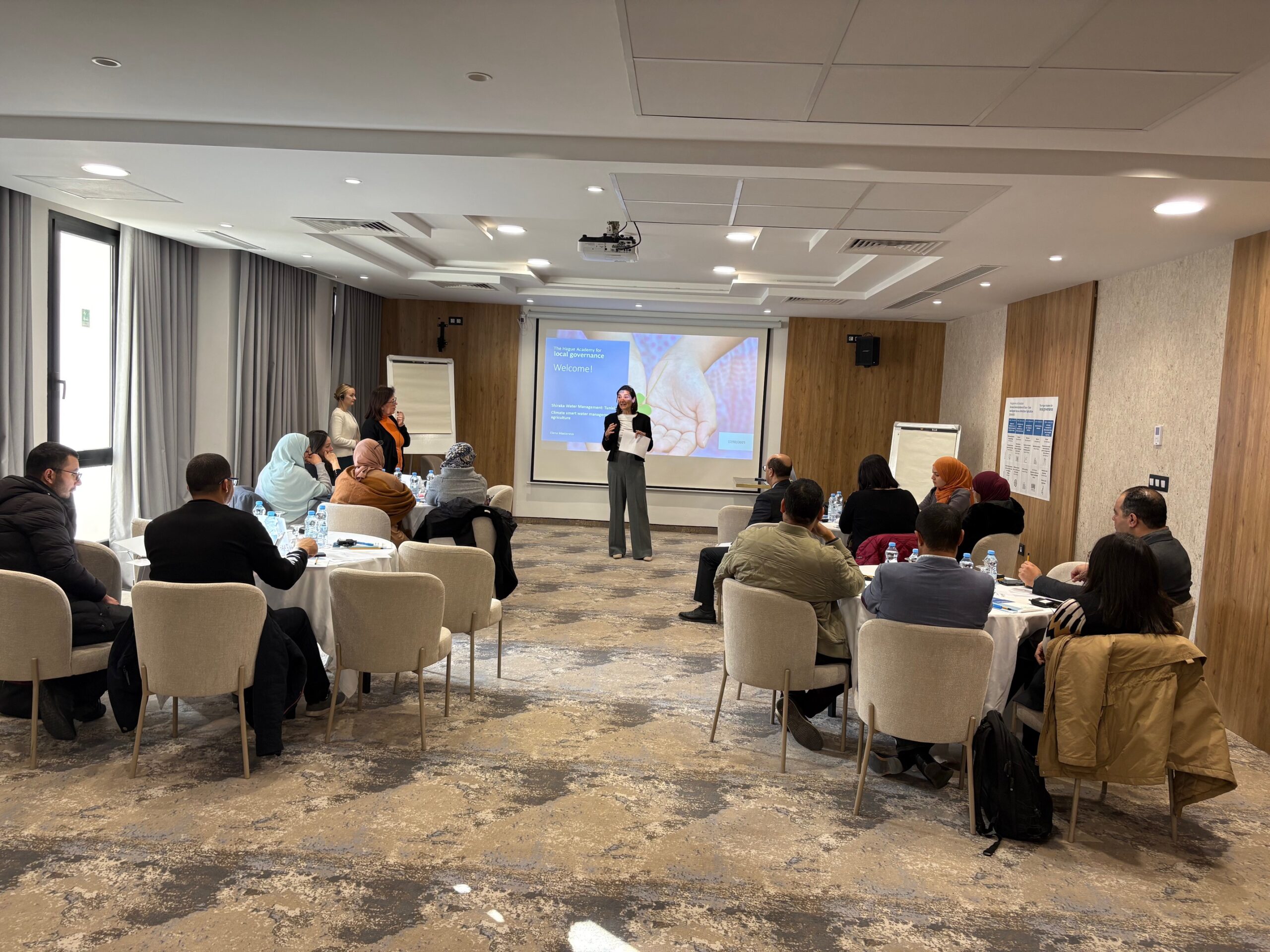
FutureWater heeft onlangs een training gegeven aan het Ministerie van Landbouw, Watervoorraden en Visserij in Tunesië over Water Governance en de Water-Energie-Voedsel-Milieu (WEFe) Nexus. Deze training, gehouden in Tunis, maakte deel uit van het door Nederland gefinancierde Shiraka trainingsprogramma en werd gegeven in samenwerking met The Hague Academy of Local Governance. Het doel van de sessie was om belanghebbenden te voorzien van de kennis en instrumenten om geïntegreerde strategieën voor het beheer van hulpbronnen te implementeren in het licht van de groeiende uitdagingen op het gebied van water en klimaat.
Een belangrijk onderdeel van de training was de Rapid Evaluation for WEFe nexus analysis (REWEFe) tool, ontwikkeld om de besluitvorming te ondersteunen door trade-offs en synergieën tussen water-, energie-, voedsel- en milieusectoren te beoordelen. Tijdens de training werd het REWEFe-instrument grondig gedemonstreerd en werd de praktische toepassing ervan getoond aan de hand van casestudy’s die relevant waren voor de context van Tunesië. De deelnemers onderzochten hoe het instrument beleidsmakers en waterbeheerders kan helpen bij het prioriteren van duurzame interventies en het verbeteren van de toewijzing van middelen.
De interactieve sessies stimuleerden discussies over bestuurskaders, institutionele coördinatie en de behoefte aan capaciteitsopbouw om de WEFe Nexus-benadering te integreren in Tunesië. Door een brug te slaan tussen wetenschap, beleid en praktijk wilde de training het ministerie beter in staat stellen om veerkrachtige en adaptieve strategieën voor waterbeheer te ontwikkelen.
Dit initiatief maakt deel uit van FutureWater’s voortdurende inzet voor de ondersteuning van duurzaam waterbeheer in MENA en daarbuiten, waarbij lokale expertise op het gebied van geïntegreerd beheer van hulpbronnen en klimaatadaptatie wordt versterkt.
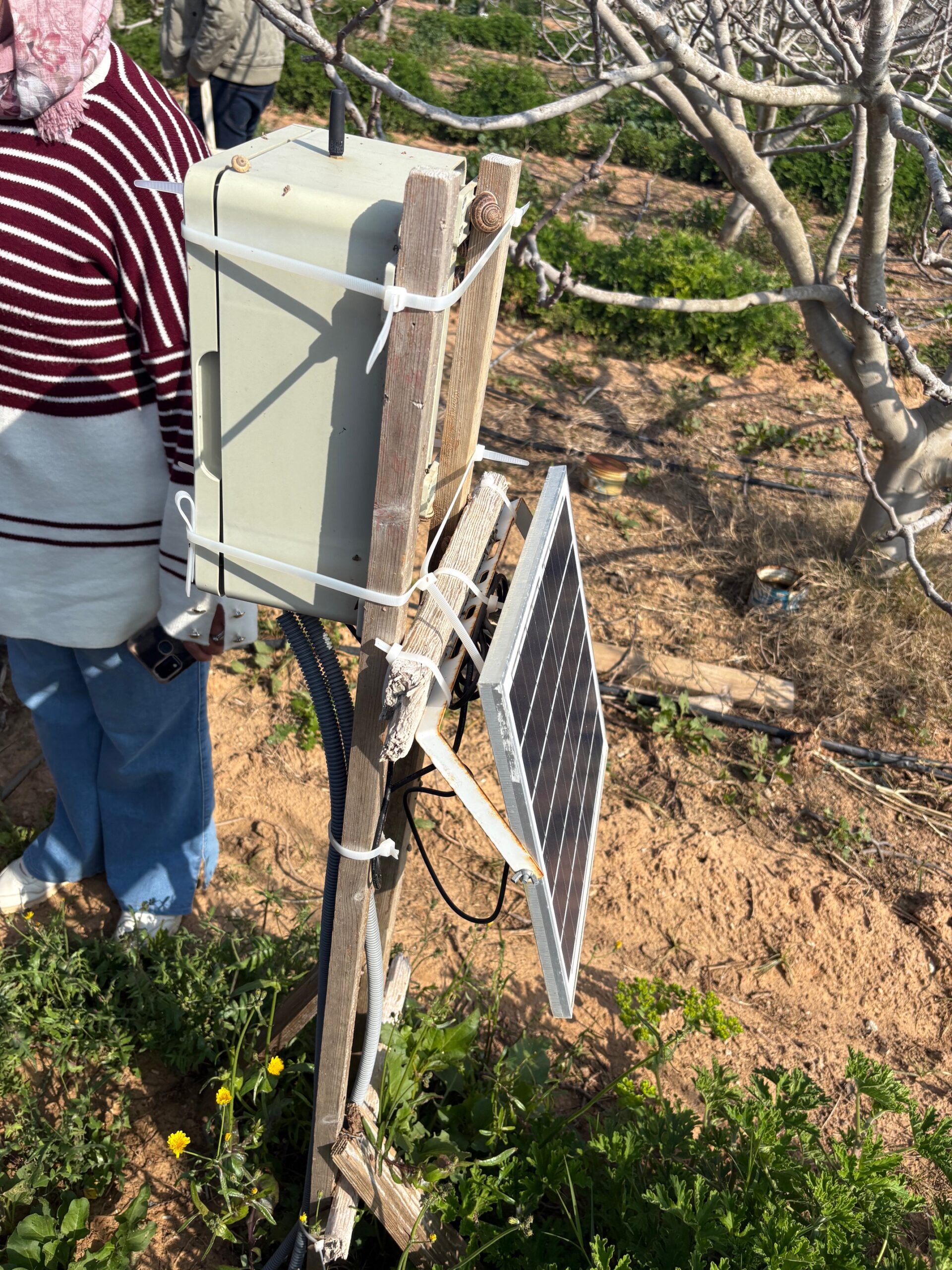
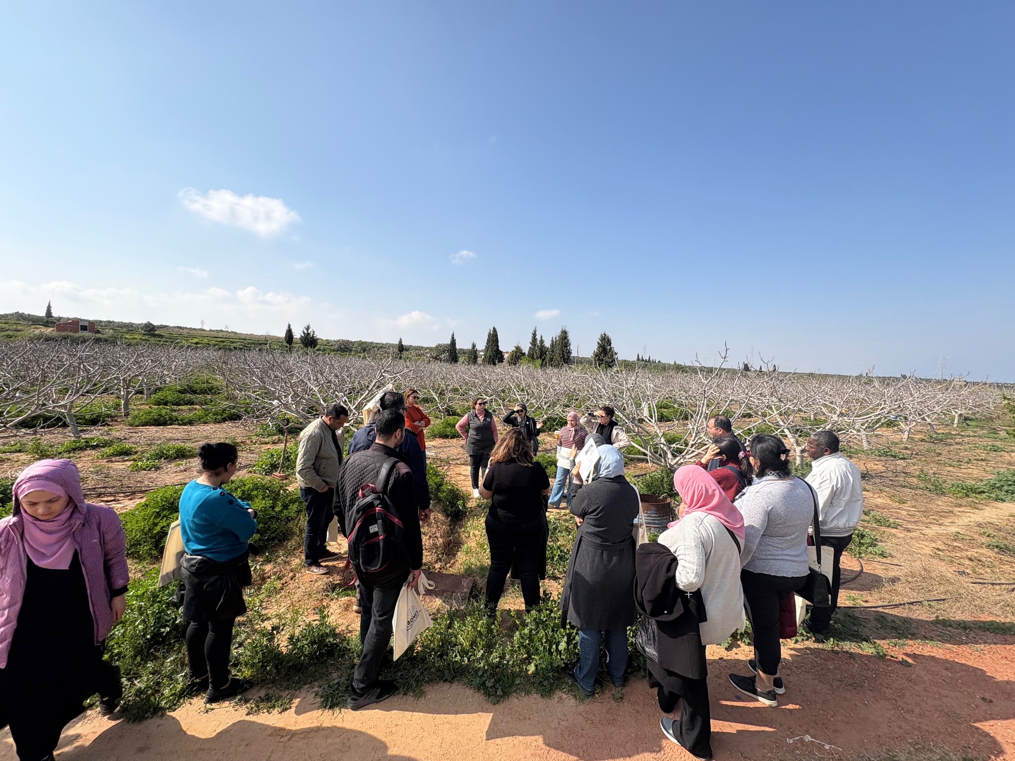
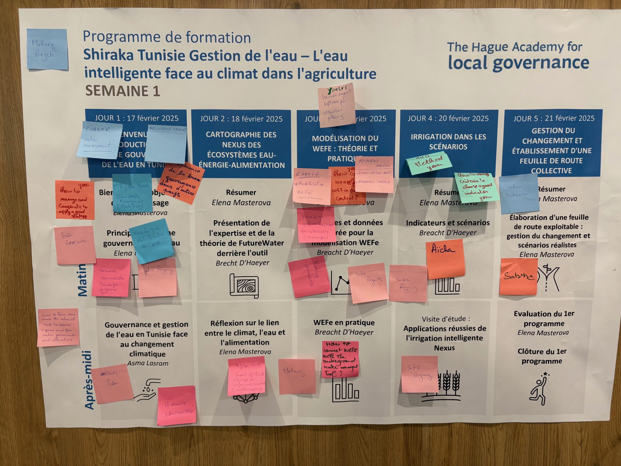
Shiraka Training openingstoespraak door de Ambassadeur van het Koninkrijk der Nederlanden in Tunesië, Josephine Frantzen.Smartlogger installatie in het Bonex Demonstratieveld, die het kunstmestgehalte, bodemvocht en bodemzoutgehalte meet.Veldtocht naar het BONEX demonstratieproject in Ouardanine, Tunesië.Trainingsschema met input en bijdragen van de deelnemers.
In the WE-ACT project at FutureWater, significant advancements are being made to improve climate-sensitive water allocation across the Syr Darya River Basin. This region faces complex challenges, including transboundary water issues and increasing climate impacts on water resources, which the project consortium addresses through advanced water modeling and decision-support tools. A key focus of the work is enhancing the Water Evaluation and Planning (WEAP) model, a foundational component of the Decision Support System (DSS) being developed for the region’s water management.
The project involves gathering, analyzing, and integrating socio-economic and water demand data into the WEAP model. Demand scenarios are being created and analyzed to understand how factors such as population growth, agricultural expansion, changing energy demand, and industrial needs shape future water use. Regionally specific socio-economic scenarios are also being developed to reflect the local context, enabling the modeling of diverse future pathways for the Syr Darya Basin. This work ensures that the model responds not only to environmental factors but also to socio-economic pressures unique to the region.
Data review and integration are systematically conducted, focusing on validating and implementing hydro-meteorological, socio-economic, and climate projection datasets. This rigorous approach ensures the accuracy and reliability of the WEAP model, supporting its role in generating outputs that inform sustainable water allocation strategies. Accurate data analysis is critical for tailoring the model to the basin’s needs and aligning with the project’s goal of addressing climate change impacts on water resources.
These efforts contribute to the WE-ACT project’s broader mission of building adaptive and sustainable water management solutions for Central Asia. The next steps in the project focus on calculating and analyzing water demand and water footprints of different users within the Syr Darya River Basin. This work evaluates the effects of water allocation on unmet water demand, environmental flow violations, and the overall sustainability of water use in the region.
The Rogun HPP is a project that will have a large reservoir capable of providing seasonal regulation. It will supply firm energy during the winter months when demand for electricity is the highest in Tajikistan and will allow for exports of clean electricity to the Central Asia (CA) region and beyond. The Project could play the role of a balancing plant for Tajikistan and the broader Central Asia region to help integrate significant new solar PV and wind generation capacity into the network.
The Rogun HPP was initially designed in the 1970s as part of the development of the Vakhsh River cascade for integrated economic development in the Central Asian republics of the Soviet Union. Construction of Rogun HPP began in 1982 and was then interrupted by political changes resulting from the independence of Tajikistan and the other Central Asia countries. The World Bank in 2011 provided funding to the Government of Tajikistan to conduct a Technical and Economic Assessment Study and an Environmental and Social Impact Assessment. The Government of Tajikistan proceeded with construction without development partners’ involvement. In 2023 a technical assistance grant was approved by World Bank to improve the financial and commercial frameworks of the Rogun HPP Project and to enhance its technical, environmental and social sustainability.
ADB is committed under Strategy 2030 operating priority 3 to support its Developing Member Countries to ensure a comprehensive approach to build climate and disaster resilience. The climate risk management approach of the ADB aims to reduce risks resulting from climate change to investment projects by identifying climate change risks to project performance in the early stages of project development and incorporating adaptation measures in the design.
FutureWater will undertake a climate risk and vulnerability assessment for the Rogun HPP project. Technical studies assessing Rogun HPP’s exposure to natural hazards, hydrology, sedimentation, and
the impact of climate change projections have been completed. These findings are incorporated into the detailed technical design of the project. FutureWater will review all existing studies and any
related studies from reputable sources and consolidate the findings into a climate risk and vulnerability assessment (CRVA) for the project. FutureWater will ensure the methodological approach and technical rigor of the existing evidence base is sufficient, flagging potential insufficiencies which may have a material impact on the conclusions of the assessments. Related tasks to support due diligence will also include a Paris Alignment Assessment in accordance with ADB guidelines, a climate financing accounting estimate, a lifecycle greenhouse gas emission estimate, and Climate Change Assessment summarizing the CRVA findings.
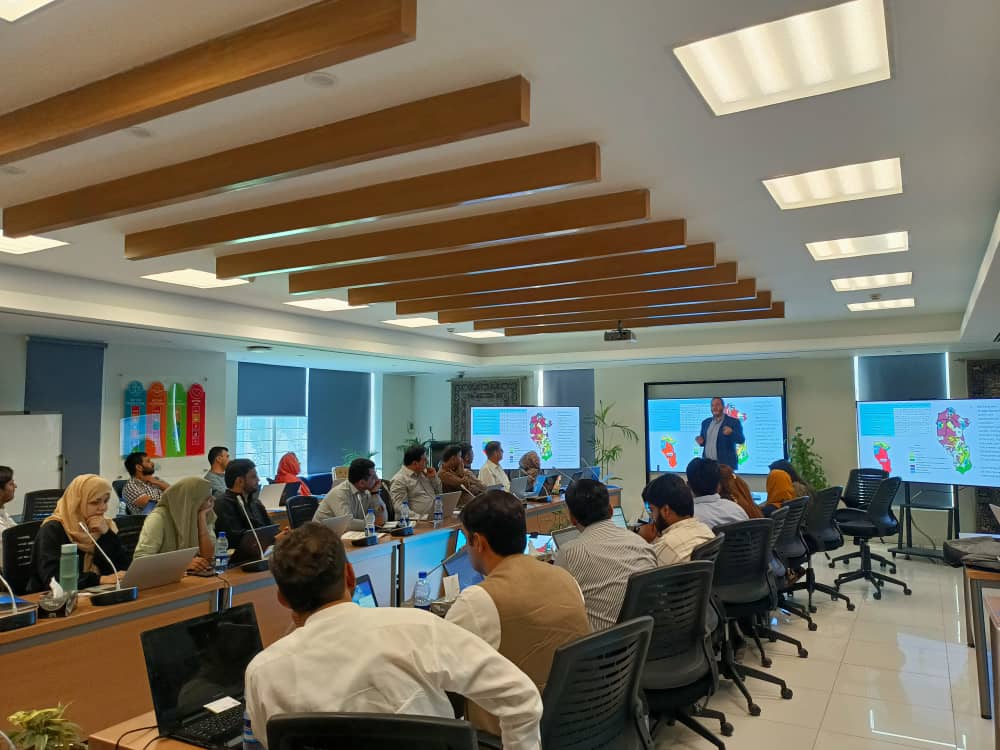
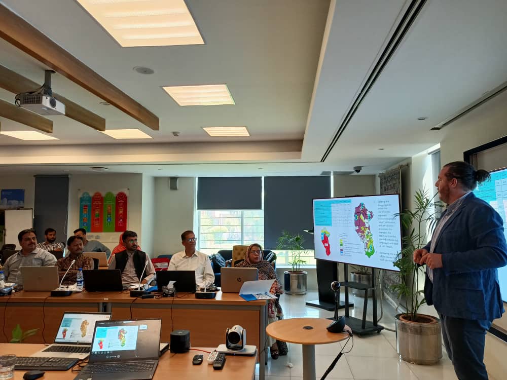
FutureWater, in collaboration with FAO Pakistan, has been implementing a hands-on training on Water Accounting under the GCF project titled “Transforming the Indus Basin with Climate Resilient Agriculture and Water Management”. Comprising of 7 modules, the capacity building program has been running since December 2023, with both online and in-country training sessions.
The latest in-country session took place from 10th-15th June at the FAO office in Islamabad where 35 participants from both Punjab and Sindh provinces successfully completed Module 5 and Module 6. Module 5 focused on the development of WEAP models for the seven respective spatial scales while the aim of Module 6 was to build and assess different socioeconomic and climate change scenarios. Participants understood the key differences between projections and interventions, and learned how to extract and pre-process climate projections data for generating different SSPs scenarios in WEAP. Similarly, the multidisciplinary groups were able to analyse the gaps between supply and demand based on the initial model results.
The next module, which is also the last module of the training program, will enable participants to translate the scientific findings into policy action through the development of different knowledge products i.e. infographics and policy briefs. The knowledge products will mainly be designed for decision makers and farmers and will serve as evidence for informed decision making and equitable use of water resources under different constraints. This training will mark the completion of the first round of water accounting which will be subject to improvement based on the in-situ monitoring equipment being installed under this project.
View of the classroomTheoretical lesson
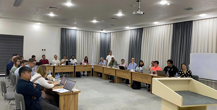
The WE-ACT General Assembly, held in Tashkent, Uzbekistan from April 23rd to 24th, 2024 focused on advancing water management in Central Asia through keynote speeches, collaborative sessions, and innovative demonstrations. Notable moments include the introduction of serious games for interactive learning and decision making, and a visit from BWO SyrDarya and SIC ICWC, emphasizing the importance of end-user engagement. Overall, the assembly exemplifies collective efforts towards sustainable water allocation in the region.
The WE-ACT General Assembly served as a medium for WE-ACT partners to share important project information. Organized by the International Water Management Institute (IWMI), in collaboration with the WE-ACT Consortium Partners and regional as well as national partners, the assembly focused on addressing key challenges and fostering collaboration in the region.
The assembly commenced with a welcome address from the project coordinator and local organizer, emphasizing the importance of collective action in addressing water-related issues.
The first keynote speaker, Dr. Tobias Siegfried from HydroSolutions, delivered a speech on hydrological forecasts and integrated water resources management in Central Asia, providing insights into Data Sharing of Hydro-Climate Information in Central Asia, and the digital assistant for operational hydrology (iEasyHydro HF), SnowMapper Central Asia, and opportunities for forecast service improvements in the region.
The session was followed by sister project Transcend and Dr Dionisio Pérez from USAL, highlighting the interconnectedness of initiatives aimed at holistic water management.
Dr. Thomas Ammerl (BayFOR) shed light on European research and innovation funding in green topics, emphasizing the significance of international partnerships, and the opportunities within the EU funds.
The assembly facilitated engagement and collaboration through participatory activities, including discussions on end-user needs and the alignment of DSS (Decision Support System) scenarios with WE-ACT partner capabilities. Mock-ups of DSS software tools offered tangible insights into ongoing developments, while discussions on regional data and model platforms helped in future technology advancements.
A panel discussion led by BayFOR provided a platform for sharing experiences on project management and EU reporting, offering valuable insights for WE-ACT partners and the upcoming reporting period.
Among a series of collaborative sessions, the visit from BWO SyrDarya and SIC ICWC was a standout moment during the WE-ACT General Assembly. Representatives from these prominent organizations took advantage of the chance to clarify their stakeholder and end-user needs and ambitions, providing light on how our collective solutions could be tailored to fit their individual requirements. They provided significant insights on potential ways to incorporate Decision Support System (DSS) technologies into their operational frameworks by delving into the subtleties of water management within their various domains.
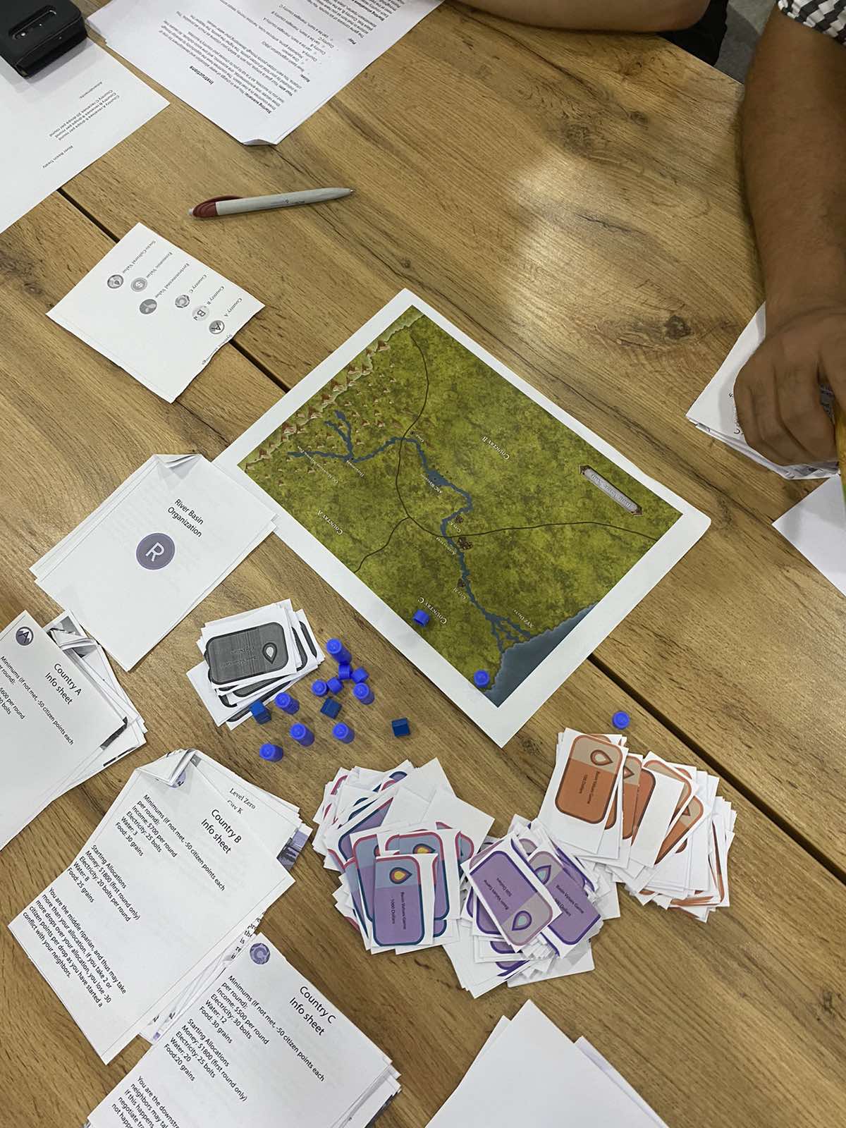
The highlight of the WE-ACT General Assembly was the initial testing of serious game. This provided partners with a unique opportunity to experience the role of decision-makers and navigate complex water management scenarios across various sectors. The serious game was designed with a specific goal in mind: to explore avenues for valuing water and fostering a deeper understanding of its intrinsic worth.
Interactive serious gaming at WE-ACT General Assembly
Participants engaged in interactive gameplay where they faced simulated challenges and dilemmas mirroring real-world scenarios. From allocating water resources among competing sectors to implementing conservation measures in the face of environmental pressures, the game was a dynamic approach for decision-making and strategic thinking.
In conclusion, the WE-ACT GA served as a forum for knowledge exchange, collaboration, and strategic planning to address water management challenges in Central Asia.
Discussions and presentations during the General Assembly for WE-ACT
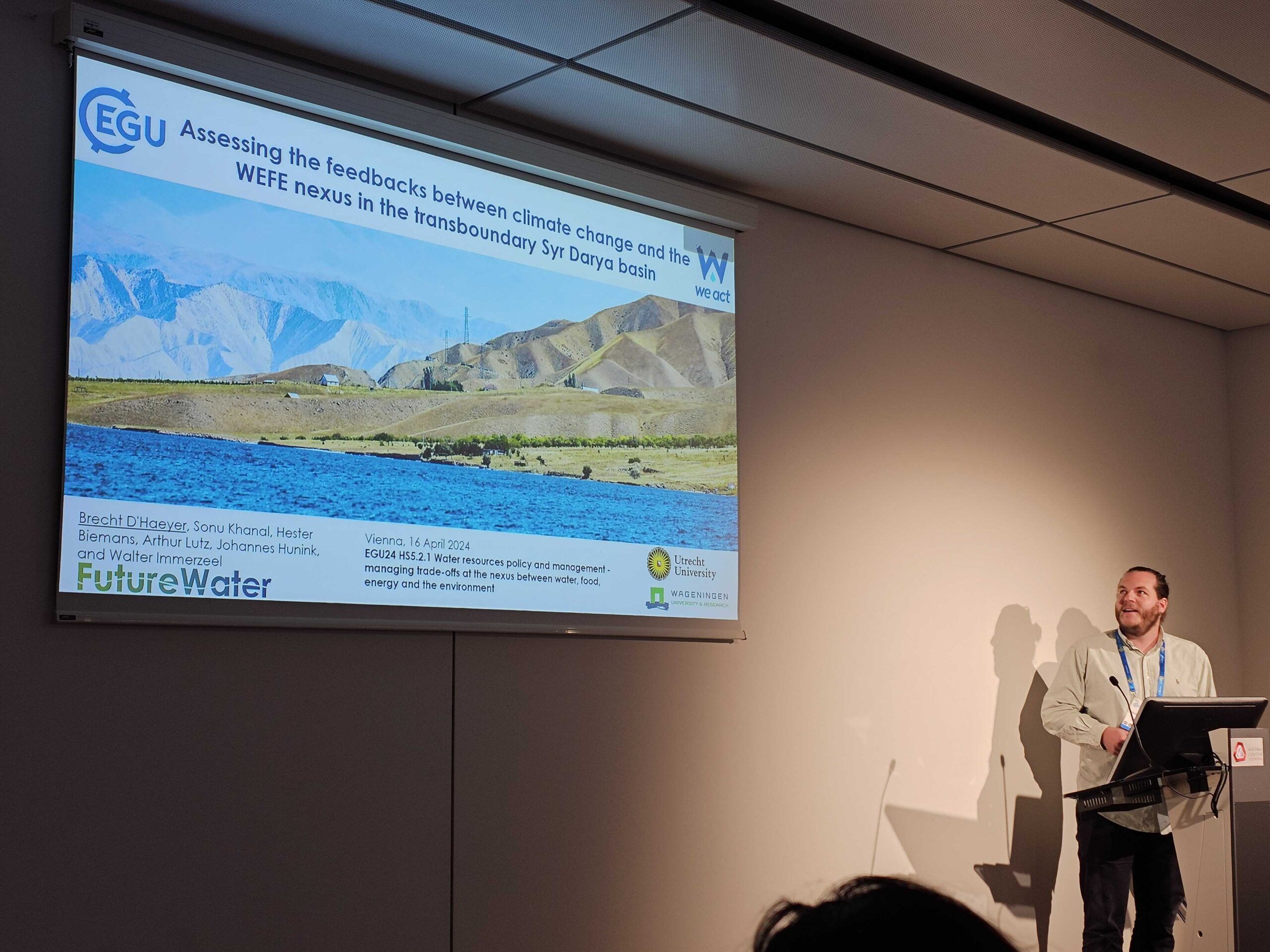
Two weeks ago, Brecht D’Haeyer, a part-time PhD candidate at Utrecht University and full-time colleague at FutureWater, joined the annual EGU conference in Vienna, where he presented his PhD proposal to fellow researchers.
Brecht commenced his PhD journey in March 2024 as an external candidate at Utrecht University, under the guidance of FutureWater and Wageningen University & Research. His research focus revolves around quantifying the intricate feedback mechanisms between climate change and the Water-Energy-Food-Environment nexus in the transboundary Syr Darya Basin. The Syr Darya Basin, characterized by its dependence on snow and glacial meltwater, presents a compelling case study for understanding the complexities of water allocation, particularly in mountainous regions. Brecht’s work, situated within the WE-ACT project, funded by the European Commission, aims to shed light on these critical interdependencies.
At the EGU meeting, Brecht took the stage to present his PhD proposal in the session titled HS5.2.1: “Water resources policy and management- managing trade-offs at the nexus between water, food, energy and the environment.” His presentation provided a comprehensive overview of his research objectives and methodologies, inviting valuable insights and discussions from fellow scholars.
Reflecting on the experience, Brecht expressed gratitude for the opportunity to engage with esteemed researchers in the field of Human-Water feedback systems. The exchange of ideas and perspectives, he noted, is paramount for refining assessment frameworks and advancing our understanding of complex environmental challenges.
Brecht D’Haeyer presents his PhD proposal at the EGU
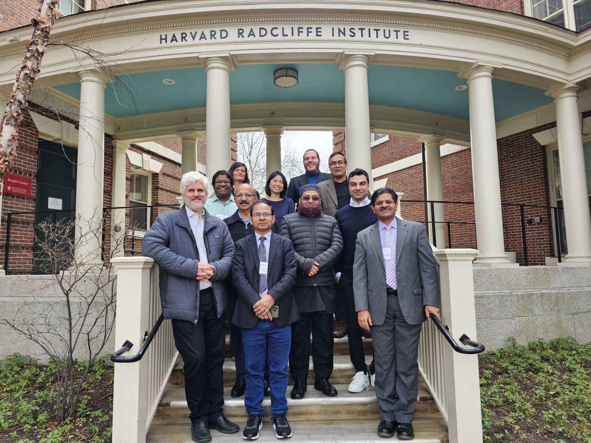
Early in April, FutureWater participated in a pivotal workshop hosted by the prestigious Harvard Radcliffe Institute. The workshop convened experts to explore water productivity issues in Bangladesh, particularly focusing on the challenges faced by coastal regions grappling with water scarcity and salinity.
A key focus of discussion revolved around pioneering strategies aimed at bolstering resilience in irrigated agriculture, with an emphasis on harnessing the potential of satellite remote sensing technologies. Notably, FutureWater’s Irrigation Advisory Tool, SOSIA, garnered attention for its role in optimizing water utilization and enhancing crop yields amidst challenging environmental conditions. A tool which is currently further explored in the SOSIA+ project in Ghana and also applicable within the context of our MAGDA project.
However, amidst the promising technological advancements, the workshop underscored the critical importance of robust infrastructure and institutional capacity. Participants highlighted that while data-driven solutions offer immense potential, their efficacy hinges on foundational support provided by infrastructure development and governance mechanisms.
The collaborative nature of the workshop brought together a diverse array of participants, including representatives from NASA, the U.S. Geological Survey, the World Bank, and esteemed academic institutions such as the Harvard T.H. Chan School of Public Health, FAO, Washington University in St. Louis, the Department of Agricultural Extension in Bangladesh and the University of Washington. Such interdisciplinary cooperation underscores the collective commitment to addressing complex environmental challenges.
Group picture
Nigeria as a country faces extensive Water Security Challenges (WSCs), from water availability and provisioning to water quality issues. These will become exacerbated by multiple future pressures, including huge increases in population and a changing climate. Oshun and Ogun catchments are located in the South West of Nigeria, in the same area as Lagos. These catchments face multiple challenges including unregulated groundwater extraction and poor sanitation infrastructure which compromise societal access to water.
NbS have the potential to contibute to addressing WSCs by increasing the overall resilience of the hydrological system, helping to increase infiltration to groundwater and buffer water quality issues. Alongside this, NbS can provide a wealth of co-benefits including carbon sequestration and increased biodiversity, complementing more traditional so-called ‘grey’ infrastructure such as pipelines and treatment plants.
Through extensive stakeholder consultation paired with GIS analysis and hydrological modelling, this project will help outline NbS which are best placed to address key WSCs, alongside identifying beneficiaries in the catchments of interest and existing parnerships in the catchment which are capable of delivering projects on-the-ground.
This work lays the foundations for the creation of so-called Watershed Investment Programmes (WIPs) in Osun and Ogun catchments, alongside the identification of further catchments in Nigeria which are disposed towards similar initiatives. WIPs aim to sustain and enhance the provisioning of key water-related ecosystem services by funding the conservation and restoration of lands that protect water quantity and quality. This is achieved through connecting downstream water users (e.g. water utilities, local governments, businesses, and the public) to upstream land managers (e.g. farmers and rural landowners). They unite these parties and others around the goal of enhancing water quality and quantity for societal benefits.