The outputs of this project can be summarized as providing real time dike and levee information at local scales (up to 10,000 ha) that is collected, analysed and used at the same local scale. The output is divided into two components. First, the Flying Sensor information will be used for risk reduction by monitoring smaller dikes and levees to quickly and accurately identify potential weak points. Second, during flood events Flying Sensors will be used to monitor flood extent and to detect the location of flood cause. Focus of the project will be on the Risk Identification component. The final result of the project will be that two water management institutions (RGD in Xai-Xai and ARA-Sul in Beira) can obtain by themselves Flying Sensor information on flood risk reduction and flood management. This will be achieved by training four Flying Sensor operators (undertaking flights, collect information, imagery analysis and interpretation).
Problem
Substantial methodological progress has been made in identifying potential risks of flooding by improved monitoring and modeling. The number of web-portals and similar information sources has been exploding over the last years (e.g. www.reliefweb.int; www.hewsweb.org; amongst many others). However, this information is often at relatively course resolutions and focused towards high-level decision makers and managers; so leaving the decision makers on-the-ground empty-handed.
Mozambique’s major rivers (Limpopo, Incomati, Zambezi) flood on a regular base with in some years devastating impact (e.g. 2000) creating attention of high-level decision makers. However, floods happen every year in the country and on-the-ground water managers are confronted with big challenges to make decision on controlling and regulating these floods. Especially, the smaller infrastructure such as small dikes and levees are key in controlling and managing risks of the very regular flooding that is not always taking lives directly, but has a huge impact on peoples’ lives. As mentioned in the risk literature: a devastating disaster brings aid, while the recurrent small disasters destroy peoples’ resilience.
Lack of information is considered as one of the major limitations to risk identification to these floods. This lack of information is both on the assessment of vulnerable dikes and levees, as well as the information during floods on appropriate responses and mitigation. Focus of this project is at on-the-ground data and tools to analyze risks.
Approach
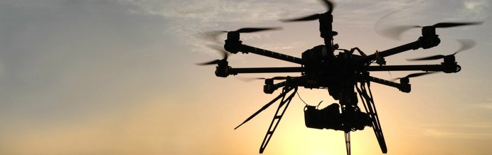
Flying Sensors’, sometimes referred to as “drone” or “unmanned aerial vehicle (uav)”, technologies have leapfrogged over the last years in terms of technology of the platforms themselves. Flying Sensors are now on the market at very achievable prices that can be used semi-automatically. The real challenge has therefore be shifted from a technically one to the use as operational observation services and to convert the raw imagery into information. Software to operate the Flying Sensors and to analyze imagery is in the public domain.
FutureWater has started a demonstration project in Mozambique to support farmers by providing crop status information based on Flying Sensors. Currently six local extension services staff are certified and are using Flying Sensors to provide high-resolution real-time crop information to farmers. Water managers (regadios and ARAs) in the same region see a huge potential to use a similar approach for risk identification of flooding. In order to do so, different sensors and image analysis procedures are needed. Specifically, current sensors are detecting at the near-infrared spectrum, while for dike and levee monitoring RGB is needed. Also, currently image analysis focusses on crop reflection, while for dike and levee monitoring ultra-high resolution elevation model and acreage detection are needed.
The outputs of this project can be summarized as providing real time dike and levee information at local scales (up to 10,000 ha) that is collected, analyzed and used at the same local scale. The output is divided into two components. First, the Flying Sensor information will be used for risk reduction by monitoring smaller dikes and levees to identify fast and accurate potential weak points. Second, during flood events Flying Sensors will be used to monitor flood extent and detection of location of flood cause. Focus of the project will be on the Risk Identification component.
The outcome will be that local water managers and decision makers make better and faster decisions regarding risk reduction by monitoring potential weak points in small dikes and levees; and during floods make the right decision disaster response like evacuation, rescue operations, and damage control.
The final result of the project will be that two water management institutions (RGD in Xai-Xai and ARA-Sul in Beira) can obtain by themselves Flying Sensor information on flood risk reduction and flood management. This will be achieved by training four Flying Sensor operators (undertaking flights, collect information, imagery analysis and interpretation). The feasibility of such an approach has been demonstrated by the on-going crop monitoring and advisory services by the extension services in the same region. Moreover, the use of Flying Sensors has a high attractiveness and has resulted already in cross-linkages between public, private and research entities in the country.
The longer-term projection is that other water managers and decision makers will see the benefits of the use of Flying Sensors in their disaster risk reduction strategy. The main “selling-points” will be: (i) affordable, (ii) access to flooded areas, (iii) local collected and local used, (iv) huge scaling potential.
Gerelateerde publicaties
2016 - FutureWater Report 155
 De Klerk, M., J. van Til, P. Droogers. 2016. Inception Report - Flying Sensors for Ultra-High Resolution Flood Risk Identification at Local Scales. FutureWater Report 155X
Flying Sensors for Ultra-High Resolution Flood Risk Identification at Local Scales – Inception Report
De Klerk, M., J. van Til, P. Droogers