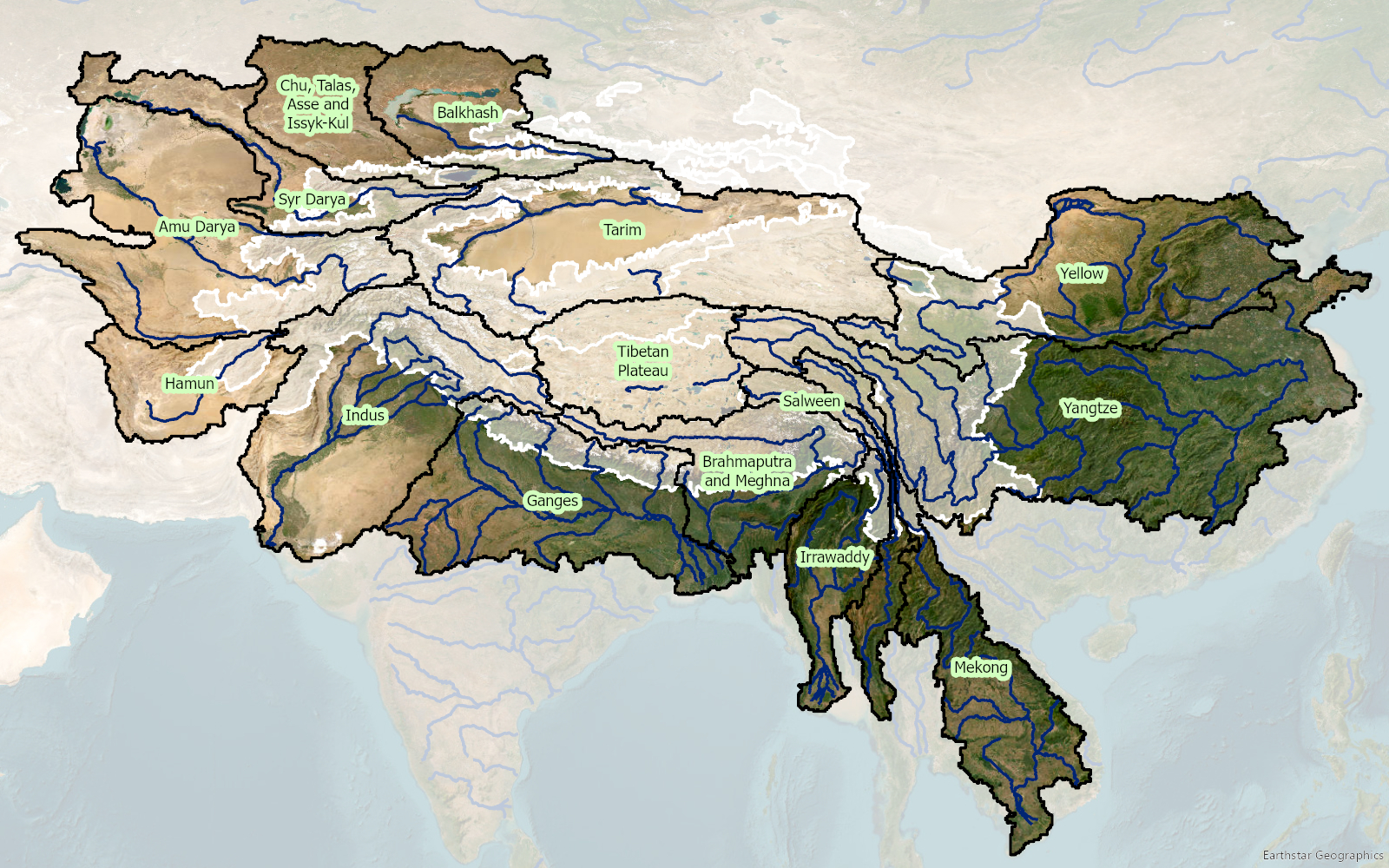
Binnen 3POLE4FOOD draagt FutureWater bij aan de beoordeling van de langetermijngevolgen van klimaatverandering voor de waterbeschikbaarheid en de gewasproductie in belangrijke Aziatische stroomgebieden. Het project combineert modellering van berghydrologie met modellering van stroomafwaartse hydrologie en gewasproductie om beter te begrijpen hoe veranderingen in sneeuw, gletsjersmelt, neerslag en temperatuur de irrigatiewatervoorziening en de landbouwproductie beïnvloeden.
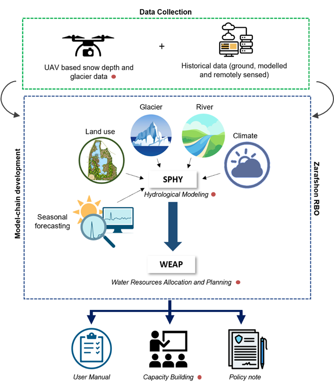
FutureWater leidt belangrijke technische activiteiten met betrekking tot klimaatforcering, biascorrectie van meteorologische datasets en het genereren van klimaatveranderingsscenario’s. Samen met Hydrominds en de Universiteit van Wageningen voeren we glacio-hydrologische modellering uit en analyseren we de waterverbindingen tussen stroomopwaartse en stroomafwaartse gebieden. Met behulp van het SPHY-model worden historische en toekomstige afvoeren uit berggebieden gesimuleerd, inclusief de bijdragen van neerslag, smeltwater uit sneeuw en gletsjers. Deze resultaten worden gekoppeld aan het LPJmL-model om de waterbeschikbaarheid stroomafwaarts, de irrigatiebehoefte, de gewasopbrengsten en de waterproductiviteit van gewassen te beoordelen onder toekomstige klimaat- en sociaal-economische scenario’s.
Het project biedt een wetenschappelijke basis voor het identificeren van risicogebieden en het inzichtelijk maken waar landbouwsystemen kwetsbaarder kunnen worden voor veranderingen in de watervoorziening uit berggebieden. Door klimaat, hydrologie en voedselproductie met elkaar te verbinden, ondersteunt 3POLE4FOOD een op bewijs gebaseerde planning voor veerkrachtige stroomgebieden en duurzame voedselsystemen in Azië.