To ensure effective implementation, FutureWater will maintain continuous engagement with ARA-Sul, providing technical support and collecting feedback through online sessions. This collaboration will help address challenges in system integration, troubleshoot issues, and refine functionalities. A significant component of this phase is the development of a comprehensive user manual and training materials, including PowerPoint slide decks, to guide ARA-Sul staff in effectively utilizing the tool for water licensing assessments. By embedding the tool within ARA-Sul’s operations, FutureWater aims to enhance decision-making capabilities and streamline the management of water resources in the region.
The WEAP model simulates water availability, supply, and demand on a small scale for over 40 irrigation, domestic, and industrial sites, running on a daily timestep to include detailed reservoir operations and water use abstractions. The updated WEAP model was co-designed together with ARA-Sul, the regional water authorities of southern Mozambique. Monthly meetings were held to support information sharing and co-ownership throughout the project.
The model will aid ARA-Sul in water accounting and the licensing of water users served by the Pequenos Libombos Reservoir. The Pequenos Libombos Reservoir, with a storage capacity of 350 MCM, is the main water supplier to the Maputo Metropolitan Area inhabited by over 3 million people. In June 2024 sessions were held in The Netherlands were ARA-Sul was trained in the usage of the model.
The cover picture was taken by David Mucambe (ARA-Sul).
Om de doelstellingen te bereiken, heeft het project een technische component en een component voor betrokkenheid van belanghebbenden. Aan de technische kant zullen hydrologische modellen worden bijgewerkt en gevalideerd. Klimaatveranderingsscenario’s zullen worden gebruikt als input voor het testen van adaptatiestrategieën binnen het Limpopo-bekken. De adaptatiestrategieën omvatten traditionele grijze infrastructuur en daarnaast op de natuur gebaseerde oplossingen. De batenanalyse van de adaptatiemaatregelen zal zowel macro- als micro-sociaal-economische voordelen omvatten.
De resultaten van deze studie zullen vervolgens worden gebruikt om de ontwikkeling van een eerste generatie Grensoverschrijdende Diagnostische Analyse (TDA) voor het Limpopo-rivierbekken (LRB) te ondersteunen. Hierdoor zullen de afzonderlijke landen in het stroomgebied het eens worden over een reeks grensoverschrijdende ontwikkelingsprioriteiten voor het bekken. Deze prioriteiten zullen toekomstige grensoverschrijdende en nationale investeringen sturen via een Strategisch Actieplan (SAP) en Nationale Actieplannen (NAP’s).
Within the project we cooperate with the hydrologists of ARA-Norte to discuss and establish the baseline for a water system analysis in the Monapo Catchment. Following discussion and mapping sessions, FutureWater is developing a Water Allocation Model in WEAP that includes climate change scenarios and mitigation and adaptation measures to asses the water availability of the catchment. Part of the assignment includes continuous training to local professional, to ensure the application of the developed model in the analysis of the system and elaborating specific proposal for implementation in the region.
Groundwater availability is critical to the Umbeluzi Catchment. Currently, there is a need for a simple tool that can asses the availability of resources in the ground.
This especially to asses the permits for groundwater extractions. It is expected that a simplified modelling approach can provide a trend analysis sufficient for the water authorities in Mozambique to perform assessments of the sub-surface water availability. Furthermore, the water availability will be assessed for current and future conditions, under different scenarios of climate change and demand increase.
Within the project, FutureWater will develop a groundwater model in WEAP, using the Strategic Model previously build for the Umbeluzi catchment. To this end a detailed data gathering activity will take place proceed by developing the model. We aim to validate and improve the model with measurements available of groundwater levels in the catchment. The model will be validated with the technical team of ARA-Sul. Ultimately, a dedicated training session for ARA-SUl will ensure that model operation is performed by local experts.
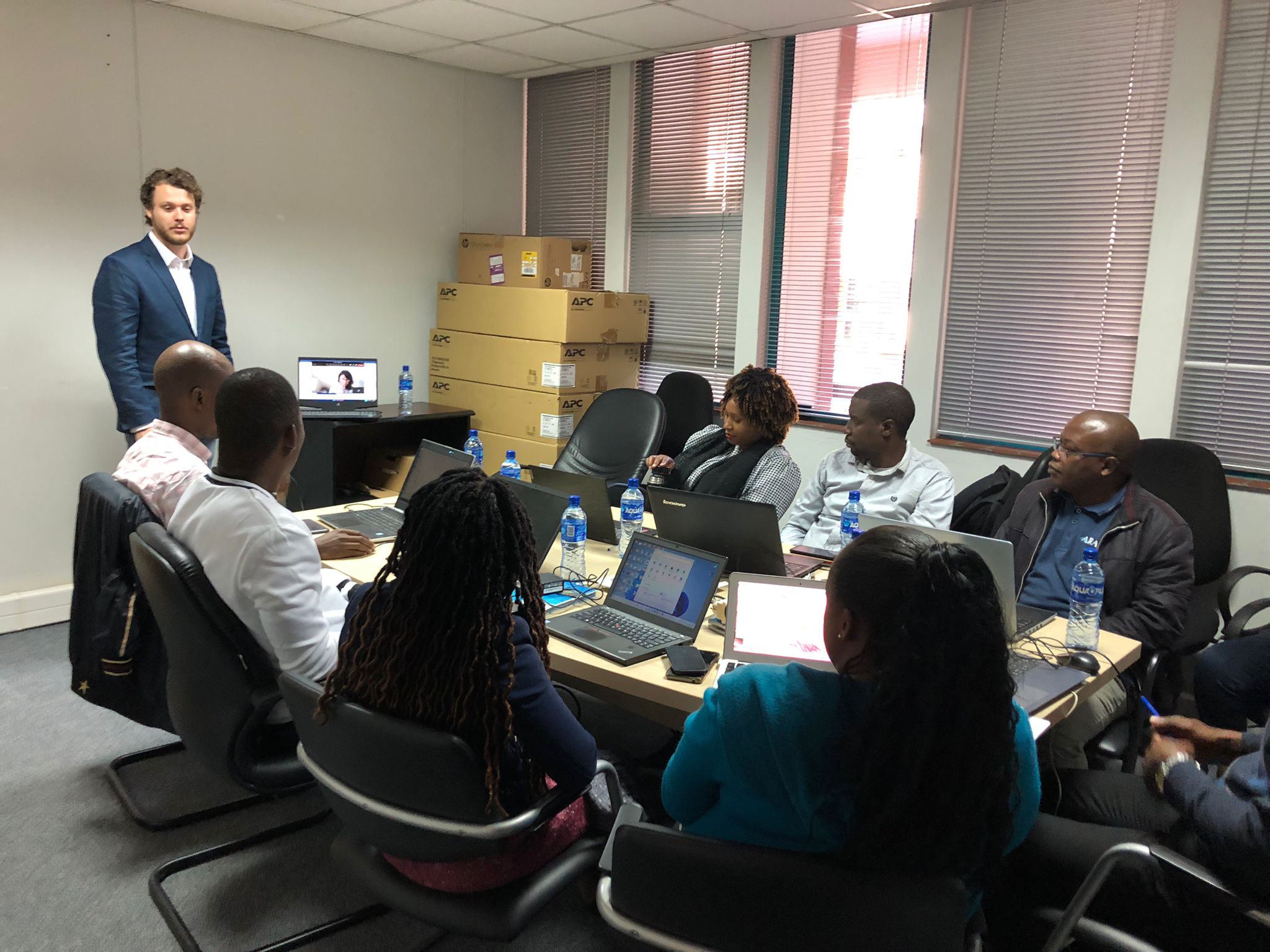
In our ongoing commitment to bolster the efforts of ARA-Sul in Mozambique, FutureWater recently conducted an intensive training course focusing on the application of the Strategic Water Allocation Model within the Umbeluzi Catchment area. This significant initiative entailed the utilization of the renowned Water Evaluation and Planning System (WEAP) model, coupled with a comprehensive update of critical information and underlying assumptions.
The primary objective of this training was to empower the dedicated professionals at ARA-Sul with the knowledge and skills necessary to effectively manage and optimize water resources within the region. The strategic allocation of water resources is of paramount importance, especially in areas like the Umbeluzi Catchment, where water plays a pivotal role in sustaining livelihoods, ecosystems, and economic activities.
One key aspect of this training involved fine-tuning the analysis-scenarios to comprehensively assess potential bottlenecks and challenges within the water allocation system. Identifying these bottlenecks is essential for making informed decisions, developing mitigation strategies, and ensuring the sustainable utilization of water resources.
Our collaborative efforts with ARA-Sul extend beyond the training itself. We are committed to providing ongoing support and guidance to ensure the long-term success of this endeavor. Through regular follow-up activities and consultations, the technical professionals at ARA-Sul are now well-equipped to independently maintain their model and conduct the essential analyses required for informed decision-making.
More information on the training here
Eswatini’s development is at risk by natural drought hazards. Persistent drought is exacerbating the country’s existing challenges of food security and the ability to attain sustainable development. Therefore, FutureWater, Hydrologic, and Emanti Management joined forces to bring together technologies and complementary expertise to implement the GLOW service which includes: short-term and seasonal forecasts of water availability and demand, an alerting service when forecasted water demand is higher than water availability, and water distribution advisories to reduce impact and maximise water security for all water users.
The GLOW service will be piloted in the Maputo River and Mbuluzi River Basins where three-quarters of the population of Eswatini lives, which includes the Hawane dam that supplies water to Mbabane (Capital City of Eswatini) and which is the major water supply source for Maputo, a Delta city (1 million inhabitants) which suffers from water shortages. The main beneficiaries of this project are the Joint River Basin Authority (JBRAS-PB) and the 5 River Basin authorities, AraSul (Mozambique) and the Department of Water and Sanitation (South Africa).
The innovation of GLOW is bringing together proven and award-winning technologies of advanced earth observation, open data, high-performance computing, data-driven modelling, data science, machine learning, operations research, and stakeholder interaction. These technologies require minimum ground truth information, which makes them very scalable and applicable in poorly monitored environments throughout the world. The coherent combination of the technologies into one decision support service ensures the optimum division of water, basically distributing every drop of water to meet the demands of all interests present in large river catchments.
The practice of using remote sensing imagery is becoming more widespread. However, the suitability of satellite or flying sensor imagery needs to be evaluated by location. Satellite imagery is available at different price ranges and is fixed in terms of spatial and temporal resolution.
TerraFirma, an organization in Mozambique with the task to map and document land rights, hired FutureWater, HiView and ThirdEye Limitada (Chimoio, Mozambique) to acquire flying sensor imagery over a pilot area near Quelimane, Mozambique. The objective of this pilot project is to determine the suitability of using flying sensor imagery for cadastre mapping in an area of small-scale agriculture in Mozambique.
Flying sensor imagery is adaptable and can be deployed at any requested time. The suitability of these remote sensing approaches is piloted in this study for a small-scale agricultural area in Mozambique. A pilot area is used as case study with flights made during a period of a few days in December 2020, by local flying sensor (drone) operators in Mozambique (ThirdEye Limitada).
The flying sensor imagery was acquired over the period of a few days in December 2020, for a total area of 1,120 hectares. This imagery was used as input for various algorithms that can be suitable for classification and segmentation, namely R packages (kmeans, canny edges, superpixels, contours), QGIS GRASS segmentation package, and ilastik software. This study shows some initial results of using flying sensor imagery in combination with these algorithms. In addition, comparison is made with high resolution satellite imagery (commercial and publicly available) to indicate the differences in processing and results.
With the conclusions from this pilot project, next steps can be made in using flying sensor imagery or high resolution satellite imagery for small-scale agriculture in Mozambique. The time and effort needed for the delineation of field boundaries can be largely reduced by using remote sensing imagery and algorithms for automatic classification and segmentation.
For smallholder farming systems, there is a huge potential to increase water productivity by improved (irrigated) water management, better access to inputs and agronomical knowledge and improved access to markets. An assessment of the opportunities to boost the water productivity of the various agricultural production systems in Mozambique is a fundamental precondition for informed planning and decision-making processes concerning these issues. Methodologies need to be employed that will result in an overall water productivity increase, by implementing tailored service delivery approaches, modulated into technological packages that can be easily adopted by Mozambican smallholder farmers. This will not only improve the agricultural (water) productivity and food security for the country on a macro level but will also empower and increase the livelihood of Mozambican smallholder farmers on a micro level through climate resilient production methods.
This pilot project aims at identifying, validating and implementing a full set of complementary Technological Packages (TP) in the Zambezi Valley, that can contribute to improve the overall performance of the smallholders’ farming business by increasing their productivity, that will be monitored at different scales (from field to basin). The TPs will cover a combination of improvement on water, irrigation, and agronomical management practices strengthened by improved input and market access. The goal is to design TPs that are tailored to the local context and bring the current family sector a step further in closing the currently existing yield gap. A road map will be developed to scale up the implementation of those TPs that are sustainable on the long run, and extract concrete guidance for monitoring effectiveness of interventions, supporting Dutch aid policy and national agricultural policy. The partnership consisting of Resilience BV, HUB, and FutureWater gives a broad spectrum of expertise and knowledge, giving the basis for an integrated approach in achieving improvements of water productivity.
The main role of FutureWater is monitoring water productivity in target areas using an innovative approach of Flying Sensors, a water productivity simulation model, and field observations. The flying sensors provide regular observations of the target areas, thereby giving insight in the crop conditions and stresses occurring. This information is used both for monitoring the water productivity of the selected fields and determining areas of high or low water productivity. Information on the spatial variation of water productivity can assist with the selection of technical packages to introduce and implement in the field. Flying sensors provide high resolution imagery, which is suitable for distinguishing the different fields and management practices existent in smallholder farming.
In May 2020, FutureWater launched an online portal where all flying sensor imagery from Mozambique, taken as part of the APSAN-Vale project, can be found: futurewater.eu/apsanvaleportal
Project video: Portrait of the activities on water productivity
Water and food security are at risk in many places in the world: now and most likely even more in the future, having large economic and humanitarian consequences. Risk managers and decision-makers, such as water management authorities and humanitarian-aid agencies/NGOs, can prevent harmful consequences more efficiently if information is available on-time on (1) the impact on the system, economy or society, and also (2) the probabilities for a failure in the system. EO information has proven to be extremely useful for (1). For looking into the future, considering the uncertainties, novel machine learning techniques are becoming available.
The proposed development is incorporated into an existing solution for providing Drought and Early Warning Systems (DEWS), called InfoSequia. InfoSequia is a modular and flexible toolbox for the operational assessment of drought patterns and drought severity. Currently, the InfoSequia toolbox provides a comprehensive picture of current drought status, based mainly on EO data, through its InfoSequia-MONITOR module. The proposed additional module, called InfoSequia-4CAST, is a major extension of current InfoSequia capabilities, responding to needs that have been assessed in several previous experiences.
InfoSequia-4CAST provides the user with timely, future outlooks of drought impacts on crop yield and water supply. These forecasts are provided on the seasonal scale, i.e. 3-6 months ahead. Seasonal outlooks are computed by a novel state-of-the-art Machine Learning technique. This technique has already been tested for applications related to crop production forecasting and agricultural drought risk financing. The FFTrees algorithm uses predictor datasets (in this case, a range of climate variability indices alongside other climatic and vegetative indices) to generate FFTs predicting a binary outcome – crop yields or water supply-demand balance above or below a given threshold (failure: yes/no).
The activity includes intensive collaboration with stakeholders in Spain, Colombia and Mozambique, in order to establish user requirements, inform system design, and achieve pilot implementation of the system in the second project year. Generic machine learning procedures for training the required FFTs will be developed, and configured for these pilot areas. An intuitive user interface is developed for disseminating the output information to the end users. In addition to development of the forecasting functionality, InfoSequia-MONITOR will be upgraded by integrating state-of-the art ESA satellite data and creating multi-sensor blended drought indices.
