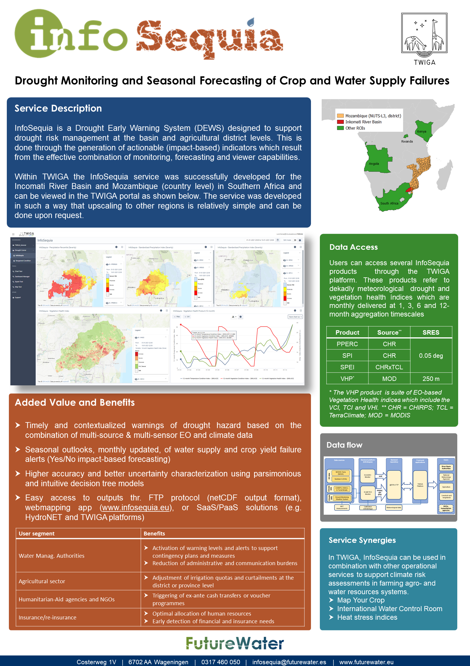
InfoSequia is the Drought Early Warning and Forecasting System developed by FutureWater to support the decision-making and risk management of drought impacts. InfoSequia rests on an advanced cloud computing and geoprocessing architecture able to effectively integrate large volume of data from satellite, reanalysis and ground-observation networks, with machine learning techniques to generate local-tailored seasonal outlooks of drought risk failures at the river basin and agricultural district levels.
InfoSequia has been recently and effectively integrated into the TWIGA geoportal, a platform that offers to African users the possibility for accessing data from ground-observation networks, and climate or agro- services with monitoring and forecasting capabilities.
The new and enhanced InfoSequia indices and products are operationally delivered for the Inkomati River Basin, a transboundary basin which extends through South Africa, Eswatini and Mozambique.
This lite service includes a full suite of 3 dekad-based (10-days) meteorological drought indices and 3 dekad-based vegetative health indices, all of them timescale aggregated at 1, 3, 6 and 12 months, and updated every month. The service is easily scalable and user-tailored to other regions of Africa upon request and agreement with FutureWater. Thanks to the advanced front-end capabilities of the TWIGA portal, users can easily access InfoSequia data and incorporate them into dashboards specifically set up according to their information needs.
A video was made to highlight how InfoSequía has been implemented, watch it here:
More information about the FutureWater’s approach on Water Scarcity and Drought can be found here.