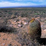
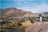
Welcome to the Rio Bravo
This website is the result of "the Remote Sensing and Hydrological Modelling of the Rio Bravo, Aguascalientes and Central Northern Valleys in Mexico" project.
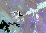
The project has shown how modern analytical tools such Remote Sensing, GIS and simulation models can help to swiftly
obtain data to support the water management decision making process. A diagnosis of the Rio Bravo and Northern Central Aquifers
has been made to demonstrate management options as well as how to obtain the minimally required data sets to base sound policy
decision making upon.
The project was implemented by the consortium of the Dutch companies WaterWatch and FutureWater
in close collaboration with the Comisión Nacional del Agua of the Mexican government.
WaterWatch and its sub-contractor FutureWater are indebted to the Bank-Netherlands-Water-Partnership Program (BNWP)
for financing this demonstration study. The World Bank branch Environmentally and Socially Sustainable Development Latin America and the Caribbean Region
World is acknowledged for initiating this study to demonstrate the capabilities of advanced computational tools in integrated water resources management in Mexico.
The working materials so obtained can be used by the Comisión Nacional del Agua to define and sharpen their future data
collection and data distribution policy.
The final project report of the Rio Bravo can be downloaded here
The final project report of Aguascalientes and the central northern acquifers can be downloaded here
|
|
|
||||||||
|
|
 |
|
|
||||||
|
|
|
|
|
||||||
|
|
|
|
|
|
|
|
|||
|
|
|
|
|||||||
|
|
|
||||||||
|
|
|
||||||||