
Concept
FutureWater biedt wereldwijd hoogwaardige onderzoeks- en adviesdiensten, waarbij wetenschappelijk onderzoek wordt gecombineerd met praktische oplossingen voor waterbeheer. WaterMaps is het webportaal waar FutureWater zijn geo-dataproducten en resultaten samenbrengt die zijn afgeleid van tal van projecten en (operationele) diensten van over de hele wereld. Het biedt een gestaag groeiende verzameling resultaten van een breed scala aan watergerelateerde projecten en diensten, die interactief kunnen worden verkend door op de kaart te bladeren. De analyse- en informatieproducten die te zien zijn op WaterMaps worden gebruikt om de effecten te beoordelen die verband houden met overstromingen, droogtes, irrigatie, waterkracht en voedselproductie.
FutureWater-toepassingen
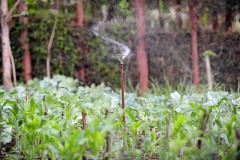
FutureWater gebruikt state-of-the-art, open-source kwantitatieve methoden om besluitvormers te informeren over huidige en toekomstige uitdagingen op het gebied van watervoorraden. WaterMaps is een visualisatietool die is ontwikkeld om gemakkelijke toegang te bieden tot modelresultaten en producten met ruimtelijke gegevens, verkregen uit projecten die uitdagingen aanpakken met betrekking tot:
- Landbouw
- Klimaatverandering
- Flying sensors (drones)
- Hydrologie
- Hydraulische eigenschappen van de bodem
- Waterschaarste
Volg deze link om het WaterMaps-webportaal te verkennen!
Gerelateerde projecten
-
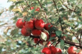
Water Risk Assessment for Private Farming in North Spain
This project aims to support a due diligence processs by reviewing and auditing water-related factors of risk for orchard fruit farming in including availibility and access, climate change impact, water quality, and potential conflicts and competence among water-demand users.
-
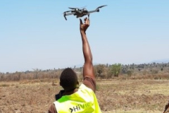
Incorporating Flying Sensors to Increase Agricultural Productivity in Central Mozambique
The PROMAC II project is an ongoing project of NCBA Clusa introducing conservation farming practices to various locations in the Manica, Tete and Zambezia provinces, with the objective to increase agricultural productivity. This project incorporates flying sensor activities in the PROMAC II project as a M&E indicator of the practices...
-
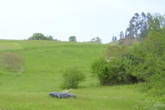
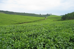
Satellite-based Monitoring of the Health Status of Grasslands at the Alagon Valley
This project is part of the technical-innovation support provided by FutureWater to ECOPRADERAS, an EIP-AGRI Operational Group which aims to improve the sustainable management of grasslands located at the Alagon Valley (Extremadura, Spain). Specific tasks included: the definition of a methodological framework for monitor the health of grasslands at the...
-
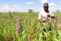
APSAN-Vale: Piloting Innovations to Increase Water Productivity and Food Security in Mozambique
The project has as its overall aim to increase climate resilient agricultural productivity and food security, with a specific objective to increase the water productivity and profitability of smallholder farmers in Mozambique, prioritizing small (family sector) farmers to increase food and nutritional security. This project will demonstrate what the best...
-
Leapfrogging Delta Management: Showcase operational rainfall monitoring
Significant decisions are to be made to manage and engineer the water systems in Myanmar and to develop large structural and non-structural projects (e.g. hydropower dams, urban water use, industrial development, extension of irrigation capacity, operational quantity and quality management, etc.). The Myanmar and Dutch governments have agreed to cooperate...
-
Mapping the Potential for Rainwater Harvesting under Various Scenarios
Identifying areas where rainwater harvesting is a feasible solution is one of the aims of the RAIN Foundation. In 2010 FutureWater and Deltares were asked by RAIN Foundation to develop maps indicating the potential for rainwater harvesting (RWH) for Mali, Senegal and Burkina Faso. FutureWater and Deltares used the same...
-
GEISEQ: Toolbox for the surveillance and the efficient management of droughts
The GEISEQ project aims to develop a Decision Support System for Drought Management integrating a set of tools for: a) the detection, surveillance and monitoring of drought periods, b) the prediction and spatial analysis of their potential impacts, and c) supporting users and decision makers on the best and more...
-
Climate adaptation Colombia
The 2011 floods and droughts in the Magdalena river basin triggered the Colombian government and water institutions to enforce the attention given to water security and dike safety. To improve the capacities of Colombia for adaptation of water management to climate change pilot projects were started in one small and...
-
SIRRIMED: Sustainable Use of Irrigation Water in the Mediterranean Region
SIRRIMED project addressed issues related to sustainable use of water in Mediterranean irrigated agricultural systems, with the overall aim of optimizing irrigation water use. In this project FutureWater was actively involved in the development of a District Information System (DIS) and a Watershed Information System (WIS) for the Campo de...
-
Assessment of the Irrigation Potential in Nile Countries in Central Africa
In order to fill gaps in the Nile Basin Initiative and member country information bases on agricultural water use the irrigation potential of seven Nile countries was assessed. This project consisted of several consecutive steps, in which hydrological modelling, the use of remote sensed data, ArcGIS analyses, consultation workshops and...
-
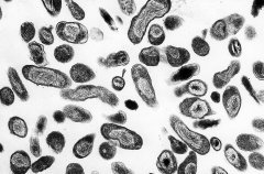
Q koorts en fysieke omgevingsfactoren
Er zijn sterke aanwijzingen dat het risico voor besmetting bij de mens met Q koorts afhangt van fysieke omgevingsfactoren, zoals warm weer met droge bodems en een bepaalde wind. Wind met genoeg snelheid en de juiste richting kan stofdeeltjes in de lucht doen komen die de bacterie invangen en deze kunnen vervolgens door mensen en...
-
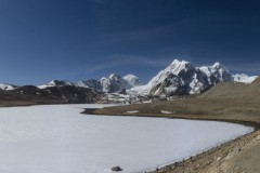
Hydrological seasonal forecasts in mountaineous basins
This project focused on the hydrology and cryosphere of the Himalayas and dealt with the influence of snow cover of the Himalayas and the Tibetan plateau on Asian monsoon dynamics, and the possibility to forecast the strength of the monsoon and the hydrological effects in downstream areas.
-
Green Water Credits Mechanism to support sustainable water use in Africa
Green Water Credits can be seen as an investment mechanism for upstream farmers to practice soil and water management activities that generate benefits for downstream water users, which are currently unrecognized and unrewarded. FutureWater coordinated and carried out the biophysical assessment that quantified the impact of Green Water Credits practices...